St George is an established residential area in east Bristol, known for St George Park, Troopers Hill, Victorian housing, local shopping streets, community facilities and direct bus connections towards Bristol city centre and neighbouring South Gloucestershire. Its identity combines suburban streets with industrial and mining heritage.
- What is St George in Bristol?
- Where is St George located in Bristol?
- How did St George develop historically?
- What is St George Park known for?
- Why is Troopers Hill important in St George?
- What is housing like in St George?
- What shops and local services are available in St George?
- How well connected is St George to Bristol city centre?
- What is the East Bristol Liveable Neighbourhood in St George?
- What can visitors do in St George?
- Why is St George important within east Bristol?
The name St George covers a wider neighbourhood than a single modern electoral ward. Bristol City Council currently divides the area into St George West, St George Central and St George Troopers Hill wards. These three wards form Area Committee 6 for local community and funding matters.
What is St George in Bristol?
St George is an east Bristol neighbourhood extending around Church Road, St George Park, Troopers Hill and nearby residential districts. It combines Victorian suburban development, historic industrial land, green spaces and strong transport links with central Bristol.
St George sits in the eastern part of Bristol, close to Redfield, Whitehall, Speedwell, Hanham and Kingswood. The area has a predominantly residential character, with local commercial activity concentrated along established roads and neighbourhood centres.
Administratively, the modern area is represented by three Bristol City Council wards: St George West, St George Central and St George Troopers Hill. The council groups these wards within Area Committee 6.
The wider St George area therefore should not be confused with St George West ward alone. Ward boundaries are administrative boundaries used for elections and council services. The neighbourhood itself has a broader geographical and historical identity.
St George is part of Bristol’s eastward urban corridor. Roads and bus routes connect it with the city centre and settlements beyond Bristol’s boundary, including Kingswood, Warmley, Hanham, Cadbury Heath and Keynsham. Current First Bus services include routes 41, 42, 43, 44 and 45 through the St George area.
The neighbourhood also has a strong green-space network. St George Park provides a major Victorian park, while Troopers Hill provides a prominent nature reserve and elevated views across the River Avon and Bristol.
Where is St George located in Bristol?
St George is in east Bristol, between established inner-east neighbourhoods and the Bristol–South Gloucestershire urban corridor. Key areas around it include Redfield, Whitehall, Speedwell, Hanham, Kingswood, Crews Hole and Troopers Hill.
The area’s location gives it a clear relationship with both Bristol’s urban core and communities farther east.
Church Road is one of the main local routes. St George Park lies around Church Road, while Troopers Hill occupies a higher position towards the River Avon. Crews Hole lies to the south-east, close to the river corridor.
The area borders or sits close to several recognisable Bristol neighbourhoods. Redfield and Whitehall are towards the west and south-west. Speedwell is north-east of St George. Hanham lies beyond the eastern side, while Kingswood is farther east and outside Bristol’s administrative boundary.
This position is important when understanding local travel. St George is not a city-centre district, but it has established bus routes that provide direct connections into central Bristol.
The East Bristol Liveable Neighbourhood project also covers parts of St George. Bristol City Council describes the trial area as including parts of St George and Redfield south of Church Road and north of the River Avon. The project introduced measures intended to improve conditions for walking, wheeling and cycling.
The precise boundary of the neighbourhood varies depending on whether the reference is a local community, electoral ward, planning document or transport project. Bristol City Council’s mapping services allow residents and visitors to check specific administrative and service boundaries.
How did St George develop historically?
St George developed from rural and industrial landscapes associated with the historic Kingswood area before becoming an urban suburb of Bristol. Coal mining, manufacturing, transport routes and Victorian residential expansion shaped the neighbourhood’s physical character.
East Bristol was historically connected with the Royal Forest of Kingswood, a large former forested area extending across parts of present-day Bristol and South Gloucestershire. Bristol City Council’s archaeological guidance records that much of east Bristol originally formed part of this historic landscape.
Industrialisation changed the area significantly from the eighteenth century. Coal mining became an important part of the wider east Bristol economy. The Bristol coalfield was one of Britain’s early coal-mining areas, and coal extraction occurred in places including Kingswood, Easton and surrounding districts.
Evidence of former mine workings remains an important part of the area’s archaeological history. Bristol City Council identifies former mine workings and associated settlements throughout the St George area. The Crews Hole district also contains evidence of historic industrial activity, including brass, pottery and glass production.
Urban growth accelerated during the nineteenth century. Bristol expanded rapidly as industrial employment, transport and population increased. Residential development created terraces and other housing forms around established roads.
St George’s present character reflects this transition. Older industrial landscapes were progressively surrounded by housing, roads, schools, shops, churches and public parks.
The Victorian period was particularly important for the area’s green infrastructure. Bristol City Council identifies St George as one of the city’s historic Victorian municipal parks. Its heritage framework states that local parks form an important part of Bristol’s neighbourhood character and green infrastructure.
Historical mapping provides another way to understand this transformation. Bristol Archives holds an 1803 plan of the parish of St George and Kingswood, while Bristol’s Know Your Place system allows users to compare historic maps and information about neighbourhood heritage.
What is St George Park known for?
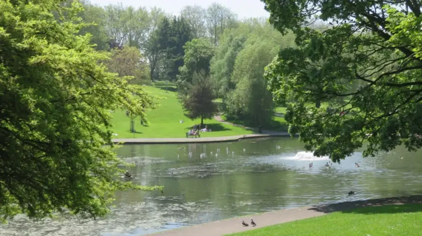
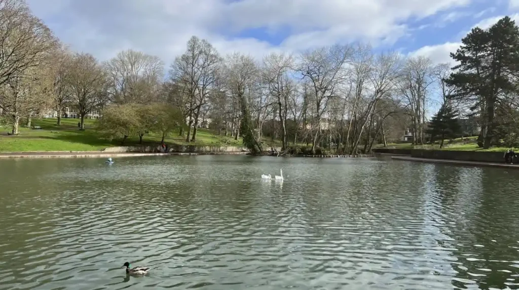
St George Park is a large Victorian suburban park with mature trees, a lake, playgrounds, tennis courts, bowling facilities, a wheels area, toilets and a café kiosk. It is one of the area’s principal public green spaces.
St George Park is located on Church Road and is open throughout the day. Bristol City Council describes it as a large Victorian suburban park.
The park contains several facilities serving different age groups and activities. These include tennis courts, a bowling green, a BMX and wheels area, a playground, a lake and walking areas.
The lake supports ducks and swans and forms one of the park’s recognisable landscape features. Fishing in the lake is prohibited under the park byelaws.
The original Victorian entrance contributes to the park’s historic character. Mature trees also form an important part of its landscape.
The playground has undergone improvement work. Bristol City Council reported that the first phase was completed in 2025, with funding secured for a second phase that includes additional inclusive equipment and facilities for older children.
The park is accessible to wheelchair users, although individual paths and changes in level affect accessibility in some parts of the site. The council lists a café kiosk, toilets and outdoor seating among the park facilities.
St George Park is therefore relevant to several types of visitor. Families use the play facilities. Walkers use the paths and open areas. Sports users have access to tennis, bowling and wheels facilities. Local residents also use the park as an everyday outdoor space.
Why is Troopers Hill important in St George?
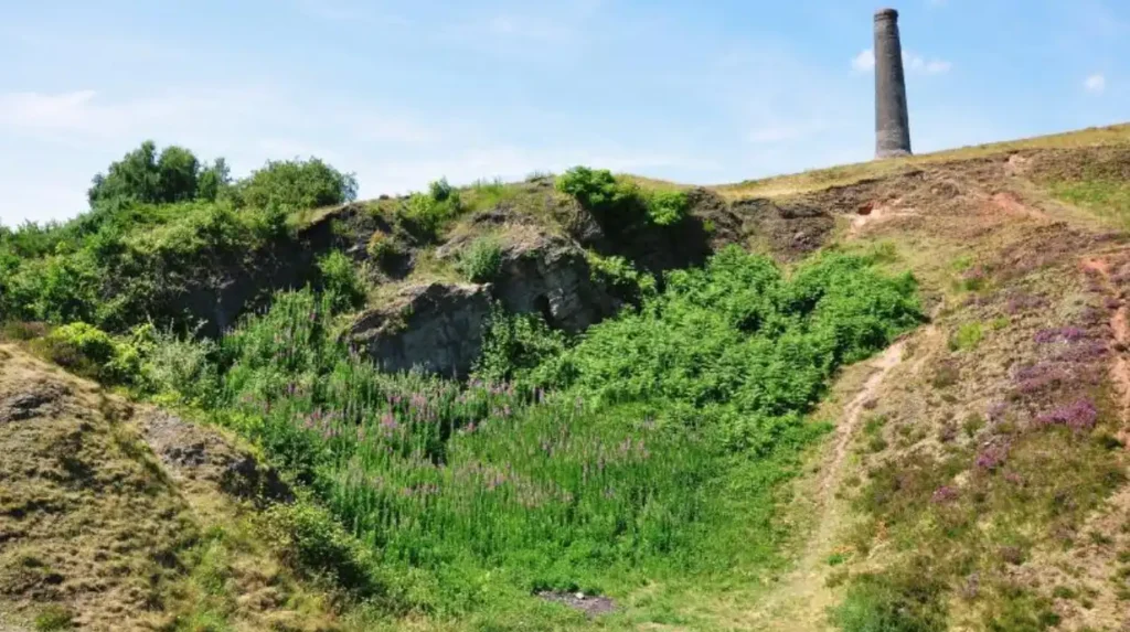
Troopers Hill is a Bristol nature reserve on elevated ground above the River Avon. It provides open grassland, wildlife habitat, walking routes and views across Bristol, making it one of the area’s most distinctive natural landmarks.
Troopers Hill is located between Air Balloon Road and Crews Hole Road in St George. Bristol City Council describes it as a hillside nature reserve overlooking the River Avon.
Its elevated position distinguishes it from St George Park. The hill provides wider views across the surrounding urban landscape and towards parts of Bristol and the Avon corridor.
The site has wildlife value and open areas suitable for informal recreation. The council specifically notes its suitability for kite flying because of its exposed and windy position.
Access varies across the site. A wheelchair-accessible path reaches the top from the Malvern Road side, while other paths remain unsurfaced and include steep sections. Visitors also need to take care around steep cliff edges.
Troopers Hill forms part of the wider green-space structure of east Bristol. Its ecological and recreational role complements the more formal Victorian landscape of St George Park.
The hill also connects St George with the historic industrial landscape of the Avon valley. The surrounding area contains evidence of earlier industrial activity, including the historic industries recorded around Crews Hole.
What is housing like in St George?
Housing in St George includes Victorian and early twentieth-century terraces, traditional brick homes, flats and later residential development. The area’s housing reflects successive phases of suburban expansion around established roads and local services.
St George has a varied residential environment rather than one uniform housing type.
Older streets contain rows of terraced houses associated with nineteenth- and early twentieth-century suburban growth. Other streets contain semi-detached homes, flats and later residential development.
The area’s historic development explains much of this variation. Industrial employment increased demand for housing, while Bristol’s wider nineteenth-century population growth expanded residential districts beyond the central area.
Bristol’s heritage framework identifies Victorian terraces as a major component of the city’s historic suburban fabric. Although its examples cover several neighbourhoods, the same period of rapid urban expansion shaped east Bristol’s residential landscape.
Housing decisions in St George depend on the precise street and property. Building age, tenure, parking arrangements, garden provision, proximity to bus routes and access to green space vary considerably.
Bristol City Council’s neighbourhood information tools provide address-level information covering subjects such as school catchment areas, resident parking schemes and nearby facilities.
The area is also part of a wider east Bristol housing market that includes Redfield, Whitehall, Speedwell, Hanham and Kingswood. This creates different commuting and housing options within a relatively compact urban corridor.
What shops and local services are available in St George?
St George has a neighbourhood-scale retail and service network centred on established roads and local commercial areas. Residents have access to everyday shops, food outlets, cafés, professional services, community facilities and nearby larger shopping destinations.
Local retail in St George serves everyday needs rather than functioning as a major regional shopping centre.
The area benefits from its position within east Bristol’s wider network. Residents can use nearby neighbourhood centres for routine purchases and travel into central Bristol or larger commercial areas for more extensive shopping.
Church Road and surrounding streets form important parts of the local activity pattern. Other nearby centres in Redfield, Kingswood and surrounding east Bristol districts provide additional services.
The local economy is closely linked with the residential population. Cafés, food businesses, convenience shops, personal services and other independent operators contribute to the area’s everyday commercial activity.
Community facilities are also important. Bristol City Council identifies a St George Community Association covering St George Central, St George West and St George Troopers Hill.
The combination of local shops, community organisations and public facilities gives St George a neighbourhood-based service structure.
How well connected is St George to Bristol city centre?
St George has direct bus connections towards Bristol city centre, Temple Meads and eastern settlements. Current services include routes 41, 42, 43, 44 and 45, providing links across east Bristol and beyond the city boundary.
Bus transport is central to St George’s connectivity.
First Bus currently lists route 41 between Avonmouth Trading Estate and Warmley or North Common via Bristol city centre, St George and Kingswood.
Route 42 links Bristol city centre with Keynsham via St George, Kingswood, Cadbury Heath, Cherry Gardens and Willsbridge. Route 43 connects Keynsham, Bristol city centre, St George, Kingswood, Warmley and North Common.
Routes 44 and 45 provide further connections through Bristol city centre and St George towards eastern and southern destinations. Route 44 links Imperial Park with Cadbury Heath, while route 45 links Hengrove with Cherry Gardens.
Route changes introduced in April 2026 increased daytime frequency on route 42 between Bristol city centre and Cherry Gardens to as often as every 30 minutes. The changes also revised routes 43 and 44 and retained overnight N43 services.
Travel conditions change when roadworks or transport projects affect individual streets. Current timetable information should therefore be checked before making a specific journey.
St George is also affected by Bristol’s broader transport strategy, which aims to increase transport options, support active travel and improve journey reliability.
What is the East Bristol Liveable Neighbourhood in St George?
The East Bristol Liveable Neighbourhood is a Bristol City Council trial covering parts of St George, Redfield and Barton Hill. It introduces traffic-management and public-realm measures designed to improve walking, cycling and neighbourhood streets.
The East Bristol scheme is Bristol’s first liveable neighbourhood project.
The trial was introduced in 2025 following work with local communities. Its area includes parts of St George and Redfield south of Church Road and north of the River Avon.
Measures include bus gates, road closures and public-realm changes. Bristol City Council states that some measures have subsequently been changed or removed following feedback.
As of spring 2026, two bus gates remained in the trial area. They were located on Avonvale Road at specified points.
The project is relevant to drivers, pedestrians, cyclists, bus passengers and residents because route patterns can change even when individual addresses remain accessible by car.
For visitors, the practical implication is straightforward: navigation apps and current council travel information provide more reliable route information than older descriptions of the road network.
The project also demonstrates how St George fits into Bristol’s wider transport transition. The city is working to manage traffic while increasing opportunities for active travel and improving local streets.
Explore ore Area Guide
Totterdown Area Guide: History, Homes, Food and Transport
Southville Area Guide: History, Things to Do & Living in Bristol
What can visitors do in St George?
Visitors can explore St George Park, walk around its Victorian landscape, visit Troopers Hill, observe wildlife, use local cafés and shops, and connect the area with nearby east Bristol neighbourhoods through established walking, cycling and bus routes.
St George is primarily a residential district, but it has several visitor-friendly features.
St George Park is the principal destination for a short outdoor visit. Its lake, mature trees, Victorian entrance, playground and recreational facilities provide several activities within one site.
Troopers Hill provides a different experience. Its elevated position, nature reserve status and views towards the River Avon create a contrasting landscape within the urban area.
Visitors interested in history can also explore the area’s industrial context. East Bristol’s former coal-mining landscape and Crews Hole’s industrial history explain why the modern residential landscape contains streets and sites associated with earlier economic activity.
Historic maps provide another route into the area’s past. Bristol’s Know Your Place platform contains historic mapping and heritage information that can help visitors understand changes to neighbourhood streets and landscapes.
A practical visit can therefore combine green space, local history and neighbourhood exploration without requiring a long-distance journey.
Why is St George important within east Bristol?
St George is important because it connects Bristol’s Victorian suburban heritage, industrial history, green infrastructure, residential communities and eastward transport network. Its parks and nature reserve give the neighbourhood a distinctive environmental and recreational role.
St George represents several stages of Bristol’s urban development.
Its historic landscape reflects the former Kingswood Forest and later industrialisation. Coal mining and manufacturing influenced employment and settlement patterns. Victorian expansion then produced much of the built environment visible today.
Its green spaces provide another defining layer. St George Park is recognised as a Victorian municipal park, while Troopers Hill provides a nature reserve overlooking the Avon.
Its transport role is equally significant. Multiple bus routes connect the area with Bristol city centre, Temple Meads, Kingswood, Keynsham, Hanham and other parts of the region.
Its current administrative structure also demonstrates its size and complexity. Three Bristol wards — St George West, St George Central and St George Troopers Hill — are grouped together in Area Committee 6.
The area’s future is linked to wider east Bristol changes involving transport, housing, public spaces and sustainable travel. The East Bristol Liveable Neighbourhood is one current example of this ongoing change.
For residents, visitors and people researching Bristol neighbourhoods, St George is therefore best understood as a connected east Bristol district rather than a single attraction or administrative boundary.
Its combination of Victorian parkland, hillside nature reserve, historic industry, established housing and city transport connections explains its continuing importance within Bristol’s eastern urban landscape.
Where is St George in Bristol?
St George is an east Bristol neighbourhood near Redfield, Whitehall, Speedwell, Hanham, Kingswood and Crews Hole. It is connected to central Bristol by several bus routes.