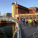
Bristol is one of South West England’s most important urban transport centres. Its rail network connects the city with London, South Wales, Bath, South Gloucestershire, Somerset, and other regional destinations. Its bus and Metrobus network provides extensive movement between residential districts, employment areas, shopping destinations, universities, and the city centre.
- Which areas in Bristol are best for living near transport links?
- Why is Temple Quarter one of the best areas near transport links?
- Why is Old Market a strong choice for public transport access?
- Why is Redcliffe convenient for transport and city-centre access?
- Why is Bedminster one of the best-connected areas in South Bristol?
- Why are Clifton and Clifton Down attractive areas near transport links?
- Why are St Philip’s and Lawrence Hill important transport areas?
- Why is Bristol Parkway one of the best areas for regional rail connectivity?
- How does Metrobus improve access to Bristol’s best-connected areas?
- How should you choose the best Bristol area based on transport needs?
- How is Bristol’s transport network expected to shape future well-connected areas?
- What makes a Bristol neighbourhood genuinely well connected?
- Where should visitors and commuters stay if transport access is the priority?
Choosing an area near transport links is important for commuters, students, visitors, families, and businesses. A well-connected location reduces interchange time and provides practical alternatives to private-car travel.
The strongest areas include Temple Quarter, Old Market, Redcliffe, Bedminster, Clifton, Clifton Down, Lawrence Hill, St Philip’s, and Bristol Parkway. Each area has a different transport profile. Some prioritise national rail. Others provide stronger bus, walking, cycling, or Metrobus connections.
Bristol Temple Meads is the central reference point. The Office of Rail and Road recorded 10.2 million passenger entries and exits at Bristol Temple Meads between April 2023 and March 2024, making it the busiest railway station in South West England. The station has 13 platforms in use and serves both Great Western Railway and CrossCountry services.
Transport investment is also changing the geography of connectivity. Bristol City Council is developing plans to improve Temple Meads as an integrated transport hub, with better pedestrian, cycling, bus, accessibility, and interchange facilities.
Which areas in Bristol are best for living near transport links?
Bristol’s strongest areas near transport links include Temple Quarter, Old Market, Redcliffe, St Philip’s, Bedminster, Clifton, Clifton Down, and Bristol Parkway. These locations provide access to rail, buses, Metrobus, walking routes, cycling infrastructure, employment centres, shopping, and regional destinations.
Transport connectivity depends on more than the distance to a railway station. A well-connected neighbourhood also needs reliable bus services, practical walking routes, cycling infrastructure, taxi access, and convenient connections between different transport modes.
Temple Quarter has the strongest concentration of transport infrastructure because Bristol Temple Meads functions as the city’s principal railway gateway. Old Market and Redcliffe benefit from their proximity to the station and central bus corridors.
Bedminster provides a useful South Bristol option because its railway station connects with the wider rail network while buses provide access to the city centre and surrounding districts.
Clifton and Clifton Down provide strong connections for people who want access to central Bristol without living immediately beside Temple Meads. Clifton Down railway station is part of the Severn Beach line, while local buses connect the area with central Bristol.
Bristol Parkway serves a different purpose. It provides strong regional and national rail connectivity in North Bristol and supports access to employment locations around Filton, Stoke Gifford, Bradley Stoke, and the wider South Gloucestershire area.
The best area therefore depends on the transport requirement. National rail commuters should prioritise Temple Quarter or Bristol Parkway. Central-city commuters can consider Old Market and Redcliffe. South Bristol commuters can consider Bedminster. People seeking access to Clifton and North Bristol can consider Clifton Down and nearby districts.
Why is Temple Quarter one of the best areas near transport links?
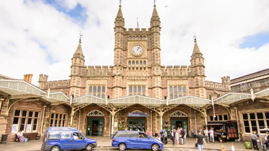
Temple Quarter is Bristol’s principal transport hub because Bristol Temple Meads combines national rail services with local buses, taxis, cycling, walking routes, and planned interchange improvements. The surrounding district provides direct access to offices, universities, cultural venues, housing, and regeneration projects.
Temple Quarter is centred on Bristol Temple Meads railway station. The station occupies a strategic position between Bristol city centre, the Floating Harbour, St Philip’s, Redcliffe, and the wider eastern part of the city.
Bristol Temple Meads is a major national railway interchange. Great Western Railway provides services across the South West and toward London, while CrossCountry connects Bristol with destinations across the national network. The station also provides access to local and regional rail routes.
The scale of the station makes Temple Quarter particularly suitable for rail commuters. The Office of Rail and Road identified Bristol Temple Meads as the busiest station in South West England based on passenger entries and exits during 2023–24.
Transport access is being reinforced by major regeneration. Bristol City Council’s Temple Meads plans include new and improved station entrances, enhanced passenger facilities, pedestrian and cycle connections, cycle parking, improved public spaces, and a new bus interchange.
The council also identifies Temple Quarter as a location where transport investment supports residential, commercial, employment, and public-realm development. The objective is to create a more integrated transport hub around the historic Grade I listed station.
Temple Quarter is therefore particularly relevant for people who need frequent rail travel. It also provides convenient access to the city centre through walking, buses, cycling, and taxis.
Why is Old Market a strong choice for public transport access?
Old Market is one of Bristol’s best-connected central areas because it sits between Bristol Temple Meads, Broadmead, Cabot Circus, and the city centre. Frequent bus corridors, walkable streets, cycling routes, and nearby rail access make it practical for residents, visitors, and workers.
Old Market occupies an important position immediately northeast of Bristol city centre. Its location places several major destinations within a relatively compact travel area.
Bristol Temple Meads is within practical walking and cycling distance. Cabot Circus and Broadmead are also close. This creates multiple transport choices without requiring a private car for every journey.
Bus connectivity is particularly important. Old Market sits within the wider central Bristol bus network and benefits from routes connecting East Bristol with the city centre.
The area also has strategic importance in Bristol’s transport planning. Bristol City Council’s city-centre public transport framework identifies Old Market alongside Broadmead, Cabot Circus, Temple Meads, Redcliffe, Bristol Bridge, and the city centre as important locations within the central transport network.
Old Market is suitable for people who need access to several central destinations rather than one specific railway route. A resident can combine walking, bus travel, cycling, and rail depending on the journey.
Its position also supports access to employment areas. Bristol’s central employment districts, shopping areas, cultural destinations, and educational facilities are all accessible from Old Market.
The area is therefore particularly useful for city-centre workers, students, visitors, and residents who value multiple transport options.
Why is Redcliffe convenient for transport and city-centre access?
Redcliffe offers strong transport access because it sits immediately west of Temple Meads and connects efficiently with the city centre. Walking, cycling, bus services, and nearby rail create short interchange distances, while regeneration is increasing housing, employment, public realm, and commercial activity.
Redcliffe is located between Bristol Temple Meads and the central city. Its geographical position gives the neighbourhood a strong transport advantage.
The area is close enough to Temple Meads for walking and cycling journeys. It also benefits from bus routes serving the central Bristol corridor.
Bristol City Council’s city-centre transport framework identifies Redcliffe alongside Temple Meads, Bristol Bridge, Old Market, Broadmead, and Cabot Circus within the wider public transport structure.
Redcliffe is also important because it connects several major movement corridors. The district sits close to Temple Way, Redcliffe Way, the Floating Harbour, Bristol Bridge, and the city centre.
For commuters, the main advantage is interchange flexibility. A person arriving at Temple Meads can continue toward Redcliffe by walking, cycling, bus, or taxi. The same network operates in reverse for people travelling to the railway station.
Redcliffe also contains a growing residential and commercial population. Transport access is therefore relevant not only to visitors but also to people working and living in the area.
The neighbourhood is particularly appropriate for people who want central-city access while remaining close to the principal railway station.
Why is Bedminster one of the best-connected areas in South Bristol?
Bedminster provides a strong combination of suburban living and transport access through Bedminster railway station, frequent buses, cycling routes, and proximity to Temple Meads. Its position south of the city centre supports commuting toward Bristol, South Bristol, the harbour, and surrounding communities.
Bedminster is one of the most important transport locations in South Bristol. Bedminster railway station provides local rail access, while buses connect the district with central Bristol and other South Bristol neighbourhoods.
Its location is particularly useful for people working in the city centre. The district lies directly south of the Floating Harbour and central Bristol, making walking, cycling, bus, and rail options practical.
Bedminster also sits within Bristol’s wider transport corridor strategy. Bristol City Council identifies the city centre, Bedminster bridges, Redcliffe Way, Bond Street, and Temple Way among locations covered by its transport corridor projects.
The area benefits from its relationship with Temple Meads. Although Temple Meads is across the central city from Bedminster, several transport routes connect the two areas.
Bedminster is also relevant to South Bristol regeneration and employment growth. Its established residential streets, commercial areas, community facilities, and transport connections create a mixed urban environment.
For residents who work in central Bristol, Bedminster provides a balance between access to the city and a distinct neighbourhood environment.
The area is especially suitable for people who need South Bristol connectivity while retaining straightforward access to central Bristol.
Why are Clifton and Clifton Down attractive areas near transport links?
Clifton and Clifton Down provide good transport access for people prioritising central Bristol, employment districts, education, culture, and leisure. Clifton Down railway station connects with the Severn Beach line, while buses link the neighbourhoods with the city centre and surrounding areas.
Clifton is one of Bristol’s most recognised inner-city districts. Its transport network combines railway access at Clifton Down with several bus routes serving Clifton Village, Whiteladies Road, the city centre, and surrounding neighbourhoods.
Visit Bristol states that Clifton Village is served by bus routes including the 5, 8, 77, and 505. Clifton Down railway station is approximately a 15-minute walk from Clifton Village, while Bristol Temple Meads is further away but remains accessible by bus, walking, and taxi.
Clifton Down railway station forms part of the Severn Beach railway line. This gives the northern part of Clifton a direct rail connection toward destinations including Redland, Montpelier, Stapleton Road, Lawrence Hill, and Bristol Temple Meads.
The area also benefits from extensive walking infrastructure. Many central destinations can be reached without using a car.
Clifton is therefore particularly relevant for students, professionals, visitors, and residents who need access to central Bristol rather than long-distance rail services.
Transport access also supports the area’s cultural and leisure economy. Clifton Village, the Clifton Suspension Bridge area, Whiteladies Road, and nearby university facilities all benefit from public transport connections.
Clifton Down is the stronger choice for rail users. Clifton Village is better suited to people prioritising bus and walking access.
Why are St Philip’s and Lawrence Hill important transport areas?
St Philip’s and Lawrence Hill offer strategic access between Temple Meads, East Bristol, and the wider transport network. Their proximity to rail, bus corridors, employment areas, and major roads supports commuting, business activity, residential development, and future transport investment across eastern Bristol.
St Philip’s and Lawrence Hill sit east and northeast of Bristol Temple Meads. Their position provides access to both central Bristol and the eastern urban area.
Lawrence Hill railway station is part of the local rail network and provides connections toward Bristol Temple Meads and other stations on routes through East Bristol.
The surrounding districts also connect with major bus corridors. This creates a multimodal transport environment where rail and bus services complement one another.
St Philip’s is particularly significant for employment and regeneration. The district contains business, industrial, residential, and development areas close to Temple Quarter.
Bristol’s transport planning identifies Lawrence Hill, Temple Meads, Old Market, and other eastern areas as important parts of the city’s movement network. Earlier transport planning also identified Metrobus and MetroWest as mechanisms for improving connections between the city centre and wider West of England communities.
The area is therefore relevant to people who need access to both central Bristol and East Bristol.
Its proximity to Temple Quarter also gives it long-term strategic importance. Bristol City Council’s Temple Meads plans include improved connections between the station and surrounding areas, with pedestrian, cycling, public transport, residential, and employment improvements.
Why is Bristol Parkway one of the best areas for regional rail connectivity?
Bristol Parkway and nearby North Bristol areas provide strong regional connectivity through a major railway station, bus services, road access, and proximity to employment centres. The area suits commuters travelling toward Bristol, South Gloucestershire, Wales, London, and other destinations across the national network.
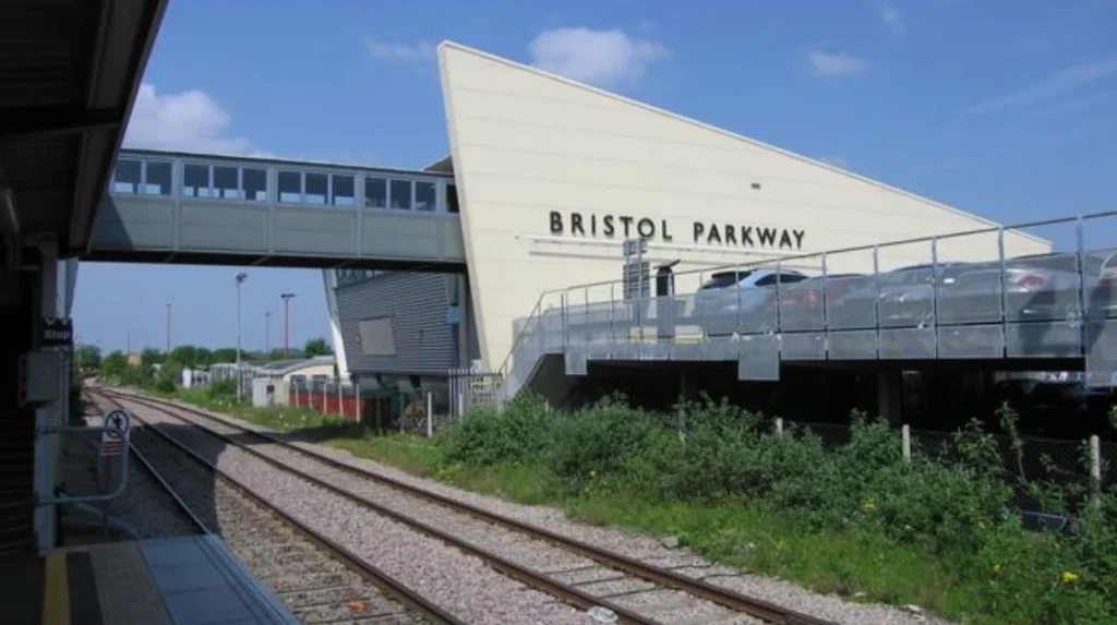
Bristol Parkway railway station is a major transport gateway in North Bristol. It serves communities including Stoke Gifford, Bradley Stoke, Filton, Patchway, and surrounding South Gloucestershire areas.
The station provides national and regional rail connections. Its position on major railway routes makes it particularly useful for longer-distance commuters.
Bristol Parkway also has strong road access. The station is located near the M4/M5 corridor, providing connections toward South Wales, London, Gloucestershire, and wider parts of England.
The North Bristol area contains significant employment concentrations. Filton, Aztec West, Bristol Business Park, UWE Bristol’s Frenchay campus, and Cribbs Causeway are all part of the wider North Bristol economic geography.
Metrobus further strengthens the area. Bristol City Council states that the m1 Metrobus route currently travels between Cribbs Causeway and Hengrove Park, passing through Patchway, Aztec West, Stoke Gifford, UWE Frenchay Campus, Broadmead, the city centre, Bedminster, Inns Court, and Hengrove.
This creates an important north-south transport corridor across Bristol.
Bristol Parkway is therefore particularly suitable for people who prioritise rail connectivity and North Bristol employment areas. It is less central than Temple Meads but stronger for some regional and national journeys.
How does Metrobus improve access to Bristol’s best-connected areas?
Metrobus improves Bristol’s transport connectivity through faster, more frequent, and more reliable services linking important destinations. Its routes connect areas such as Cribbs Causeway, North Bristol, the city centre, Bedminster, Hengrove, and other major employment and residential locations.
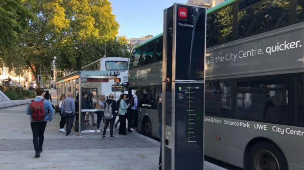
Metrobus is Bristol’s bus rapid transit system. Bristol City Council describes it as a modern public transport service for the greater Bristol area, designed to provide faster, more frequent, and more reliable journeys to key destinations.
The system uses dedicated infrastructure on parts of its network. This reduces exposure to general traffic on selected sections and improves journey reliability.
Metrobus also supports interchange. Its routes connect with railway stations, conventional bus services, walking routes, cycling infrastructure, employment centres, and major destinations.
The m1 route demonstrates the importance of this network. It connects Cribbs Causeway with Hengrove Park and passes through several major North, Central, and South Bristol locations.
Bristol City Council is extending the m1 service further south toward Imperial Retail Park. The project also includes improved walking, wheeling, cycling, bus stops, real-time passenger information, and step-free boarding facilities.
For people choosing where to live or work, Metrobus access therefore expands the practical area around major transport hubs.
A neighbourhood without a railway station can still have strong transport connectivity if it has direct Metrobus or high-frequency bus access.
How should you choose the best Bristol area based on transport needs?
The best Bristol area depends on the journey pattern. Temple Quarter suits national rail users; Old Market and Redcliffe suit central commuters; Bedminster suits South Bristol; Clifton Down suits North-Central Bristol; and Bristol Parkway suits regional and national rail commuters.
Transport decisions should begin with the destination rather than the neighbourhood name.
People commuting to London or other national destinations should prioritise proximity to Bristol Temple Meads or Bristol Parkway. Temple Meads is particularly strong for city-centre access, while Parkway is strategically positioned for North Bristol and South Gloucestershire.
People working in central Bristol can consider Old Market, Redcliffe, Temple Quarter, Clifton, and Clifton Down. These areas provide combinations of walking, buses, cycling, and rail.
South Bristol commuters can consider Bedminster because the railway station and bus network provide direct connections toward the centre and wider South Bristol.
North Bristol workers can consider areas around Bristol Parkway, Filton, Stoke Gifford, Patchway, and Bradley Stoke because of the combination of rail, bus, Metrobus, and road connectivity.
Accessibility is another important consideration. Bristol City Council’s Temple Meads programme specifically identifies improved step-free access, wayfinding, cycle parking, pedestrian routes, and interchange facilities as priorities.
Transport costs also matter. Bristol’s bus network includes conventional local buses, Metrobus, and Park and Ride services. Bristol City Council confirms that eligible concessionary passholders can use local buses, Metrobus, Park and Ride, and community transport under specified conditions.
The final decision should therefore consider rail frequency, bus frequency, interchange requirements, walking distance, cycling provision, accessibility, employment location, and travel direction.
How is Bristol’s transport network expected to shape future well-connected areas?
Bristol’s best-connected areas will continue to be influenced by railway investment, Temple Meads regeneration, Metrobus expansion, active-travel schemes, and regional transport projects. These improvements strengthen connections between residential districts, employment centres, universities, regional destinations, and Bristol’s central transport hubs.
Transport connectivity in Bristol is an evolving system rather than a fixed network.
Temple Meads is undergoing major planning and investment aimed at creating a more integrated transport interchange. Bristol City Council identifies new entrances, improved public spaces, enhanced passenger facilities, cycle connections, bus interchange facilities, and better accessibility as major components of the programme.
Metrobus expansion is also reshaping connections. The m1 extension toward Imperial Retail Park is accompanied by active-travel improvements and upgraded bus infrastructure.
The wider West of England transport strategy also includes major corridor projects. Bristol City Council identifies projects covering the city centre, A4 Portway, and the Bus Route 2 corridor between Henbury and Stockwood.
Rail investment is another important factor. In July 2026, the Department for Transport announced that work had started to restore passenger services on the Portishead railway line. The project includes two new stations and is scheduled to provide direct Portishead–Bristol Temple Meads services from 2028, with journeys expected to take around 25 minutes.
This project will increase the importance of transport-linked locations around the Portishead corridor and Temple Meads.
Future transport investment therefore reinforces the importance of areas around major interchanges. Temple Quarter remains the strongest central hub, while Bristol Parkway, Bedminster, Clifton Down, Lawrence Hill, Old Market, and Redcliffe each serve different parts of the urban transport network.
Explore More Area Guide
Cycling Around Bristol: Routes, Paths & Guide 2026
Bristol Bus Guide: Routes, Fares & Travel Tips 2026
What makes a Bristol neighbourhood genuinely well connected?
A genuinely well-connected Bristol neighbourhood combines reliable public transport with practical walking, cycling, interchange, and road access. The strongest locations connect residents to multiple destinations without requiring private-car travel for every journey, while providing access to employment, education, services, and leisure.
Distance to a station is only one measure of connectivity.
A neighbourhood with one railway station but limited bus services has a different transport profile from an area with several bus corridors, a railway station, cycle routes, and direct walking connections.
Interchange is especially important. Bristol’s transport strategy increasingly focuses on connections between different modes rather than isolated services.
Temple Meads demonstrates this principle. The city council’s plans explicitly identify seamless interchange between transport modes, pedestrian and cycle connectivity, cycle parking, and accessible passenger routes as key requirements.
Frequency also matters. A frequent bus or Metrobus service provides more flexibility than a service operating only occasionally.
Accessibility is another defining factor. Step-free boarding, accessible station entrances, clear signage, safe walking routes, and appropriate cycle facilities all affect the practical usability of a transport hub.
Employment geography should also be considered. Bristol Parkway is especially relevant to North Bristol employment areas. Temple Quarter is important for central Bristol. Bedminster serves South Bristol. Clifton Down provides access to Clifton and surrounding northern central districts.
The best-connected neighbourhood is therefore the one that matches the user’s regular journey pattern.
Where should visitors and commuters stay if transport access is the priority?
Visitors and commuters prioritising transport should consider Temple Quarter first, followed by Old Market, Redcliffe, Bedminster, Clifton Down, and areas around Bristol Parkway. These locations provide different combinations of railway, bus, Metrobus, walking, cycling, and regional connectivity.
Temple Quarter is the strongest all-purpose choice for visitors arriving by train. Bristol Temple Meads provides direct access to the national rail network and multiple onward transport options.
Old Market and Redcliffe are strong choices for visitors who want to remain close to the city centre while maintaining easy access to Temple Meads.
Bedminster is useful for people spending time in South Bristol or travelling regularly between South Bristol and the centre.
Clifton and Clifton Down suit visitors interested in Clifton, Whiteladies Road, the university area, and northern central Bristol. Clifton Down adds the advantage of local rail access.
Bristol Parkway is more suitable for visitors and commuters whose journeys focus on North Bristol, South Gloucestershire, Filton, Bradley Stoke, or longer-distance rail travel.
Transport planning should also include the final walking journey. Bristol is a hilly city, so a short map distance does not always represent an equally easy walking route.
The city also supports shared mobility. Visit Bristol states that e-bikes and e-scooters are available at Bristol Parkway and Temple Meads, with designated parking zones used for e-scooters.
This provides an additional first-mile and last-mile transport option.
Overall, transport-linked areas provide the strongest foundation for flexible travel across Bristol. Temple Quarter remains the principal hub, while Old Market, Redcliffe, Bedminster, Clifton Down, Lawrence Hill, St Philip’s, and Bristol Parkway each provide specialised advantages.
Bristol’s ongoing railway, Metrobus, active-travel, and interchange investment will continue to increase the importance of locations with direct connections to major transport corridors. For residents, visitors, students, workers, and businesses, proximity to reliable transport remains a major factor in choosing where to live, work, stay, or invest.
What is the best area in Bristol for transport links?
Temple Quarter is the best overall area for transport links in Bristol because Bristol Temple Meads provides extensive national rail connections alongside buses, taxis, walking routes, cycling facilities, and planned transport interchange improvements.