Redland is a residential neighbourhood in north-east Bristol, close to Clifton, Cotham, Bishopston, Westbury Park and the University of Bristol. The area combines Victorian and Edwardian residential streets, historic Georgian buildings, local green spaces, independent businesses and strong public transport connections.
- What is Redland in Bristol?
- Where is Redland located in Bristol?
- How did Redland develop historically?
- What type of architecture can you see in Redland?
- What is Redland Green and what can visitors do there?
- What are the main shopping and food areas in Redland?
- How well connected is Redland by public transport?
- What is Redland like for students and university visitors?
- Is Redland a good area for families and everyday residential life?
- What historic places should visitors look for in Redland?
- How does Redland compare with nearby Bristol neighbourhoods?
- What should visitors know about parking and getting around Redland?
- Why is Redland important to Bristol today?
- What is the practical Redland area guide for first-time visitors?
Redland also forms part of Bristol’s wider Cotham and Redland historic townscape. Bristol City Council identifies the Cotham and Redland Conservation Area as an important area of architectural and spatial character. Its streets include substantial villas, terraces, detached houses, institutions, gardens and historic routes.
The neighbourhood serves several groups. Students live close to the University of Bristol. Long-term residents use local shops, parks and community facilities. Visitors use Redland as a base for exploring Clifton, the Downs, Gloucester Road and central Bristol. The combination of housing, green space, food businesses and transport gives Redland a distinct place within Bristol.
What is Redland in Bristol?
Redland is a north-east Bristol neighbourhood known for Victorian and Edwardian housing, historic Georgian buildings, Redland Green, independent businesses, student accommodation and transport connections linking the area with Clifton, central Bristol and wider north Bristol.
Redland is primarily residential, but its character is shaped by several different land uses. Residential streets occupy much of the neighbourhood. Local commercial activity is concentrated around roads such as Chandos Road, Redland Road and nearby Whiteladies Road. Green spaces provide another important component.
The University of Bristol describes Redland as a popular residential neighbourhood within walking distance of its Clifton campus. It also identifies elegant townhouses, greenery, smaller parks and independent food businesses as important features of the area.
Redland should also be distinguished from the formal administrative Redland ward. A neighbourhood is a geographical and social area, while a ward is an electoral and administrative division used by Bristol City Council. The boundaries of the Redland neighbourhood and Redland ward are not identical in every context.
Bristol City Council places Redland within Area Committee 2 alongside Bishopston and Ashley Down, Stoke Bishop, and Westbury-on-Trym and Henleaze.
For visitors, the name Redland generally refers to the neighbourhood around Redland Road, Redland Green, Chandos Road, Redland Grove and adjoining streets. The wider area connects directly with Cotham, Clifton, Bishopston and Westbury Park.
Where is Redland located in Bristol?
Redland sits north-east of Clifton and north-west of central Bristol, between neighbourhoods including Cotham, Bishopston, Westbury Park and Henleaze, with Clifton Down, Gloucester Road and Whiteladies Road providing important nearby connections.
Redland occupies a well-connected position between Bristol’s central neighbourhoods and northern residential districts. Clifton lies to the south-west. Cotham lies closer to the city centre. Bishopston and Westbury Park extend north and north-west. Clifton Down provides access to the larger open landscape of The Downs.
The area’s street pattern reflects several stages of development. Bristol City Council’s conservation appraisal identifies Hampton Road, Cotham Road, Cotham Grove, Cotham Brow, Redland Road, Redland Grove and Cheltenham Road as historically important routes.
The railway line is another major geographical feature. It runs east-west through the conservation area and separates parts of the northern and southern street network. The council appraisal identifies Gloucester Road, Hampton Road, Redland Grove, Redland Road and Kingsley Road as important crossings or routes beneath or across the railway corridor.
The location provides practical access to several major Bristol destinations. The University of Bristol’s Clifton campus is nearby. Clifton Village, Clifton Suspension Bridge, Bristol city centre, Gloucester Road and The Downs are also within the wider local area.
This position explains why Redland attracts both permanent residents and students. The neighbourhood provides residential streets close to employment, education, shopping, leisure and transport destinations.
How did Redland develop historically?
Redland developed from an earlier rural and estate landscape into an urban neighbourhood through Georgian development and rapid nineteenth-century expansion, producing historic villas, terraces, institutions, churches and planned streets that still shape Redland’s appearance today.
Redland’s history extends well beyond its Victorian residential streets. Redland Court provides one of the clearest surviving examples of the area’s earlier development. Historic England records the present Redland Court as a Grade II* listed building dating from 1732–1735. It was designed by John Strachan for John Cossins.
The current building replaced an earlier Elizabethan house. Historic England records that the earlier house was demolished in 1730 before the Georgian building was constructed. Redland Court was designed in the Palladian style, with limestone ashlar construction and a formal symmetrical composition.
Redland Chapel provides another important historical landmark. Historic England dates the chapel to 1740–1743 and lists it at Grade I. The building uses Baroque architectural features, limestone ashlar and a distinctive domed form.
The history of Redland Court also connects with Bristol’s involvement in the transatlantic slave economy. Historic England’s research identifies longstanding connections between Redland Court and people associated with Caribbean plantations and the slave trade. These connections form part of the documented historical context of the estate and Bristol.
Urban expansion accelerated during the nineteenth century. The Cotham and Redland conservation appraisal describes the transition from earlier eighteenth-century terraces to larger villas, mid-Victorian terraces and denser semi-detached housing in East and West Redland.
The railway also influenced the area’s structure. Its cutting became a defining physical feature and remains part of the neighbourhood’s townscape.
What type of architecture can you see in Redland?
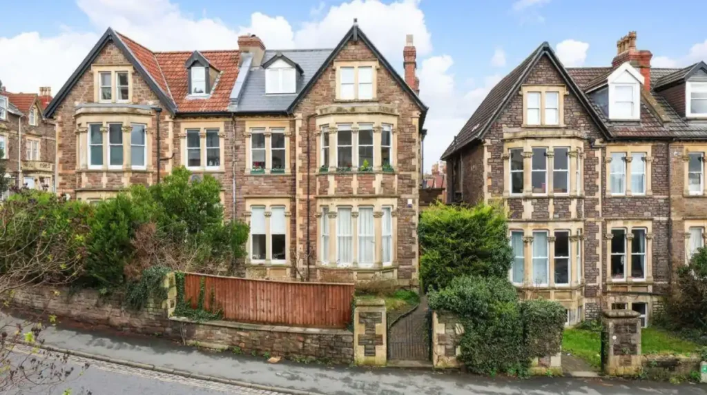
Redland contains Georgian, Victorian and Edwardian architectural forms, including villas, terraces, semi-detached houses, detached homes, churches and institutional buildings, with limestone construction, sash windows, decorative façades, gardens and boundary walls appearing across historic residential streets.
Architecture is one of Redland’s most visible characteristics. The Cotham and Redland Conservation Area appraisal describes a network of residential streets dominated by substantial semi-detached villas, with terraces, detached houses and institutional buildings also present.
The architectural character changes between streets. Earlier routes retain less regular layouts shaped by historic field divisions and topography. Later Victorian development produced more regular streets and repeated house forms.
Chandos Road and surrounding streets contain examples of nineteenth-century residential architecture. East and West Redland contain substantial areas of semi-detached housing. The areas around Redland Green and Redland Court contain larger historic buildings and open spaces.
Cambridge Park contains listed Victorian houses. Historic England records Nos. 13 and 14 Cambridge Park as a Grade II listed pair dating from 1865. The buildings were designed by W. H. Hawtin and use Italianate architectural details.
Redland Court represents an earlier architectural period. Its Palladian design differs substantially from the later Victorian housing that dominates many surrounding streets. Redland Chapel adds a Baroque landmark to the historic environment.
The architectural mix explains the visual diversity of Redland. Visitors can identify changes in building scale, façade treatment, street width, gardens and construction materials while walking between different parts of the neighbourhood.
What is Redland Green and what can visitors do there?
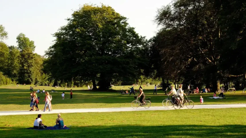
Redland Green is a public green space in Redland with grassed areas, a children’s playground, sports-related facilities, walking and cycling connections, and links towards Westbury Park, making it an important recreational space for residents and visitors.
Redland Green is one of the area’s principal open spaces. Bristol City Council lists it as a local park with a children’s playground and grassy area. The council states that it is open at all times and has no admission charge.
The park includes facilities for different activities. These include a children’s playground, bowling club, private tennis club and pedestrian and cycling routes connecting Redland Green with Westbury Park.
Redland Green also has formal heritage significance. Bristol City Council includes it on the city’s Village Green Register.
The surrounding landscape is important to the conservation area’s character. The Cotham and Redland appraisal identifies Redland Green and its allotments as an open northern edge to the conservation area. It also identifies Redland Green, Redland Grove and Cotham Grove as important public spaces.
The green is suitable for short walks, informal recreation and family visits. Its position also makes it useful as a stopping point when exploring the wider Redland neighbourhood.
Visitors should distinguish Redland Green from The Downs. The Downs is a much larger open landscape near Clifton and Clifton Down. Redland Green is a smaller neighbourhood green with a more local function.
What are the main shopping and food areas in Redland?
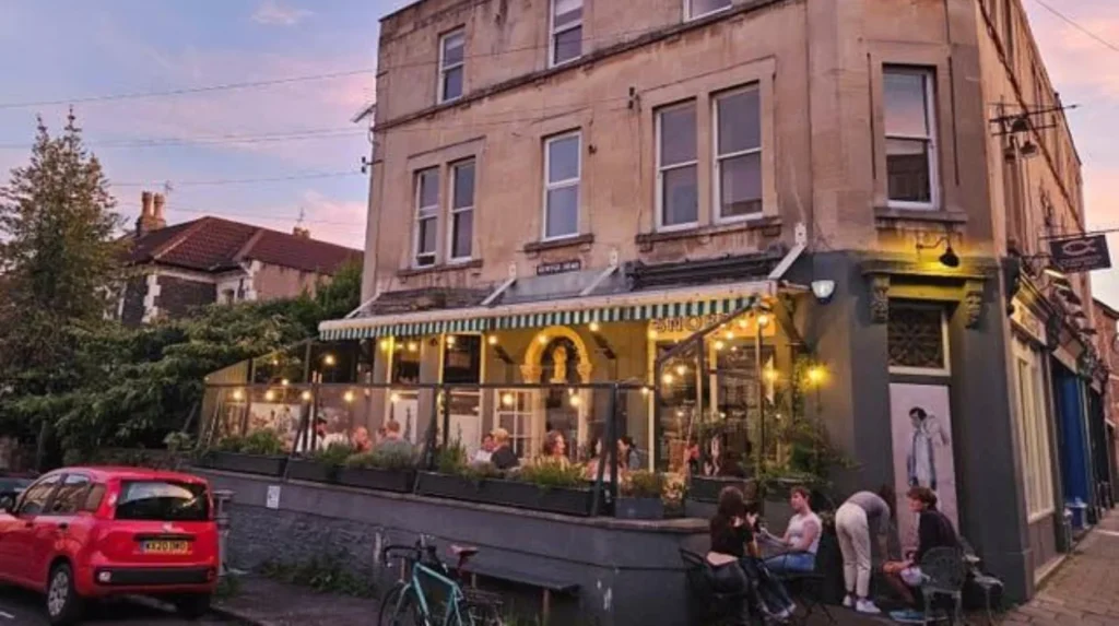
Redland’s local commercial activity is concentrated around streets such as Chandos Road, Lower Redland Road and nearby Whiteladies Road, where independent cafés, restaurants, food businesses and everyday services support residents, students and visitors.
Chandos Road is one of the most recognisable local commercial streets. The University of Bristol specifically identifies Chandos Road and Lower Redland Road as locations for independent eateries and cafés.
The food offer reflects Redland’s residential and student population. Cafés provide daytime food and drinks. Restaurants serve different cuisines. Independent businesses add everyday services to the neighbourhood.
Whiteladies Road is another major commercial destination close to Redland. It connects Redland with Clifton and Clifton Down and contains a wider concentration of shops, restaurants, cafés and services.
The commercial pattern is different from Bristol city centre. Redland does not function as a large central shopping district. Its businesses are distributed along local high streets and neighbourhood routes.
For visitors, this structure supports a walking-based itinerary. A visitor can combine a walk through residential streets with a café stop, Redland Green and nearby historic buildings.
The University of Bristol identifies coffee shops and independent eateries as part of Redland’s local amenities. It also describes the neighbourhood as having convenient public transport connections.
How well connected is Redland by public transport?
Redland has bus and rail connections serving Bristol’s central and northern areas, while nearby Clifton Down station provides access to the Severn Beach railway corridor and onward connections towards Bristol Temple Meads and other destinations.
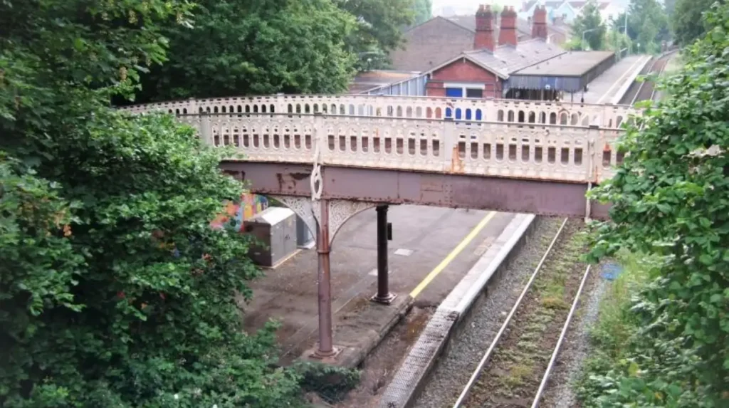
Rail is an important part of Redland’s transport structure. Redland station is located on the Severn Beach Line, while nearby Clifton Down station provides another rail option. The railway corridor runs through the wider neighbourhood.
National Rail identifies Clifton Down station as being on Whiteladies Road and records step-free access to its platforms through ramps. The station also provides bicycle storage and local bus connections.
The onward travel information for Clifton Down lists bus routes serving destinations including Bristol Temple Meads, Temple Quay, Redland, Durdham Downs, the University of Bristol and several northern Bristol districts.
The University of Bristol states that Bristol Temple Meads is approximately ten minutes from Redland by train.
Bus services provide additional connections. Routes around Clifton Down and Whiteladies Road link the area with central Bristol and northern neighbourhoods.
Travel times depend on service patterns, traffic and the exact starting point. Visitors should check current timetables before travelling because railway engineering works and temporary service changes affect Bristol’s rail network at different times.
Redland is also suitable for walking. Clifton, Cotham, Bishopston and the University of Bristol campus are all connected through the surrounding street network.
What is Redland like for students and university visitors?
Redland is a significant student residential area because it sits close to the University of Bristol’s Clifton campus and combines shared housing, independent cafés, food businesses, green spaces, rail services and bus routes within a walkable north Bristol neighbourhood.
The University of Bristol identifies Redland as an area where a significant number of university students live. Its location close to the Clifton campus makes it practical for students who want access to university facilities and local amenities.
Student housing is integrated into the existing residential environment. Large Victorian and Edwardian houses often contain multiple rooms or flats, while other properties remain single-family homes.
The concentration of students influences local businesses. Cafés, restaurants and convenience services operate alongside established residential uses. Chandos Road and Lower Redland Road are specifically identified by the University of Bristol as local destinations for independent food and drink businesses.
Transport adds another advantage for university users. Bus services connect the area with the Clifton campus and central Bristol. Rail services provide access to other parts of the city.
The student presence does not define every part of Redland. The neighbourhood includes families, professionals, older residents, landlords, homeowners and long-term residents. Its population therefore includes several residential groups rather than a single demographic.
Is Redland a good area for families and everyday residential life?
Redland provides a residential environment with parks, playgrounds, schools, local shops, cafés, public transport and established housing, while its conservation-area status protects important elements of the historic townscape and influences some property alterations.
Families use Redland Green and other nearby open spaces for recreation. The playground at Redland Green provides dedicated facilities for younger children. The park also includes pedestrian and cycling routes.
Housing varies by street. Larger Victorian and Edwardian properties provide substantial accommodation. Terraced houses, semi-detached houses and flats add different housing formats.
The historic environment also affects property management. Parts of Redland fall within the Cotham and Redland Conservation Area. Bristol City Council provides a formal character appraisal covering architecture, landscape, historic development and management issues.
An Article 4 Direction applies to the Cotham and Redland Conservation Area for boundary walls and hard standings. Article 4 Directions remove specified permitted development rights, meaning certain works require planning permission.
Residents therefore need to check the planning status of individual properties before undertaking external alterations. Conservation area status and Article 4 controls do not apply identically to every property.
Bristol City Council’s local information system provides property-level information covering matters such as conservation areas, resident parking schemes and school catchment areas.
What historic places should visitors look for in Redland?
Visitors exploring Redland can identify Redland Court, Redland Chapel, historic villas, Victorian terraces, Cambridge Park buildings, Redland Green and historic street layouts as key elements of the neighbourhood’s built and cultural heritage.
Redland Court is one of the most important historic buildings in the area. Historic England lists it at Grade II* and dates the surviving building to 1732–1735. It was built for John Cossins and designed by John Strachan.
Redland Chapel stands close to Redland Green. Historic England lists it at Grade I and dates it to 1740–1743. Its Baroque design includes a domed roof structure and detailed classical decoration.
The relationship between Redland Court, Redland Chapel and surrounding open space is important. Bristol City Council’s conservation appraisal identifies the landscape around these buildings as contributing to the area’s character.
Cambridge Park provides examples of listed Victorian residential architecture. Historic England records the pair at Nos. 13 and 14 Cambridge Park as Grade II listed buildings dating from 1865.
Redland Court Library is another listed structure. Historic England records it as a Grade II building dating from 1735.
Many historic buildings are privately occupied or have restricted access. Visitors should therefore distinguish between seeing a building from public streets and entering a heritage property.
A walking route through Redland can focus on public streets, open spaces and publicly visible architecture without requiring access to private buildings.
How does Redland compare with nearby Bristol neighbourhoods?
Redland sits between several distinct Bristol neighbourhoods, combining the residential character of Bishopston and Westbury Park with proximity to Clifton, Cotham, Gloucester Road and the University of Bristol’s Clifton campus.
Clifton lies south-west of Redland and is known for its Georgian architecture, Clifton Village, Clifton Suspension Bridge and proximity to The Downs. Cotham sits closer to the city centre and University of Bristol campus.
Bishopston and Ashley Down extend north-east. Westbury Park and Henleaze lie further north. Gloucester Road provides a major commercial corridor east of parts of Redland.
Redland shares characteristics with each surrounding area while retaining its own street pattern. The conservation appraisal identifies different character areas including West Redland, Redland Green and Redland Court, and East Redland.
The University of Bristol groups Redland with Cotham and Kingsdown in its local area guide because of their relationship with the Clifton campus. It describes Redland as a residential neighbourhood with greenery, townhouses, independent eateries and transport connections.
For visitors, these neighbourhoods can be explored together. A route can begin around Clifton Down, continue through Redland, reach Chandos Road, pass Redland Green and continue towards Gloucester Road or Cotham.
The boundaries between neighbourhoods are often less obvious on the ground than on administrative maps. Roads, railway infrastructure, open spaces and changes in architecture provide stronger visual markers.
What should visitors know about parking and getting around Redland?
Redland has controlled parking arrangements in parts of the neighbourhood, while walking, cycling, buses and rail provide alternatives for local travel; visitors should check current parking restrictions because permit zones operate on specified roads and hours.
Bristol City Council operates a Redland Residents’ Parking Scheme. The council states that its operational hours are Monday to Friday from 9am to 5pm. The scheme has a defined boundary and specific permit arrangements.
There is no dedicated car park at Redland Green. Bristol City Council directs visitors to general Bristol parking information rather than providing a dedicated park-and-ride facility at the green.
Parking restrictions vary by street. Visitors should read signs and check the applicable parking scheme before leaving a vehicle.
Walking is practical for short journeys between Redland Green, Chandos Road, Redland Road and nearby neighbourhoods. Cycling is also supported by local routes. Redland Green includes pedestrian and cycling connections towards Westbury Park.
Public transport provides an alternative to driving. Rail services operate through Redland and Clifton Down, while buses connect the wider district with central and northern Bristol.
For visitors staying in accommodation outside Redland, public transport is particularly useful because the neighbourhood connects to major Bristol destinations without requiring parking within the residential streets.
Explore More Area Guide
Clifton Area Guide: Village, Bridge, History & Attractions
Best Areas Near UWE Bristol: Frenchay, Fishponds & More
Why is Redland important to Bristol today?
Redland remains important because it combines historic architecture, protected townscape, residential communities, university-related activity, local businesses, green space and public transport within a compact part of north-east Bristol.
Redland’s current identity results from several historical layers. Georgian estates established important landmarks. Victorian expansion created much of the residential street network. Railway development changed movement through the area. Modern universities, businesses and transport continue to shape everyday activity.
The conservation area provides a formal framework for protecting historic character. Bristol City Council’s appraisal identifies architecture, historic routes, open spaces, landscape, trees and townscape details as important elements of the area’s special character.
Redland Green adds an important public landscape function. Its playground, grassed areas and pedestrian and cycling connections serve local residents, while its inclusion on the Village Green Register gives it additional legal and historical significance.
The University of Bristol contributes another major dimension. Student residents support local cafés, restaurants and services, while the university’s nearby Clifton campus keeps Redland closely connected to higher education.
Transport strengthens the neighbourhood’s wider role. Rail and bus services connect Redland with central Bristol, northern districts and destinations beyond the immediate neighbourhood. National Rail identifies Clifton Down as a key local interchange for bus and rail travel.
Redland therefore functions as more than a residential district. It is a historic urban neighbourhood with active local commerce, educational links, green infrastructure and strong connections to the wider Bristol urban area.
What is the practical Redland area guide for first-time visitors?
A practical Redland visit combines its historic streets, Redland Green, local cafés and restaurants, railway surroundings, nearby Clifton Down and architectural landmarks, with walking providing an effective way to connect the neighbourhood’s main areas.
Start around Redland or Clifton Down and explore the surrounding residential streets. Look for changes in architectural scale between terraces, villas and semi-detached houses.
Continue towards Redland Green. The park provides open space, a children’s playground and pedestrian and cycling connections.
Continue towards Redland Court and Redland Chapel where publicly accessible views allow. These buildings represent the area’s eighteenth-century architectural heritage. Historic England records Redland Court as Grade II* and Redland Chapel as Grade I.
Chandos Road provides a natural point for food and drink. The University of Bristol identifies the street and Lower Redland Road as local destinations for independent eateries and cafés.
From there, visitors can continue towards Whiteladies Road, Clifton, Cotham or Gloucester Road. The exact route depends on the visitor’s interests and available time.
Redland works particularly well as part of a wider north Bristol walking itinerary. Its proximity to Clifton, Cotham, Bishopston, Westbury Park and The Downs makes it possible to combine several neighbourhoods in one day.
The area also rewards slower exploration. Its historic character is distributed across streets rather than concentrated inside one visitor attraction. Architectural details, gardens, boundary walls, green spaces and historic routes form the main experience.
Redland is therefore best understood as a neighbourhood rather than a single attraction. Its significance comes from the combination of built heritage, residential life, green space, food businesses, education and transport.
For anyone researching Bristol, moving to the city, visiting the University of Bristol or exploring neighbourhoods beyond the central tourist core, Redland provides a detailed example of how historic and modern urban uses coexist within north-east Bristol.
What is Redland Bristol known for?
Redland is known for its Victorian and Edwardian homes, Georgian heritage, Redland Green, independent cafés and restaurants, and proximity to the University of Bristol, Clifton and Gloucester Road.