Bedminster is a historic inner-south Bristol area located immediately south of the River Avon and close to Bristol city centre. It combines historic streets, Victorian housing, independent businesses, parks, cultural venues, transport links and major regeneration projects. Its identity reflects centuries of settlement, industry and urban growth.
- What is Bedminster and where is it in Bristol?
- How old is Bedminster and what is its history?
- What architectural character does Bedminster have?
- What are the main streets and commercial areas in Bedminster?
- What can visitors do in Bedminster?
- Which parks and green spaces are in Bedminster?
- How does transport work in Bedminster?
- What is Bedminster Green and why is it important?
- What is the River Malago’s connection with Bedminster?
- What is Bedminster known for today?
- How is Bedminster changing in 2026?
- Why is Bedminster important within Bristol?
What is Bedminster and where is it in Bristol?
Bedminster is an established south Bristol neighbourhood located close to the city centre, with East Street, West Street and North Street forming important local routes. The wider area connects residential streets with shopping, parks, culture, transport facilities and Ashton Gate.
Bedminster sits south of the River Avon and forms part of Bristol’s inner southern urban area. It is closely connected with Southville, Windmill Hill, Ashton Gate, Ashton Vale, Bedminster Down and Totterdown.
The name Bedminster refers to both the historic settlement and the modern neighbourhood associated with the wider BS3 area. Administrative boundaries do not perfectly match the everyday meaning of Bedminster. The current Bedminster ward includes The Chessels, parts of Windmill Hill, Ashton Vale, Bedminster Down and Victoria Park. Bristol City Council recorded a Bedminster ward population of 12,916 in the 2021 Census.
Bedminster belongs to Bristol City Council’s Area Committee 7 alongside Southville, Windmill Hill and Filwood. A ward is an electoral and administrative division used for local government purposes.
The area’s location gives it a strong connection with central Bristol. Bedminster Green sits within walking distance of central areas, Temple Quarter and local employment locations. The council identifies this accessibility as one reason for ongoing investment in the area.
How old is Bedminster and what is its history?
Bedminster is an ancient settlement with Roman-era activity and a pre-Norman church foundation. It remained independently governed for centuries before entering Bristol in 1897, then expanded rapidly through coal mining, industry, housing and Victorian urban development.
Bedminster’s history predates modern Bristol. Historic evidence identifies Roman activity around the present East Street and West Street corridor. By 1086, Bedminster was recorded as a substantial royal manor.
The medieval settlement developed around St John the Baptist Church. The church served as an important religious centre and became associated with surrounding communities. East Street and West Street followed an ancient route towards the River Avon crossing and Bristol.
During the medieval period, Bedminster increasingly interacted with Bristol’s expanding commercial economy. North Street developed as an important route west from the city. The area’s location between Bristol and Somerset helped establish its transport and trading importance.
Bedminster experienced severe destruction during the English Civil War. In 1644, Prince Rupert’s forces attacked the settlement before the second siege of Bristol. Historic England records that much of Bedminster was destroyed by fire during the attack.
Coal mining later transformed the area’s economy. Bristol’s coalfield supported mining in Bedminster, Easton, Kingswood and Ashton. The Dean Lane Colliery in Bedminster employed more than 400 men and children during the industrial period.
Industrial expansion changed Bedminster from a rural parish into a dense urban settlement. Bristol Museums records the population rising from approximately 3,000 in 1801 to more than 70,000 in 1901 when considering the historic parish and its industrial expansion.
Bedminster entered Bristol’s municipal boundary in 1897. This marked a major administrative change after centuries as a distinct settlement.
What architectural character does Bedminster have?
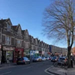
Bedminster has a mixed architectural character shaped by medieval routes, industrial development, Victorian terraces, community buildings and modern regeneration. East Street, West Street, North Street and surrounding residential streets retain much of the area’s historic urban structure.
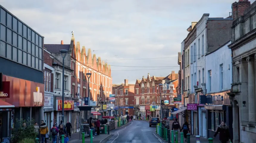
Victorian terraces form an important part of Bedminster’s built environment. Bristol City Council’s heritage framework identifies Bedminster among Bristol’s neighbourhoods where terraced streets are predominantly Victorian in character.
The historic street pattern remains visible around East Street, Bedminster Parade and West Street. Narrow plots and older building lines reflect earlier development patterns.
Industrialisation created demand for large quantities of workers’ housing. Terraced homes appeared close to mines, factories, workshops and commercial streets. Many streets therefore combine residential architecture with evidence of the area’s industrial past.
Ashton Gate also contains historic civic architecture. Ashton Gate Junior School dates from 1876 and 1881 and is listed at Grade II. Its design includes Gothic architectural details, Pennant rubble construction and decorative tiled features.
Modern development is now adding another architectural layer. Bedminster Green includes housing, public-realm improvements and plans connected with restoring the River Malago.
The result is an area where historic terraces, commercial buildings, community facilities and contemporary developments sit within a relatively compact urban landscape.
What are the main streets and commercial areas in Bedminster?
East Street, Bedminster Parade and North Street are central commercial routes in Bedminster. They provide shops, cafés, restaurants, markets, services and cultural venues, while West Street and surrounding residential roads connect the commercial core with neighbouring communities.
East Street is one of Bedminster’s oldest commercial corridors. Its origins connect with the historic route through the settlement.
Bedminster Parade forms another important section of the central commercial area. Shops and services occupy premises along the route, linking East Street with surrounding neighbourhoods.
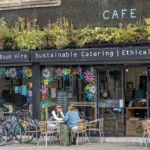
North Street has a different commercial identity. It is strongly associated with independent businesses, food, cultural venues and street art. Visit Bristol describes North Street as a centre for independent shops, cafés, bars, restaurants and markets.
The Tobacco Factory is a major cultural landmark near North Street. The former industrial building now contains a café-bar and theatre spaces and hosts regular performances and markets.
East Street and Bedminster Parade provide more conventional high-street functions. Businesses include food shops, bakeries, butchers, delis, charity shops and other everyday services.
This combination gives Bedminster several distinct commercial zones rather than a single shopping centre.
What can visitors do in Bedminster?
Visitors can explore independent shops, street art, theatres, markets, parks, food venues, historic streets and sporting facilities across Bedminster. North Street, Tobacco Factory, Victoria Park, Windmill Hill and Ashton Gate provide key destinations within the wider area.
Bedminster is recognised by Visit Bristol as a destination for independent retail, dining, urban art, cultural activity and parks.
Street art is one of the area’s most visible cultural features. North Street and surrounding streets contain murals associated with Bristol’s urban-art culture.
Upfest began at the Tobacco Factory in 2008. By 2018, the festival had hosted 400 artists representing more than 60 countries, demonstrating the international scale that the event achieved.
Tobacco Factory Theatres provides another cultural attraction. Its programme includes theatre, comedy, dance, music and other performances. The adjoining café-bar also functions as a social and event space.
Visitors can also explore markets. The Tobacco Factory hosts a Sunday market, creating a regular destination for local produce, crafts, food and independent trading.
Ashton Gate Stadium is another major destination. It is home to Bristol City Football Club and Bristol Bears Rugby.
The combination of cultural venues, sporting facilities and independent businesses makes Bedminster suitable for visitors seeking activities outside Bristol’s central tourist core.
Which parks and green spaces are in Bedminster?
Bedminster has several accessible green spaces, including Victoria Park, Dame Emily Park, Luckwell Park, Greville Smyth Park and Bedminster Common. These spaces provide playgrounds, walking areas, sports facilities, open grassland and community recreation within the urban neighbourhood.
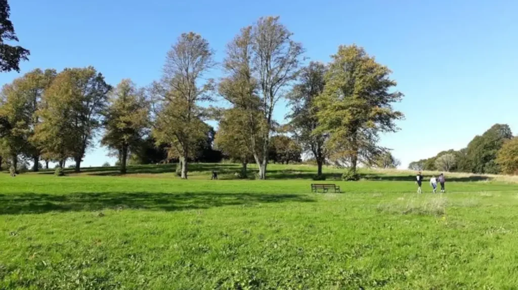
Victoria Park is one of Bedminster’s largest and most recognisable green spaces. Bristol City Council describes it as a large Victorian park with a children’s play area and extensive grassy space.
The park includes tennis courts, a bowling green, outdoor gym facilities, a multi-use games area, a skate and wheels park and children’s play areas. It also has a marked 1,700-metre walking, jogging and running route.
Dame Emily Park provides another community green space in Bedminster. Bristol City Council identifies it as a community park with a children’s park, skate facilities and green space.
Greville Smyth Park lies nearby and provides further open space and children’s facilities. Luckwell Park is a smaller inner-city park with a playground and grass area.
Bedminster Common also forms part of Bristol’s green-space network. The council has included the site in ecological grassland management work using wildflower and yellow-rattle techniques.
These parks are important because Bedminster has a dense urban form. They provide recreation, children’s activities, exercise space and accessible outdoor areas without requiring travel outside south Bristol.
How does transport work in Bedminster?
Bedminster has rail, bus, walking and cycling connections linking the neighbourhood with central Bristol and surrounding areas. Bedminster railway station, local bus routes, MetroBus services and major roads support travel across Bristol and connections towards employment, leisure and regional destinations.
Bedminster’s location provides a strong transport connection with central Bristol. The neighbourhood sits close to major routes linking south Bristol with the city centre.
Bedminster railway station is an important part of the area’s transport infrastructure. Bristol City Council identifies the station alongside MetroBus services and bus routes as a key transport asset within the Bedminster Green regeneration area.
Bristol Temple Meads provides the principal regional railway gateway. The station opened on 31 August 1840 as the western terminus of the Great Western Railway’s main line from London to Bristol.
Temple Meads expanded substantially as Bristol’s population and railway traffic increased. The present historic complex includes work associated with Brunel and later railway engineers.
Bus services provide additional connections between Bedminster, central Bristol and surrounding neighbourhoods. Visit Bristol identifies several bus routes connecting the wider Southville and Bedminster area with the city centre and other parts of Bristol.
Walking is also significant because parts of Bedminster are close to central Bristol. The council’s Bedminster Green project specifically identifies walking distance to the city centre and Temple Quarter as an advantage of the location.
What is Bedminster Green and why is it important?
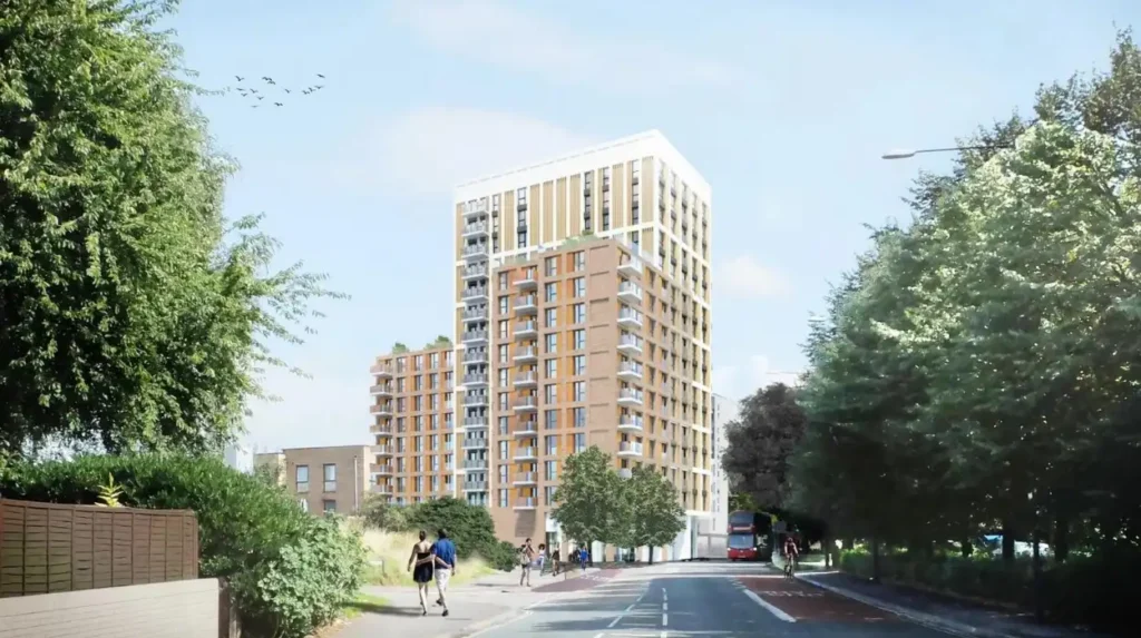
Bedminster Green is a major regeneration area around Hereford Street, Providence Place, Bedminster station, St Catherine’s Place and nearby streets. The project combines new housing, public-realm improvements, transport infrastructure and restoration of the River Malago.
Bedminster Green occupies a strategically important location between the traditional town centre and transport connections towards central Bristol.
The regeneration area includes the area around Bedminster station and St Catherine’s Place. Earlier planning work defined the area around Hereford Street, Providence Place, Bedminster station and surrounding land.
Bristol City Council states that the project is intended to provide new homes in a growing city. The council also identifies the area’s proximity to the city centre, Temple Quarter, jobs, shops and public transport as important development factors.
The project includes restoration of the River Malago. The Malago historically influenced Bedminster’s settlement pattern and once flowed through the area towards the Avon.
Regeneration also aims to reconnect areas separated by car parks and former industrial sites. The council describes the project as an opportunity to strengthen East Street and support local businesses and employment.
For residents and visitors, the long-term significance is the physical relationship between housing, transport, green space, high-street activity and public infrastructure.
What is the River Malago’s connection with Bedminster?
The River Malago is a historic watercourse that influenced Bedminster’s settlement pattern and drainage. It formerly followed a route through the area towards the River Avon, and current regeneration plans include restoring sections of the river as part of Bedminster Green.
The Malago has played an important role in Bedminster’s physical development.
Historical evidence places the watercourse along the line of present-day Malago Road and Dalby Avenue before it crossed near Bedminster Parade and continued northwards towards the Avon.
Watercourses influenced settlement because they affected agriculture, drainage, industry and transport routes. Bedminster developed within a fertile and well-watered landscape before industrialisation changed its physical character.
Industrial expansion subsequently altered many parts of the natural environment. Urban construction, roads, commercial premises and infrastructure reduced the visibility of the historic river system.
The Bedminster Green regeneration project includes restoration of the River Malago. This reconnects current planning with an important feature of Bedminster’s historic geography.
The river therefore has both historical and contemporary relevance. It provides a direct link between Bedminster’s medieval landscape and current urban regeneration.
What is Bedminster known for today?
Bedminster is known for its independent businesses, North Street, street art, Victorian terraces, parks, cultural venues, sporting facilities and strong links with central Bristol. Its identity combines historic industry with contemporary food, retail, arts, recreation and regeneration.
North Street remains one of the strongest symbols of modern Bedminster. Independent retailers, cafés, restaurants, bars and cultural venues create a concentrated commercial environment.
Street art is another defining feature. Upfest helped establish Bedminster and Southville as internationally recognised locations for large-scale urban art. Visit Bristol identifies more than 170 murals across the wider area.
The area’s industrial heritage also remains important. Coal mining, manufacturing and dense worker housing shaped the neighbourhood during the nineteenth century. The transition from industrial settlement to mixed urban neighbourhood explains much of the present built environment.
Sport is represented by Ashton Gate Stadium, while cultural activity is centred around venues such as Tobacco Factory Theatres.
Parks provide another major part of local life. Victoria Park, Dame Emily Park, Greville Smyth Park and other open spaces provide recreational facilities within a densely developed urban environment.
Bedminster therefore has several interconnected identities rather than one single defining function.
Explore More Area Guide
Bishopston Bristol Area Guide: Gloucester Road, History & Local Life
Redland Area Guide: History, Food, Homes and Things to Do
How is Bedminster changing in 2026?
Bedminster is undergoing continued investment in housing, transport, public space, walking infrastructure, green infrastructure and high-street regeneration. Current projects focus on Bedminster Green and wider South Bristol liveable-neighbourhood proposals affecting streets and connections around the area.
Bedminster’s future development is closely linked with Bristol’s wider growth.
The Bedminster Green project is delivering a long-term transformation focused on housing, public space, transport connections, the River Malago and East Street.
South Bristol Liveable Neighbourhood proposals also affect the wider area. Bristol City Council’s revised 2026 proposals include changes involving North Street and Bedminster East, with measures designed to improve walking, cycling, crossings, accessibility and connections between neighbourhoods.
The council has identified improvements such as dropped kerbs, tactile paving, pedestrian crossings and clearer wayfinding. These measures form part of a wider approach to making local streets easier to navigate.
Parking management is another component of current planning. Proposed measures include Residents’ Parking Schemes and other parking controls across parts of south Bristol.
These projects demonstrate that Bedminster’s development is not limited to new buildings. The transformation also involves streets, public spaces, transport, walking infrastructure, ecological features and the historic high street.
Why is Bedminster important within Bristol?
Bedminster is important because it combines an ancient settlement, major industrial heritage, dense Victorian housing, established commercial streets, cultural destinations, green spaces and strategic transport connections. Its location also makes it a significant part of Bristol’s wider south-city regeneration strategy.
Bedminster connects several stages of Bristol’s development. Its Roman-era origins demonstrate the age of the settlement. Its medieval routes show its relationship with Bristol and Somerset. Its coal industry explains nineteenth-century industrial expansion. Its Victorian terraces document rapid urban growth.
Its modern commercial streets demonstrate how historic urban areas adapt to changing economic patterns. North Street has developed a strong independent retail, food and arts identity, while East Street retains an important high-street function.
Its parks provide essential recreational infrastructure. Victoria Park alone includes sports, play, walking and community facilities.
Its transport position gives it direct relevance to Bristol’s future growth. Bedminster Green is close to central Bristol, Temple Quarter and established transport corridors.
The combination of heritage, community infrastructure, commerce and regeneration makes Bedminster a significant part of Bristol’s urban geography.
For visitors, the area provides access to independent shops, markets, street art, theatres, food venues, parks and sport. For residents, it provides established neighbourhood infrastructure close to central Bristol. For the city, it represents an important location for accommodating growth while retaining historic character.
What is Bedminster known for?
Bedminster is known for its historic streets, Victorian terraces, independent shops, North Street, street art, parks, cultural venues, food businesses and proximity to central Bristol. The area also has a strong industrial and coal-mining heritage.