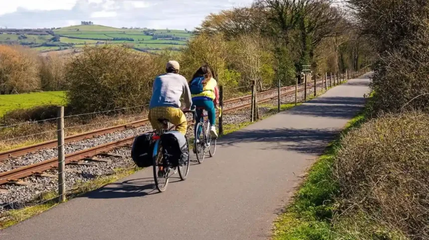
The Bristol and Bath Railway Path is one of the South West of England’s most established walking and cycling routes. Connecting Bristol with Bath, this 13.9-mile (23.3-kilometre) shared-use trail follows much of a former Midland Railway line. It provides a traffic-free route for everyday journeys, recreational cycling, walking, running and wheelchair-accessible outdoor activities.
- What Is the Bristol and Bath Railway Path?
- What Is the History of the Bristol and Bath Railway Path?
- Where Does the Bristol and Bath Railway Path Start and Finish?
- What Are the Main Attractions Along the Bristol and Bath Railway Path?
- What Can Visitors See at Staple Hill Tunnel?
- Why Is Mangotsfield Station Historically Important?
- What Can Visitors Discover at Warmley Station?
- Why Is Bitton a Popular Stop?
- What Makes Saltford Worth Exploring?
- Is the Bristol and Bath Railway Path Suitable for Walking and Cycling?
- Is the Route Suitable for Beginner Cyclists?
- Can Families Walk or Cycle Along the Path?
- Is the Path Accessible to Wheelchair Users?
- What Wildlife and Natural Landscapes Can Visitors Experience?
- Which Birds Can Be Seen Along the Route?
- How Does the Railway Path Support Local Biodiversity?
- When Is the Best Time for Wildlife Observation?
- What Facilities and Refreshment Stops Are Available Along the Route?
- Where Can Cyclists Stop for Food and Drinks?
- Are There Toilets and Rest Areas?
- Can Visitors Access Public Transport?
- How Can Visitors Plan a Bristol to Bath Railway Path Journey?
- Should Visitors Cycle One Way or Return?
- What Should Cyclists Bring?
- What Is the Best Way to Choose a Route Section?
- What Safety Rules Should Users Follow on the Railway Path?
- How Should Cyclists Share the Path?
- Are There Traffic Crossings Along the Route?
- What Should Visitors Know About Route Maintenance?
- What Improvements Are Planned for the Bristol and Bath Railway Path?
- How Does the Bristol and Bath Railway Path Benefit Local Communities?
- How Does the Path Support Sustainable Transport?
- How Does the Route Support Local Businesses?
- What Is the Route’s Contribution to Public Health?
- What Should Visitors Know Before Visiting the Bristol and Bath Railway Path?
The route forms part of National Cycle Network Route 4 (NCN 4), a long-distance cycling route connecting destinations across southern England and Wales. Its relatively flat alignment, predominantly asphalt surface, historic railway infrastructure and connections with local communities make it an important part of Bristol’s active travel network.
The Bristol and Bath Railway Path also has historical significance. It was the first major project undertaken by Sustrans, now known as the Walk Wheel Cycle Trust. Its development demonstrated how disused railway infrastructure could become a practical public route for sustainable transport.
The path serves several purposes. Commuters use it to travel between neighbourhoods, families use it for recreational outings, and visitors use it to explore the landscape between Bristol and Bath. It also functions as a wildlife corridor, connecting green spaces and habitats along the former railway.
What Is the Bristol and Bath Railway Path?
The Bristol and Bath Railway Path is a 13.9-mile shared walking and cycling route connecting Bristol and Bath. It follows a former Midland Railway corridor and forms part of National Cycle Network Route 4, providing an almost entirely traffic-free route.
The route is managed by the Walk Wheel Cycle Trust, formerly Sustrans, a UK charity promoting walking, wheeling and cycling. It is open to pedestrians, cyclists, runners and other permitted path users.
According to the charity’s route information, the path measures approximately 23.3 kilometres. Around 97.6% of the route is traffic-free, while 99.7% has an asphalt surface. These characteristics make it suitable for a wide range of everyday and recreational journeys.
The route starts in Bristol and continues eastwards through residential neighbourhoods, suburban settlements and countryside towards Bath. Its former railway alignment provides a relatively level gradient compared with many surrounding roads and countryside routes.
Why Is the Railway Path Important to Bristol?
The Bristol and Bath Railway Path provides an alternative to motorised transport for journeys between communities. It supports active travel, reduces dependence on private vehicles for suitable local journeys and gives residents access to outdoor recreation.
Its importance extends beyond transport. The path connects residential areas with railway heritage sites, local businesses, public green spaces and countryside landscapes.
It also provides a continuous shared-use corridor for people who walk, cycle, run or use mobility equipment. This combination of transport, recreation and environmental functions makes it an important regional asset.
What Is the History of the Bristol and Bath Railway Path?
The Bristol and Bath Railway Path was developed during the late 1970s and early 1980s along a disused Midland Railway corridor. The first section opened in 1979, and the completed route officially opened on 6 August 1985.
The route has its origins in the decline of Britain’s traditional railway network. The former Midland Railway Mangotsfield and Bath branch line connected communities between Bristol and Bath. Passenger services eventually ended in the 1960s, leaving railway infrastructure that later became available for alternative uses.
The railway corridor offered an opportunity to create a continuous walking and cycling route without constructing an entirely new transport network.
How Did Sustrans Develop the Route?
The project began with Cyclebag, a Bristol-based cycling organisation established in 1977. Cyclebag promoted the development of safe cycling infrastructure and recognised the potential of disused railway lines.
Work on the Bristol and Bath Railway Path started in June 1979. More than 300 volunteers contributed approximately 800 days of labour to the first construction phase. The initial section covered around eight kilometres and opened before the end of 1979.
Further development required negotiations with landowners and local residents, alongside additional volunteer work. Different sections were gradually connected to create a continuous route.
The completed railway path officially opened on 6 August 1985. This date was significant because it marked 150 years since the opening of the original railway line.
The project established an important model for converting abandoned transport infrastructure into public cycling and walking facilities. It also became the first major project undertaken by Sustrans, which subsequently developed a much wider network of sustainable transport routes. visitbristol.co.uk+2
What Was the Original Midland Railway Line?
The Midland Railway was a major British railway company that operated routes across England and other parts of the country. Its former Mangotsfield and Bath branch provided a railway connection between the Bristol area and Bath.
The line’s closure formed part of the wider restructuring of Britain’s railway network during the 1960s. Following the removal of passenger services, the disused trackbed became a potential resource for local transport improvements.
The railway’s former alignment explains several characteristics of the modern path, including its relatively gentle gradients, long straight sections and historic station locations.
Where Does the Bristol and Bath Railway Path Start and Finish?
The Bristol and Bath Railway Path connects the Bristol city area with Bath over approximately 13.9 miles. It follows an eastbound corridor through Staple Hill, Mangotsfield, Warmley, Bitton and Saltford before reaching Bath.
The route provides access to several residential communities and historic railway locations. Its alignment also connects with other walking and cycling routes, making it useful for both short local journeys and longer recreational trips.
Which Locations Does the Route Pass Through?
The main locations along the route include:
Bristol: The western end connects with Bristol’s urban cycling network. Riders can access the path from the city’s eastern neighbourhoods and surrounding residential districts.
Staple Hill: This suburban area provides access to the route and is close to the historic Staple Hill railway tunnel.
Mangotsfield: The former Mangotsfield railway station is an important historical feature. Its distinctive railway layout reflects the area’s former role as a railway junction.
Warmley: The former Warmley station provides a convenient stopping point. Its railway heritage and nearby facilities make it a recognised location along the path.
Bitton: Bitton is associated with the Avon Valley Railway, a heritage railway that preserves part of the area’s railway history.
Saltford: This village provides access to local refreshments and the surrounding countryside. The nearby River Avon adds environmental and recreational interest.
Bath: The eastern end connects with Bath’s transport and walking networks, providing access to the historic city.
These locations give the route a combination of urban, suburban and rural characteristics.
How Long Does It Take to Complete the Route?
The full journey generally takes between 1 hour 15 minutes and 4 hours 30 minutes, depending on the activity and pace. The Walk Wheel Cycle Trust publishes these estimated journey times for the 13.9-mile route.
Cyclists travelling at a steady recreational speed generally complete the route faster than walkers. Families with children, people taking refreshments and visitors exploring historical locations should allow additional time.
Walking the entire route requires a longer commitment. A section-by-section approach is more practical for visitors who want to explore the railway heritage or surrounding communities.
What Are the Main Attractions Along the Bristol and Bath Railway Path?
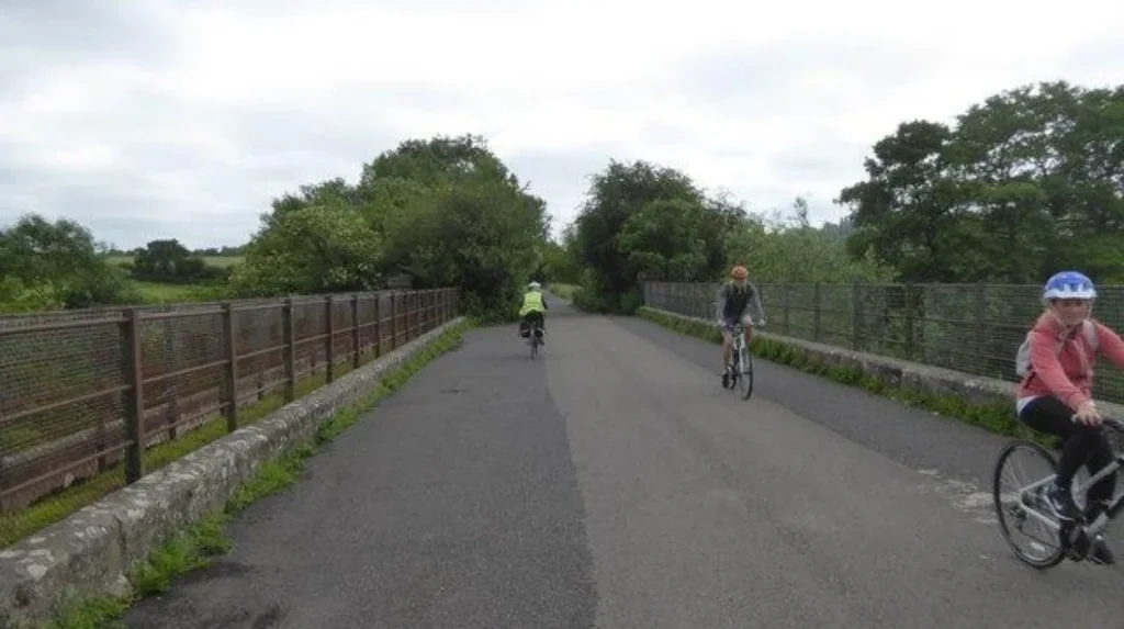
The Bristol and Bath Railway Path combines railway heritage, countryside scenery, historic stations and access to local communities. Notable attractions include the Staple Hill tunnel, Mangotsfield station remains, Warmley station, Bitton and the Avon Valley Railway.
The route is not simply a transport corridor. Its former railway infrastructure provides historical interest, while the surrounding environment offers opportunities to observe wildlife and explore nearby settlements.
What Can Visitors See at Staple Hill Tunnel?
Staple Hill tunnel is one of the recognisable railway structures along the Bristol section of the route. It reflects the engineering history of the former Midland Railway.
The tunnel forms part of the railway corridor reused for modern walking and cycling. Its presence helps visitors understand how the original railway infrastructure shaped the current route.
Visitors should maintain awareness of other path users when approaching and travelling through enclosed sections.
Why Is Mangotsfield Station Historically Important?
Mangotsfield was an important railway junction on the former railway network. Its station served the surrounding communities and formed part of the historic railway infrastructure connecting Bristol and Bath.
The former station area provides an opportunity to understand the railway’s previous layout. Its history also demonstrates how railway stations influenced the growth and transport connections of local settlements.
What Can Visitors Discover at Warmley Station?
Warmley station is a popular stopping point along the route. Its former railway buildings preserve the character of the area’s transport history.
The station location provides a convenient place to pause during a longer cycling journey. Visitors can also explore the surrounding Warmley area before continuing towards Bitton or Bath.
Why Is Bitton a Popular Stop?
Bitton is particularly significant because of its association with the Avon Valley Railway.
The heritage railway preserves railway operations and historic locomotives. It offers a different experience from the shared-use path, allowing visitors to explore the area’s railway heritage.
The station is also a useful stopping point for cyclists and walkers travelling between Bristol and Saltford.
Visitors interested in heritage train services should check the railway’s official operating timetable before travelling because operating days and services vary.
What Makes Saltford Worth Exploring?
Saltford is a village between Bristol and Bath with access to the River Avon and surrounding countryside.
The area provides opportunities to explore local landscapes and observe wildlife. The river environment supports habitats for birds and other wildlife, while nearby village facilities provide options for refreshments.
Saltford is also a useful location for people who prefer shorter walking or cycling journeys rather than completing the entire route.
Is the Bristol and Bath Railway Path Suitable for Walking and Cycling?
The Bristol and Bath Railway Path is suitable for walking, cycling, running and wheeling. Its predominantly asphalt surface and relatively flat railway alignment support different activity levels, although shared-use etiquette and road crossings require attention.
The route is designed for multiple users rather than cyclists alone. Pedestrians, recreational cyclists, commuters, runners and families share the same corridor.
Its accessibility characteristics make it an important outdoor facility for people with different mobility requirements. However, users should understand that accessible infrastructure does not automatically mean every section is suitable for every mobility aid.
Is the Route Suitable for Beginner Cyclists?
The route is generally suitable for beginner cyclists because most of it follows a former railway line with relatively gentle gradients.
New cyclists can practise maintaining a steady speed without navigating continuous motor traffic. The predominantly asphalt surface also provides a consistent riding environment.
Beginners should start with a shorter section before attempting the complete journey. This approach helps them assess their cycling ability, comfort and confidence.
Families cycling with children should pay particular attention to busy junctions, other path users and the approach to the urban sections.
Can Families Walk or Cycle Along the Path?
Families can use the railway path for recreational outings, short walks and cycling trips. Its connections with local communities make it possible to select manageable sections rather than completing the full distance.
Parents should supervise younger children, particularly near crossings, tunnel entrances and areas where cyclists travel at higher speeds.
The route’s popularity among families is supported by recent usage figures. The Walk Wheel Cycle Trust reported that, near Easton Community Centre, average annual journeys by children increased from 110,000 in 2021 to 230,000 in 2024. Journeys by women increased from 340,000 to 720,000 over the same period.
These figures demonstrate the growing importance of comfortable and accessible active travel infrastructure in Bristol.
Is the Path Accessible to Wheelchair Users?
The railway path provides access for disabled users and has a predominantly asphalt surface. Its relatively flat alignment supports wheeling and other forms of assisted mobility.
However, some locations contain narrow sections, junctions and pinch points that affect ease of movement. Users with larger wheelchairs, mobility scooters or adapted cycles should check current access information before travelling.
The Walk Wheel Cycle Trust and regional transport authorities have identified accessibility improvements as an important part of the route’s development.
What Wildlife and Natural Landscapes Can Visitors Experience?
The Bristol and Bath Railway Path passes through urban green spaces, wooded sections, hedgerows and countryside habitats. These environments support local wildlife, including birds, insects and other species associated with riverside and green corridor landscapes.
A wildlife corridor is a connected strip of habitat that allows animals and plants to move between larger green spaces. The railway path performs this environmental function alongside its transport and recreational purposes.
The route’s vegetation and surrounding habitats create opportunities for nature observation throughout the year.
Which Birds Can Be Seen Along the Route?
The Saltford section is particularly relevant to birdwatching because of its proximity to the River Avon and associated habitats.
Bird species associated with the wider area include:
- Kingfishers, which hunt small fish along suitable waterways.
- Herons, which feed in shallow water and riverside habitats.
- Cormorants, which dive for fish in rivers and lakes.
- Woodpeckers, which use mature trees and woodland environments.
These are examples of species reported or associated with the surrounding landscape, not guaranteed sightings at every visit.
Birdwatchers should avoid disturbing nesting birds and remain on designated paths when observing wildlife.
How Does the Railway Path Support Local Biodiversity?
Biodiversity refers to the variety of living organisms within an environment. Along the railway path, vegetation, trees, hedgerows and nearby waterways provide habitats and movement corridors for different species.
Wildflowers and other vegetation support pollinating insects, including bees and butterflies. Trees provide nesting and feeding opportunities for birds, while connected green spaces help wildlife move through developed areas.
The path’s environmental value depends on habitat management, vegetation protection and responsible public access.
Visitors can support biodiversity by avoiding littering, keeping dogs under control and respecting wildlife habitats.
When Is the Best Time for Wildlife Observation?
Spring and summer provide opportunities to observe flowering plants, butterflies and active birdlife. Autumn offers changing vegetation and seasonal bird activity, while winter provides clearer views through areas with reduced leaf cover.
Wildlife sightings depend on weather, habitat conditions and seasonal behaviour. Early morning visits often provide favourable conditions for observing birds and other animals.

What Facilities and Refreshment Stops Are Available Along the Route?
The Bristol and Bath Railway Path connects with local facilities, former railway stations, village amenities and nearby refreshment locations. Warmley, Bitton and Saltford provide useful stopping opportunities, although facilities and opening times vary.
The route passes through residential and rural communities rather than operating as a fully serviced recreational park. Visitors should therefore plan food, water and rest breaks according to their journey length.
Where Can Cyclists Stop for Food and Drinks?
Bitton and Warmley are recognised stopping points along the route. Both locations have railway heritage connections and provide opportunities to take a break.
Saltford offers access to village amenities and nearby places for refreshments. Visitors should check current business opening hours before relying on a particular café or pub.
For longer journeys, carrying drinking water and a small supply of food provides additional flexibility.
Are There Toilets and Rest Areas?
Facilities are not distributed evenly along the entire railway path. Visitors should identify suitable stopping points before starting, particularly when travelling with children or people who require regular breaks.
Some nearby attractions and businesses provide customer facilities, but access conditions vary. Users should check whether facilities are available to the general public or restricted to customers.
Can Visitors Access Public Transport?
The Bristol and Bath Railway Path connects two cities with established railway stations and wider public transport networks.
Visitors can arrange a one-way journey by cycling in one direction and returning by train, subject to bicycle carriage availability.
The main railway connections include:
- Bristol Temple Meads.
- Bath Spa.
Travellers should check train timetables, engineering works and bicycle reservation requirements with Great Western Railway before travelling.
How Can Visitors Plan a Bristol to Bath Railway Path Journey?
Visitors can plan a Bristol to Bath Railway Path journey by selecting an access point, checking route conditions, choosing a suitable activity and arranging refreshments or return transport. Preparation is particularly important for families and people completing the full distance.
A successful visit depends on matching the route section with available time, physical ability and transport arrangements.
Should Visitors Cycle One Way or Return?
A one-way journey is suitable for visitors who want to explore both cities without cycling the full distance twice. Travellers can finish in Bath and use the train network to return towards Bristol.
A return cycling journey requires approximately 27.8 miles (46.6 kilometres) of riding, excluding additional local exploration.
People choosing this option should consider their fitness, daylight hours and the availability of refreshments along the route.
What Should Cyclists Bring?
Cyclists should prepare for changing weather conditions and possible delays along the route.
Useful equipment includes:
- A roadworthy bicycle with functioning brakes.
- A helmet that fits correctly.
- Front and rear bicycle lights.
- Drinking water and snacks.
- A charged mobile phone.
- A puncture repair kit and basic tools.
- Weather-appropriate clothing.
Visitors should also carry any medication or personal mobility equipment they require during the journey.
What Is the Best Way to Choose a Route Section?
The best section depends on the purpose of the visit. Families often prefer shorter journeys with convenient stopping points, while experienced cyclists can complete the full Bristol-to-Bath route.
Walking visitors should consider dividing the route into manageable sections. The full distance is substantial for a recreational walk and requires suitable footwear, food and water.
Checking the route map before departure helps visitors identify road crossings, access points and alternative transport connections.
What Safety Rules Should Users Follow on the Railway Path?
Safety on the Bristol and Bath Railway Path depends on considerate shared use, controlled cycling speeds, clear communication and awareness of junctions. Users should respect pedestrians, give sufficient passing space and follow signs wherever the route meets public roads.
The route accommodates different speeds and mobility requirements. Cyclists therefore have a responsibility to ride predictably and avoid creating unnecessary risks for pedestrians and other users.
How Should Cyclists Share the Path?
Cyclists should maintain a speed appropriate to the available space and surrounding activity. They should give pedestrians sufficient room when overtaking and use a bell or clear verbal warning when approaching from behind.
Pedestrians should remain aware of approaching cyclists, particularly in narrow sections and busy urban areas.
Dogs should be kept under control, with owners ensuring that leads do not obstruct other users.
Are There Traffic Crossings Along the Route?
Although the railway path is predominantly traffic-free, it is not completely separated from the public road network.
Some junctions and crossings require users to stop and assess traffic conditions. Particular attention is necessary around the Bristol and Bath urban sections.
The Walk Wheel Cycle Trust identifies the route as 97.6% traffic-free. Visitors should not interpret this figure as meaning that the entire journey is completely isolated from motor traffic. Walk Wheel Cycle Trust+1
What Should Visitors Know About Route Maintenance?
Path conditions can change because of weather, vegetation growth, surface damage and maintenance work.
Users should check current route notices before travelling. Temporary restrictions, construction activity and local diversions can affect individual sections without closing the entire route.
Visitors should follow temporary signs and avoid entering restricted work areas.
What Improvements Are Planned for the Bristol and Bath Railway Path?
The Bristol and Bath Railway Path is receiving investment to improve safety and accessibility. In February 2026, the West of England Mayoral Combined Authority announced more than £450,000 for improvements between Staple Hill tunnel and Bitton Station.
The investment reflects the increasing importance of the route for commuting, recreation and active travel.
According to the West of England Mayoral Combined Authority, the relevant section receives an average of more than 1,100 cyclists and pedestrians daily. Growing housing and employment activity in the surrounding area is expected to increase demand. West of England Combined Authority+1
What Improvements Are Being Introduced?
The announced investment includes several safety and accessibility measures.
These include:
- Installing CCTV cameras between Staple Hill tunnel and the former Mangotsfield Station.
- Improving nine pinch points along the route.
- Making the path more accessible for disabled people and families using non-standard wheeled equipment.
Pinch points are narrow sections where the available space restricts movement or makes it difficult for different users to pass safely.
Improving these locations supports more comfortable journeys for pedestrians, cyclists, wheelchair users and families.
Why Is Investment in the Route Important?
The route’s popularity creates demands for better maintenance, accessibility and safety.
Increasing residential development and employment opportunities around Bristol and South Gloucestershire contribute to additional journeys. Improvements help maintain the route’s capacity to serve both everyday transport and recreational activities.
The investment also supports wider regional objectives for sustainable travel, healthier communities and reduced dependence on private vehicles.
Explore More Area Guide
Bristol Cycling Guide: Routes, Bike Hire and Safety
Best Cycling Routes in Bristol: Scenic Trails and City Paths
How Does the Bristol and Bath Railway Path Benefit Local Communities?
The Bristol and Bath Railway Path benefits local communities by providing an accessible transport corridor, supporting physical activity, connecting residential areas and encouraging sustainable travel. It also attracts visitors to local businesses and preserves important railway heritage.
Its benefits extend beyond the people who complete the full journey between Bristol and Bath. Residents use individual sections for commuting, shopping, exercise and access to community facilities.
How Does the Path Support Sustainable Transport?
Active travel refers to journeys completed through walking, wheeling and cycling rather than relying entirely on motorised transport.
The railway path provides a practical alternative for suitable journeys between neighbourhoods and nearby settlements.
Its connection with National Cycle Network Route 4 also makes it part of a wider network of walking and cycling infrastructure.
By providing a continuous route, it helps residents incorporate physical activity into everyday journeys.
How Does the Route Support Local Businesses?
Visitors travelling along the path create opportunities for nearby cafés, pubs, shops and tourism businesses.
Bitton, Warmley and Saltford provide examples of communities where visitors can stop during their journeys.
The heritage railway at Bitton also contributes to local tourism by attracting visitors interested in historic locomotives and railway experiences.
These connections demonstrate how active travel infrastructure supports local economic activity alongside transport objectives.
What Is the Route’s Contribution to Public Health?
Walking and cycling provide opportunities for regular physical activity. The railway path supports these activities by offering a relatively flat route separated from motor traffic for most of its length.
Regular physical activity contributes to cardiovascular fitness, muscular strength and general wellbeing.
The path also gives residents access to outdoor environments, which supports recreational activity and contact with nature.
What Should Visitors Know Before Visiting the Bristol and Bath Railway Path?
Visitors should check route conditions, weather forecasts, transport arrangements and available facilities before travelling. Choosing an appropriate section, carrying essential equipment and respecting shared-use rules helps create a safer and more enjoyable visit.
The path remains an important destination for Bristol residents and visitors exploring the wider South West.
Its combination of railway history, countryside access and practical transport connections makes it suitable for different types of journeys.
Visitors should remember that the route is a shared public space rather than a dedicated high-speed cycling track. Consideration for other users remains essential.
The Bristol and Bath Railway Path also demonstrates the long-term value of converting disused railway infrastructure into sustainable transport facilities. Its development from a volunteer-led project in 1979 into a major regional route highlights the importance of community participation and long-term infrastructure investment.
As investment in accessibility and safety continues, the path retains its role as a significant connection between Bristol, South Gloucestershire and Bath.
For residents, it provides an alternative way to travel and exercise. For tourists, it offers access to historic railway locations, riverside landscapes and local communities. For the wider region, it remains an important example of how walking and cycling infrastructure supports sustainable transport, environmental connections and local economic activity.
How long is the Bristol and Bath Railway Path?
The Bristol and Bath Railway Path is approximately 13.9 miles (23.3 kilometres) long. It connects Bristol with Bath through several communities, including Staple Hill, Mangotsfield, Warmley, Bitton and Saltford.