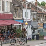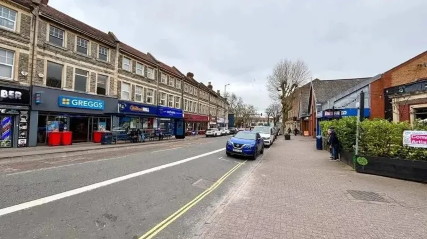
Fishponds is a large residential neighbourhood in east Bristol, centred on Fishponds Road and positioned about 3 miles northeast of Bristol city centre. The area combines a historic village core, a busy high street, green spaces, the Bristol and Bath Railway Path, local schools, community facilities, and access to the Frome Valley. Bristol City Council identifies central Fishponds as an established town centre with opportunities for further housing and mixed-use development.
- What is Fishponds and where is it in Bristol?
- How did Fishponds get its name and develop historically?
- What are the main landmarks and historic places in Fishponds?
- What is Fishponds Road like?
- What food and drink can visitors find in Fishponds?
- Which parks and green spaces are near Fishponds?
- How can people use the Bristol and Bath Railway Path from Fishponds?
- How well connected is Fishponds to central Bristol?
- What is everyday life like in Fishponds?
- What development is taking place in Fishponds?
- Why is Fishponds significant within Bristol?
What is Fishponds and where is it in Bristol?
Fishponds is an established east Bristol neighbourhood centred on Fishponds Road, about 3 miles northeast of Bristol city centre. It connects residential streets, shops, cafés, parks, cycling routes and the Frome Valley with surrounding communities including Eastville, Stapleton, Frenchay and Staple Hill.
Fishponds forms part of the wider east Bristol urban area. The neighbourhood is closely associated with Fishponds Road, which functions as its principal commercial route. Bristol City Council describes central Fishponds as a town centre approximately 3 miles from Bristol city centre.
The wider Fishponds area overlaps several administrative areas, including Frome Vale, Eastville and Hillfields. The exact boundary depends on whether the reference is a neighbourhood, ward, planning area or postal district.
Fishponds is positioned between established Bristol neighbourhoods and settlements beyond the city. Eastville lies to the west and southwest, Stapleton lies nearby to the west, Frenchay is to the north, Staple Hill is to the east, and Downend is farther east.
The area has an important relationship with the River Frome and the green spaces of the Frome Valley. This gives Fishponds a combination of urban streets and accessible natural landscapes.
Fishponds also sits close to major transport corridors. The M32 provides a road connection towards central Bristol and the wider motorway network, while Fishponds Road provides the main local north-east route.
For visitors, residents and people considering the area, Fishponds is therefore best understood as an urban neighbourhood rather than a single attraction or compact tourist district.
How did Fishponds get its name and develop historically?
Fishponds takes its name from former quarry workings that became ponds, with evidence of fishponds existing by the early 17th century. The settlement developed from a rural landscape into an industrial and residential suburb before becoming part of Bristol in 1897.
The name Fishponds reflects the area’s historic landscape. Bristol City Council’s archaeological planning guidance records fishponds in the area by the early 17th century and notes that they possibly existed considerably earlier.
The area’s geology influenced its development. Quarrying created excavations that later filled with water. These ponds contributed to the name that became associated with the settlement.
Fishponds was originally connected with the wider Kingswood Forest landscape. Bristol City Council records that much of east Bristol was formerly part of the royal forest of Kingswood. Settlement gradually expanded across this landscape.
Industrial activity increased across east Bristol from the 18th century. Nearby areas developed coal mining, metalworking, pottery, glass production and other industries. The River Frome also supported watermills and industrial activity.
Fishponds developed a stronger suburban identity during the 19th century. A regular omnibus service connected the settlement with Bristol and Downend by the 1860s. A railway station also opened in the area during the same period.
The arrival of electric trams in 1897 strengthened Fishponds’ connection with Bristol. The same year brought an important administrative change because Fishponds became part of the expanding city of Bristol.
This transition from rural settlement to connected suburb shaped the street pattern and built environment visible today.
What are the main landmarks and historic places in Fishponds?
Fishponds’ principal historic features include St Mary’s Church, the former St Matthias educational campus, historic streets and buildings around the old village area, and the former railway corridor now used by the Bristol and Bath Railway Path. These features reflect religious, educational, transport and industrial development.
Historic buildings remain an important part of Fishponds’ identity.
St Matthias is one of the area’s most significant historic buildings. The former educational campus began as a teacher-training institution. UWE Bristol records that the original institution was founded in 1853 and eventually became part of Bristol Polytechnic and then the University of the West of England.
The St Matthias site closed to students in 2014 after teaching moved to UWE Bristol’s Frenchay Campus. UWE records that approximately 10,000 students were taught at the campus between its foundation in 1853 and its closure as an educational campus.
The historic character extends beyond individual buildings. Bristol City Council’s conservation documentation identifies the relationship between Fishponds, Stapleton and the Frome Valley as an important historic landscape. The architectural character includes cottages, stone walls, rendered buildings, red brick structures and historic houses.
The former railway route provides another visible link with Fishponds’ industrial past. The railway corridor was transformed into the Bristol and Bath Railway Path, creating a modern active-travel route along a historic transport alignment.
Historic maps are useful for understanding this transformation. Bristol City Council’s Know Your Place service provides historic mapping and heritage information for Bristol, allowing users to compare historical landscapes with present-day neighbourhoods.
What is Fishponds Road like?
Fishponds Road is the commercial spine of the neighbourhood and provides shops, supermarkets, cafés, restaurants, pubs, professional services, pharmacies and community facilities. It functions as an everyday high street rather than a specialist tourist district, serving residents and visitors throughout the day.
Fishponds Road runs through the centre of the neighbourhood and provides the strongest concentration of local services.
The road contains independent businesses alongside national retailers. Local commercial listings document food outlets, cafés, pharmacies, banks, professional services, supermarkets, specialist retailers and community facilities along the route.
The high street also provides access to Fishponds Library, which supports local education, information access and community activity.
Food businesses form an important part of the area’s commercial identity. The wider Fishponds district includes restaurants and cafés serving British, Indian, Thai, Caribbean, Italian and other cuisines. Visit Bristol identifies Fishponds Road as the main thoroughfare and highlights its independent shops, cafés, pubs and restaurants.
Fishponds Road also provides everyday services that reduce the need for residents to travel into central Bristol for routine shopping.
For visitors, the high street works as a practical base for combining food, shopping and local exploration. It also provides access points towards the railway path and surrounding residential streets.
What food and drink can visitors find in Fishponds?
Fishponds has a varied food and drink scene concentrated around Fishponds Road and nearby streets. Restaurants, cafés, pubs, bakeries, takeaways and independent food businesses provide choices ranging from international cuisine and casual meals to coffee, traditional pub food and everyday dining.
Fishponds has developed a diverse local food economy.
Visit Bristol describes Fishponds and nearby Staple Hill as an area with substantial choice in food and drink, including cafés, pubs, restaurants and independent businesses.
The area’s dining offer includes casual restaurants, cafés and takeaway businesses. Fishponds Road also contains specialist food retailers and everyday grocery stores.
Local guides identify businesses such as Porto Lounge, The Crafty Egg, FED and Grounded among the area’s food and café options. Local pubs provide another part of the neighbourhood’s social infrastructure.
Fishponds’ food scene reflects the area’s residential population. Businesses serve breakfast, coffee, lunch, evening meals and takeaway demand. This creates a commercial pattern focused on regular local use rather than short-term visitor consumption.
The area also has a pub tradition. Historic and newer venues contribute to evening activity without transforming Fishponds into a major central Bristol nightlife district.
Visitors seeking late-night entertainment have broader options in central Bristol, while Fishponds provides a more neighbourhood-focused evening environment.
Which parks and green spaces are near Fishponds?
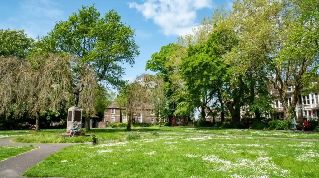
Fishponds has direct access to several important green spaces, including Fishponds Park, Oldbury Court Estate, Snuff Mills and the wider Frome Valley. Nearby Eastville Park adds further open space, walking routes, recreational facilities and connections with the River Frome.
Green space is one of the defining physical characteristics of the wider Fishponds area.
Fishponds Park is located directly off Fishponds Road. Bristol City Council lists facilities including children’s play equipment and access from Fishponds Road and Manor Road.
Oldbury Court Estate provides a larger landscape with woodland, open grassland, riverside routes and recreational facilities. Its destination play area includes accessible equipment, natural play features and facilities for different age groups.
Snuff Mills forms part of the Frome Valley landscape. The area combines woodland, riverside scenery and historic industrial features.
The wider Frome Valley is also important for walking and biodiversity. Bristol City Council identifies Frome Valley and Snuff Mills among the area’s designated local green spaces.
Eastville Park is another major nearby green space. It provides a large park landscape and connects with the River Frome corridor.
These green spaces create a continuous recreational network around Fishponds. They support walking, informal recreation, children’s activities, cycling and access to nature within the urban area.
How can people use the Bristol and Bath Railway Path from Fishponds?
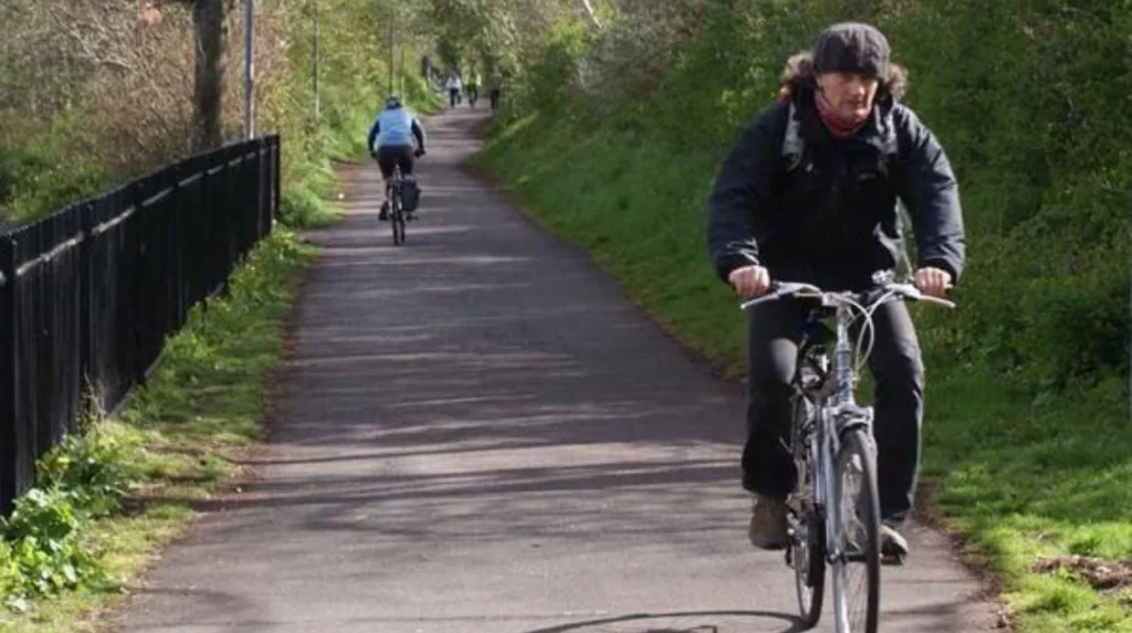
The Bristol and Bath Railway Path follows a former railway alignment through Fishponds and provides a dedicated active-travel route for walking and cycling. It connects the neighbourhood with East Bristol and the wider route towards Bath while avoiding many busy roads.
The Bristol and Bath Railway Path is one of Fishponds’ most important transport and recreational assets.
The route follows the former railway corridor. The railway infrastructure played a significant role in Fishponds’ industrial and suburban development before the railway line closed.
Sustrans identifies the Bristol and Bath Railway Path as historically important to its organisation. The first cycle route developed by the organisation was the Bristol and Bath Railway Path, reflecting its role in the development of modern active travel in Bristol.
The path provides a practical alternative to road travel. Cyclists use it for commuting, leisure rides and longer journeys. Pedestrians also use it to reach nearby neighbourhoods.
The route passes through the central Fishponds area. Bristol’s Local Plan identifies the railway path as a Site of Nature Conservation Interest and as reserved open space within the Central Fishponds planning area.
This combination of transport and environmental functions gives the railway path strategic importance.
For visitors, it provides an efficient way to explore Fishponds and connect the area with other parts of east Bristol.
How well connected is Fishponds to central Bristol?
Fishponds is well connected to central Bristol through bus services, Fishponds Road, the M32 and the Bristol and Bath Railway Path. The neighbourhood no longer has an operating railway station, so most public transport journeys rely on buses, cycling, walking and nearby rail stations.
Fishponds developed as a connected suburb because of successive improvements in public transport.
The former Fishponds railway station opened in the 19th century and later closed. Its railway corridor now forms part of the Bristol and Bath Railway Path. This explains why the neighbourhood has a prominent railway path but no current station.
Bus transport is therefore central to modern mobility. Services connect Fishponds with Bristol city centre and neighbouring communities.
Fishponds Road provides the principal road connection. The M32 is also close to the western side of the neighbourhood and provides access towards Bristol and the wider motorway network.
Cycling has a particularly strong role because of the railway path. The route provides an off-road connection through east Bristol.
The nearest rail options are outside Fishponds itself. Travellers using national rail services typically connect through Bristol’s wider railway network and use buses, walking or cycling for the final part of the journey.
This transport structure makes Fishponds particularly relevant to visitors who combine public transport with active travel.
What is everyday life like in Fishponds?
Everyday life in Fishponds centres on residential streets, local shopping, schools, parks, cafés, community facilities and public transport. The neighbourhood combines established housing with newer development and provides access to central Bristol without being part of the city-centre environment.
Fishponds has a predominantly residential character.
Housing includes older terraces, traditional suburban properties and newer developments. The area’s historic growth as a Victorian and early modern suburb remains visible in its street layout and building stock.
Schools and community facilities support established residential communities. The neighbourhood also benefits from its proximity to UWE Bristol’s Frenchay Campus and other education centres.
Fishponds Road provides the main concentration of everyday services. Residents can access groceries, pharmacies, cafés, restaurants, professional services and other facilities without travelling into central Bristol.
The green-space network adds another important dimension. Oldbury Court, Snuff Mills, Fishponds Park and the Frome Valley provide recreation close to residential areas.
Local area guides also identify supermarkets and other everyday retailers across the neighbourhood.
This combination creates a self-contained suburban environment while maintaining strong links to central Bristol.
Explore More Area Guide
Horfield Area Guide: History, Homes, Parks and Local Life
Easton Bristol Area Guide: History, Culture, Transport and Local Life
What development is taking place in Fishponds?
Fishponds is an active planning and regeneration area, with Bristol City Council identifying opportunities for new housing, mixed-use development and improved town-centre connections. Central Fishponds includes underused land around former industrial sites and Fishponds Road.
Future development is an important part of the current Fishponds story.
Bristol’s Local Plan identifies Central Fishponds as a strategic location for development. The council states that underused land around Fishponds Road and former industrial areas provides opportunities for new homes and mixed-use development.
The 2024 Strategic Housing Land Availability Assessment identifies a 34.2-hectare Central Fishponds area and an assessed capacity of 1,277 homes across the identified development opportunity.
The assessment focuses on land around Fishponds town centre and former industrial areas, including sites around Goodneston Road and Filwood Road.
Planning policy also recognises the importance of the Bristol and Bath Railway Path. Development proposals must account for its environmental and open-space functions.
The former St Matthias site demonstrates how major institutional land can change use. UWE transferred teaching activities from Fishponds to Frenchay before the campus closed to students in 2014.
These changes form part of a broader pattern of urban regeneration in east Bristol.
Why is Fishponds significant within Bristol?
Fishponds is significant because it combines historic settlement, established residential communities, a major local high street, extensive green infrastructure, active-travel routes and ongoing development. Its location between central Bristol, the Frome Valley and northeast Bristol gives it strategic local importance.
Fishponds demonstrates how Bristol’s suburbs have developed through successive phases of transport, industry, education and housing.
Its historical identity comes from the former ponds and quarry landscape. Its suburban identity grew through improved road, omnibus, tram and railway connections. Its modern identity is shaped by Fishponds Road, cycling infrastructure, green spaces, schools and residential development.
The neighbourhood also contributes to Bristol’s wider active-travel network through the Bristol and Bath Railway Path.
Its green infrastructure is equally significant. The Frome Valley connects urban neighbourhoods with woodland, riverside environments and recreational landscapes.
Planning policy gives central Fishponds an important future role. Bristol City Council identifies opportunities for housing and mixed-use redevelopment while seeking stronger connections between the town centre, transport routes and surrounding areas.
For visitors, Fishponds provides a different experience from Bristol’s central tourist districts. Its main attractions are distributed across parks, historic buildings, local businesses, walking routes and neighbourhood streets.
For residents, its importance comes from the combination of everyday services and access to central Bristol.
For the future, housing delivery, town-centre investment, active travel and protection of green infrastructure will continue to shape Fishponds.
Where is Fishponds in Bristol?
Fishponds is an east Bristol neighbourhood located about 3 miles northeast of Bristol city centre. It is centred on Fishponds Road and sits close to Eastville, Stapleton, Frenchay, Staple Hill and Downend.