Horfield is a residential area in north Bristol, centred around Horfield Common, Gloucester Road and a network of Victorian and twentieth-century streets. The area combines historic housing, independent businesses, green space, community facilities and access to wider north Bristol. Bristol City Council identifies Horfield as one of the city’s wards, while the wider neighbourhood extends beyond the current electoral boundary.
- What is Horfield and where is it in Bristol?
- How did Horfield develop historically?
- What is Horfield Common and what can visitors do there?
- What is Gloucester Road like in Horfield?
- What types of homes are found in Horfield?
- What schools and education facilities serve Horfield?
- What leisure and sports facilities are available in Horfield?
- How is Horfield connected to Bristol and surrounding areas?
- What healthcare and public services are available near Horfield?
- What makes Horfield relevant for families, students and workers?
- What green and community spaces are near Horfield?
- How is Horfield changing in 2026 and beyond?
- Why is Horfield important within Bristol?
Horfield has a long transition from rural parish to urban neighbourhood. Historic routes, former smallholdings, Victorian terraces, interwar housing and modern community facilities all contribute to its present character. Gloucester Road provides an important commercial corridor, while Horfield Common provides a substantial open-space focus.
The area is also closely connected with Bishopston, Southmead, Filton, Henleaze and Ashley Down. This location gives Horfield relevance for residents, students, workers, families, visitors and people using north Bristol’s employment, healthcare and education facilities.
What is Horfield and where is it in Bristol?
Horfield is a north Bristol neighbourhood and electoral ward located between areas including Bishopston, Southmead, Filton, Henleaze and Ashley Down. Its character combines residential streets, Gloucester Road businesses, Horfield Common, community facilities and established transport connections.
Horfield forms part of north Bristol. It sits north of the central Bristol area and close to the city’s boundary with South Gloucestershire.
The name refers to a historic settlement that existed before modern Bristol expanded northwards. Bristol City Council’s heritage framework identifies Horfield among the historic villages and rural settlements absorbed into the expanding urban city.
Modern Horfield has several recognisable geographical components. Gloucester Road forms a major north-south commercial route. Horfield Common provides open space and recreation. Residential streets extend towards Southmead, Henleaze, Bishopston, Ashley Down and Filton.
The present Horfield ward is also useful for understanding local population data. The 2021 Census recorded 13,838 residents in the Horfield ward. The age profile included 2,329 people aged 15 or under, 2,555 aged 16–24, 2,705 aged 25–34 and 2,686 aged 35–49.
Ward boundaries do not represent every street traditionally described as Horfield. This distinction matters when comparing population, housing and demographic information.
How did Horfield develop historically?
Horfield developed from a rural parish into an urban Bristol neighbourhood through nineteenth- and twentieth-century expansion. Smallholdings and country landscapes gave way to Victorian terraces, later residential estates, roads and community facilities as Bristol expanded northwards.
Historic Horfield was associated with agriculture and rural land. The landscape included fields, smallholdings, gardens and individual houses.
Gloucester Road was already an established route in the nineteenth century. Bristol City Council’s Gloucester Road Conservation Area appraisal uses the 1840s Horfield Tithe Map to document the area’s earlier landscape. At that time, development remained relatively limited and smallholdings occupied parts of the slopes around the road.
The nineteenth century brought rapid urbanisation. By the 1880s, development had expanded substantially along Gloucester Road. Terraced streets replaced many earlier smallholdings and created the dense residential pattern that remains visible in parts of north Bristol today.
The wider Bristol expansion continued during the twentieth century. New housing, roads and public facilities extended the built-up area beyond the older Victorian streets.
Bristol Archives records also document house construction in Horfield during the 1920s. Building plans include houses on Highbury Road and Court Road during this period.
Council housing formed another part of Horfield’s twentieth-century development. Bristol Archives records identify Horfield among areas receiving housing associated with the Housing Act 1924.
This historical layering explains the area’s varied housing stock. Victorian terraces sit alongside later semi-detached houses, twentieth-century estates, flats and modern residential development.
What is Horfield Common and what can visitors do there?
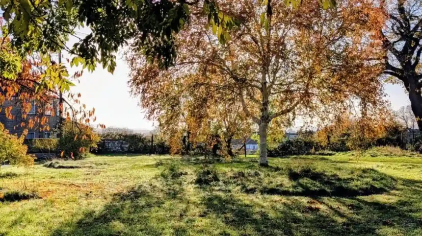
Horfield Common is a publicly accessible green space in north Bristol with tennis courts, a bowling green, wildlife pond, children’s play areas, a community café and marked 500-metre, 1-kilometre and 5-kilometre walking, jogging and running routes.
Horfield Common is one of the defining open spaces in the neighbourhood. Bristol City Council describes it as an open space in the quiet suburbs of north Bristol. It is open at all times and has no admission charge.
The common provides several types of recreation. Its marked routes support walking, jogging and running. The published distances are 500 metres, 1 kilometre and 5 kilometres. This makes the space useful for short exercise sessions and longer local activity.
The site has tennis courts and a bowling green. A wildlife pond adds ecological interest within the urban landscape.
Families have access to two dog-free play areas. One play area on Dorian Road connects with nearby skate facilities and provides equipment designed for different age groups.
Horfield Common also has a community café and an organised Friends of Horfield Common group. The community group supports the park and its local use.
The council acquired Horfield Common in 1908, according to the Henleaze character appraisal. The open space therefore forms part of the area’s twentieth-century civic and recreational history.
What is Gloucester Road like in Horfield?
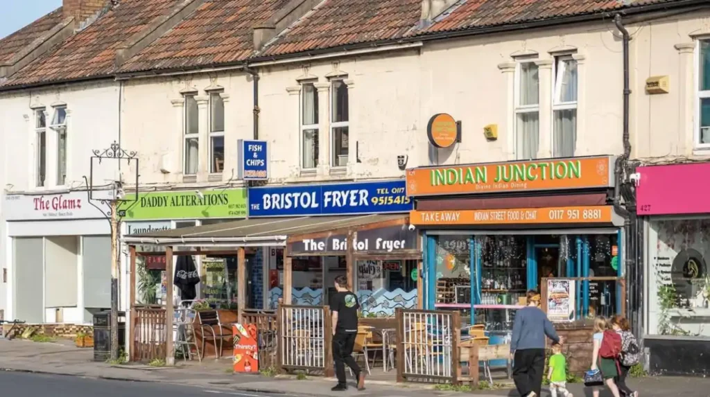
Gloucester Road is a major commercial and historic corridor connecting Horfield with Bishopston and central Bristol. It contains shops, cafés, restaurants, pubs and services, while its surrounding streets preserve substantial Victorian residential development from the nineteenth-century expansion of the area.
Gloucester Road is central to understanding Horfield’s relationship with neighbouring north Bristol communities.
The road developed from an older route into Bristol. The 1840s landscape contained relatively few buildings, but the area experienced substantial growth by the 1880s.
The surrounding residential streets reflect this development. Raglan Road, Wolseley Road and Shadwell Road are examples of streets whose layouts developed from earlier house-and-garden plots.
Today, Gloucester Road functions as a mixed-use corridor. Commercial premises sit beside homes, creating a walkable local centre with everyday services and food businesses.
The Gloucester Road Conservation Area was formally adopted in 2017. Bristol City Council’s character appraisal identifies the historical route, street pattern, buildings and relationship between commercial and residential development as important elements of the area’s character.
The conservation designation is relevant to property owners and developers. Bristol has specific planning controls for conservation areas because these locations have historic character and appearance that planning policy seeks to preserve or enhance.
What types of homes are found in Horfield?
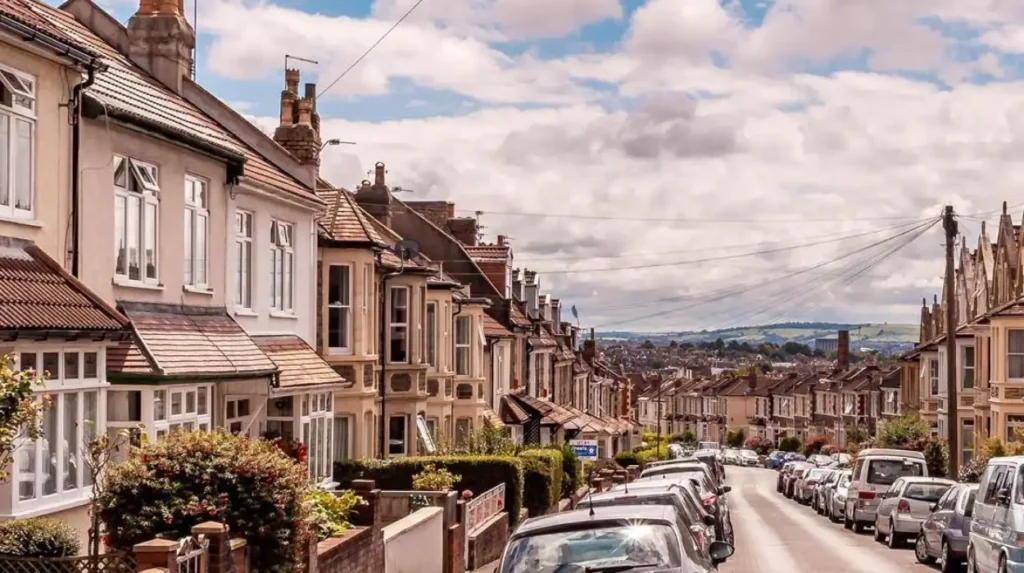
Horfield contains a varied housing stock shaped by Victorian expansion, interwar development and later twentieth-century housing programmes. Common forms include terraced houses, semi-detached properties, flats and other residential buildings across streets surrounding Gloucester Road and Horfield Common.
Housing character changes across Horfield.
Older streets closer to the historic Gloucester Road corridor contain substantial Victorian-era development. These homes reflect the rapid nineteenth-century expansion documented by Bristol City Council.
Later housing expanded into areas previously occupied by fields and smallholdings. Interwar development added another layer to the neighbourhood.
Twentieth-century public housing also contributed to the housing structure. Bristol Archives identifies Horfield among Bristol locations where housing was constructed under the Housing Act 1924.
Property characteristics therefore vary considerably by street. Building age, tenure, parking arrangements, gardens, extensions and proximity to commercial roads all influence individual properties.
People researching a specific address should use Bristol City Council’s local information services. The council’s My Neighbourhood and Pinpoint systems provide information on subjects including schools, parking schemes, conservation areas and local facilities.
Planning status is also important. Bristol currently has conservation areas and other planning designations across the city, while a new Article 4 Direction affecting parts of Southmead and Horfield is scheduled to take effect from 1 January 2027. It concerns changes from dwelling houses to small houses in multiple occupation in specified areas.
What schools and education facilities serve Horfield?
Horfield is served by local primary schools and wider north Bristol education facilities, with school admissions determined according to each school’s governance and catchment arrangements. Bristol City Council lists Horfield Church of England Primary and Upper Horfield Community among its 2026–27 admission arrangements.
Education provision extends across Horfield and its surrounding neighbourhoods.
For the 2026–27 admissions year, Bristol City Council lists Upper Horfield Community among its community primary schools and Horfield C of E Primary among its voluntary controlled schools.
School admission arrangements do not mean that every nearby address belongs to the same catchment area. Catchment boundaries and admission criteria vary by school.
Families moving to Horfield should therefore check the precise address against the current Bristol City Council admissions information. The council publishes annual admission arrangements and school-specific information.
Early-years provision also forms part of the local education network. Bristol City Council identifies Upper Horfield Children’s Centre within the North Bristol Children’s Centre hub.
The wider area provides access to additional schools in Bishopston, Henleaze, Southmead, Ashley Down and neighbouring districts.
For residents, the practical education picture therefore depends on exact location, pupil age, school status and current admissions rules rather than neighbourhood name alone.
What leisure and sports facilities are available in Horfield?
Horfield has established sports and leisure facilities centred on Horfield Common and Horfield Leisure Centre. Facilities include swimming and fitness provision, tennis, bowling, play areas, running routes and other physical-activity opportunities for local residents.
Horfield Leisure Centre is located on Dorian Road, close to Horfield Common. Bristol City Council lists it among the city’s swimming pools, leisure centres and sports facilities.
The centre supports organised exercise and physical activity. It is also an accessible leisure centre within Bristol’s disability-sport network.
Horfield Common extends the recreational offer outdoors. Tennis courts, a bowling green, play areas and marked routes provide several forms of physical activity in the same neighbourhood.
The combination of indoor and outdoor facilities is important for everyday life. Residents have access to structured leisure activities without relying entirely on central Bristol venues.
The common’s 5-kilometre marked route also creates a defined local running and walking option. Shorter 500-metre and 1-kilometre routes provide alternatives for shorter sessions.
How is Horfield connected to Bristol and surrounding areas?
Horfield has strong road and bus connections with central Bristol and north Bristol districts. Gloucester Road provides a major north-south route, while surrounding roads connect the neighbourhood with Bishopston, Southmead, Filton, Henleaze and other parts of the Bristol urban area.
Transport in Horfield is strongly shaped by its position on the north side of Bristol.
Gloucester Road is the area’s most recognisable transport corridor. It connects Horfield with Bishopston and continues towards central Bristol.
Other roads distribute traffic towards Southmead, Henleaze, Filton and surrounding residential districts. The street network reflects both historic routes and later residential expansion.
Bus services are particularly relevant because Horfield does not have a conventional National Rail station within the neighbourhood. Residents generally use bus connections, cycling, walking and nearby rail stations depending on destination.
The location also provides access to major north Bristol employment and healthcare areas. Southmead Hospital is nearby, while Filton and the wider north Bristol employment corridor lie further north.
Travel conditions vary according to time of day. Gloucester Road carries significant local movement, so journey times differ between peak and off-peak periods.
People planning regular journeys should check current services rather than relying on historic timetables. Bristol’s transport network changes through service revisions, road schemes and development.
What healthcare and public services are available near Horfield?
Horfield benefits from proximity to major north Bristol healthcare and community infrastructure. Southmead Hospital is nearby, while local leisure, children’s, council and community services provide additional facilities within or close to the neighbourhood.
Southmead Hospital is one of the most significant healthcare facilities serving north Bristol and the wider region. Its location makes Horfield relevant to hospital employees, patients, visitors and households needing access to healthcare services.
Local public services extend beyond healthcare. Bristol City Council provides neighbourhood information through My Neighbourhood and Pinpoint, covering schools, community centres, parking, conservation areas and other local facilities.
Horfield also has community-focused facilities around the common and Dorian Road.
The council identifies Horfield Leisure Centre as a venue for physical-activity referral programmes. Its address is Dorian Road, Horfield, BS7 0XW.
Community infrastructure contributes to the area’s residential function. Residents can combine access to green space, recreation, education, shopping and essential services without travelling into Bristol city centre for every daily need.
What makes Horfield relevant for families, students and workers?
Horfield’s combination of housing, schools, green space, leisure facilities, Gloucester Road businesses and access to north Bristol employment areas makes it relevant to different groups, including families, students, healthcare workers, professionals and residents seeking established urban neighbourhood infrastructure.
Families can use Horfield Common’s play areas, sports facilities and open space. Local primary schools and nearby children’s services add to the family infrastructure.
Students benefit from Horfield’s connection with central Bristol and nearby education districts. The neighbourhood’s location between central Bristol and the northern employment and university areas supports public transport and cycling-based travel.
Workers have particular reason to consider the area’s geography. Southmead Hospital is close by, while Filton and other north Bristol employment locations are accessible from the surrounding road network.
The Gloucester Road commercial corridor adds another layer of everyday convenience. Food businesses, cafés, shops and services provide activity close to residential streets.
Different parts of Horfield have different housing and transport characteristics. The most useful assessment therefore comes from the individual street rather than treating the whole neighbourhood as uniform.
What green and community spaces are near Horfield?
Horfield Common is the principal green space within the neighbourhood, supported by smaller parks, allotments and nearby open spaces across north Bristol. These spaces provide recreation, community activity, wildlife habitat, children’s play and opportunities for walking and exercise.
Horfield Common provides the strongest concentration of public recreational facilities. Its wildlife pond, play areas, tennis courts, bowling green and measured routes create several uses within one open space.
Allotments provide another form of local green infrastructure. Bristol City Council lists Horfield A Allotments on Downend Road, with 11 plots managed by the council.
The wider north Bristol area contains additional parks and open spaces. Southmead, Henleaze, Bishopston and neighbouring districts all contribute to the wider recreational network.
Green infrastructure has practical value beyond leisure. It provides places for walking, outdoor exercise and informal community activity within an urban environment.
Horfield Common is also registered as a village green. Bristol City Council’s town and village green register includes Horfield Common under its village green records.
Explore More Area Guide
Easton Bristol Area Guide: History, Culture, Transport and Local Life
St George Bristol Area Guide: Parks, History and Local Life
How is Horfield changing in 2026 and beyond?
Horfield continues to evolve through housing demand, planning controls, transport pressures, community investment and changes in local services. The confirmed 2027 Article 4 Direction for specified parts of Horfield adds another planning consideration for future residential development.
The neighbourhood’s future is closely connected to Bristol’s wider growth.
Housing pressure affects established areas where older homes are adapted, extended or converted. Planning policy determines how these changes take place.
The confirmed Article 4 Direction is particularly relevant to houses in multiple occupation. From 1 January 2027, planning permission will be required for changes from dwelling houses in Class C3 to small houses in multiple occupation in the specified Southmead and Horfield areas.
The policy forms part of Bristol’s wider approach to managing neighbourhood development and housing conditions.
Heritage protection will also remain relevant around historic areas. Bristol has 33 conservation areas, with additional planning controls intended to protect historic character.
Horfield’s historic development therefore remains important to future planning. Victorian street patterns, older buildings, green spaces and established community facilities form part of the area’s existing character.
Why is Horfield important within Bristol?
Horfield is an established north Bristol neighbourhood where historic rural origins, Victorian urbanisation, modern housing, Gloucester Road commerce, Horfield Common and major community facilities meet. Its location provides connections between central Bristol and important northern residential, healthcare and employment districts.
The area’s significance comes from its combination of functions.
Historically, Horfield records the transformation of rural land into an urban Bristol neighbourhood. The Gloucester Road corridor documents nineteenth-century expansion, while twentieth-century housing and public facilities show later stages of city growth.
Today, Horfield combines residential streets with an active commercial corridor and substantial green space.
Horfield Common provides public recreation and community facilities. Gloucester Road provides shops, food businesses and services. Schools and children’s facilities support households with young people. Horfield Leisure Centre provides indoor recreation. Nearby Southmead provides major healthcare infrastructure.
The 2021 Horfield ward population of 13,838 provides a useful official demographic reference, although the traditional neighbourhood extends beyond electoral boundaries.
For visitors, Horfield offers access to a historic Bristol street corridor, local food and shopping, green space and recreational facilities. For residents, its importance comes from everyday infrastructure and its position within north Bristol.
For property research, school planning or local services, the exact address remains important because ward boundaries, catchment areas, planning designations and service areas do not always match the commonly understood neighbourhood boundary. Bristol City Council’s local information tools provide address-level information for many of these questions.
Horfield therefore represents a distinct part of Bristol’s northern urban landscape, combining historical development with contemporary residential, commercial and community functions.
Where is Horfield in Bristol?
Horfield is a neighbourhood in north Bristol. It is close to Bishopston, Southmead, Henleaze, Ashley Down and Filton. Gloucester Road is one of its main commercial and transport corridors.