Cycling around Bristol is a major part of the city’s transport network, linking the city centre with neighbourhoods, parks, harbourside areas and surrounding towns. Bristol was the United Kingdom’s first Cycling City, and its current transport strategy continues to prioritise walking, cycling, public transport, road safety and lower-carbon travel. In 2024, 15% of Bristol residents who travelled to work cycled, while 24% of residents reported riding a bike at least once a week.
- Why is cycling around Bristol important?
- When did Bristol become known as a Cycling City?
- What types of cycling routes are available around Bristol?
- What are the best-known cycling routes around Bristol?
- Bristol and Bath Railway Path
- Bristol Docks Loop
- Festival Way
- Whitchurch Way
- Portway and western connections
- How does the Bristol and Bath Railway Path work for cyclists?
- Which Bristol cycling routes are suitable for beginners?
- How does Bristol’s cycling infrastructure support everyday journeys?
- How many people cycle in Bristol?
- What should cyclists know about Bristol’s hills and geography?
- How should cyclists plan a route around Bristol?
- What cycling safety rules apply in Bristol?
- How does cycling connect with Bristol’s environmental and transport policies?
- What future developments are relevant to cycling around Bristol?
- What makes cycling around Bristol different from ordinary city transport?
Bristol’s cycling environment combines traffic-free paths, segregated cycleways, signed on-road routes, shared-use paths and quieter residential streets. The network also connects with longer-distance routes such as the Bristol and Bath Railway Path and National Cycle Network routes. The official Better by Bike route planner provides route planning across Bristol, Bath and surrounding areas.
Why is cycling around Bristol important?
Cycling around Bristol provides a practical transport option for commuting, leisure and local journeys, supported by dedicated routes, traffic-free paths, cycle parking, route-planning services and continued investment in active-travel infrastructure across the city.
Bristol’s geography makes cycling both useful and technically challenging. The city contains steep streets, river crossings, busy radial roads and dense central neighbourhoods. Transport planning therefore focuses on connected routes rather than isolated cycle lanes.
Bristol City Council’s transport strategy was adopted in July 2019. It sets objectives for an inclusive transport system, healthier places, improved air quality, safer roads, reduced congestion and sustainable economic growth. Cycling forms part of this wider transport framework.
The council’s design guidance states that cycling investment has contributed to Bristol’s status as the UK’s first Cycling City and calls for safe, connected routes and high-quality cycle parking. It also identifies the need to remove gaps in the existing network and create additional links to new developments.
Cycling also supports short-distance travel. A bicycle does not require parking in the same way as a private car, and journeys between central neighbourhoods can avoid congestion on heavily trafficked roads when an appropriate cycle route is available.
The city’s transport policies therefore treat cycling as part of the permanent urban transport system rather than only as a recreational activity.
When did Bristol become known as a Cycling City?
Bristol became the United Kingdom’s first Cycling City through the Cycling City programme launched in 2008, which supported infrastructure, promotion and monitoring and helped establish cycling as a central part of Bristol’s long-term transport planning.
The Cycling City programme represented an important stage in Bristol’s cycling history. It combined infrastructure improvements with measures intended to encourage more residents to cycle.
Monitoring undertaken through the Cycling City and Towns programme recorded substantial use on key routes. The Bristol and Bath Railway Path, for example, recorded an overall average of 1,089 users at one monitored location, with weekday counts averaging 1,326 compared with 638 on weekend days during the monitoring period.
The same monitoring programme recorded weekday commuting peaks on the Bristol and Bath Railway Path. This demonstrated that major off-road routes served transport purposes rather than functioning only as leisure trails.
The programme also supported routes such as the Whitchurch Railway Path. This traffic-free shared-use route forms part of National Cycle Network Route 3 and connects areas south-east of central Bristol.
Bristol’s later transport policies continued this approach. The city centre framework established an objective to complete an All Ages and Abilities cycle network. It also identified cycling as a contributor to health, environmental improvements and reduced congestion.
This historical development explains why cycling infrastructure is now distributed across different parts of Bristol rather than concentrated in one recreational corridor.
What types of cycling routes are available around Bristol?
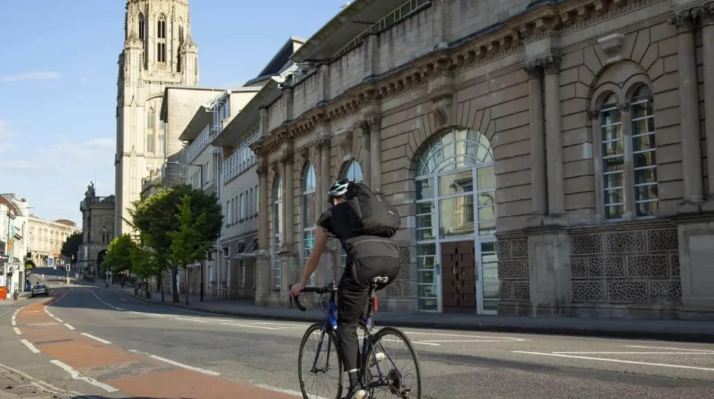
Bristol provides several route types, including traffic-free paths, segregated cycleways, signed on-road routes, bus-and-cycle corridors and shared-use paths, with examples including the Bristol and Bath Railway Path, Whitchurch Way and the Portway.
Traffic-free routes provide separation from general motor traffic. They are important for leisure riders, commuters and people who prefer routes away from busy roads.
Segregated cycleways provide dedicated space for cycling alongside roads. Their design separates cyclists from motor traffic for at least part of the route.
Signed on-road routes use existing streets and provide cyclists with designated or recommended connections. These routes remain part of the normal road environment and require riders to follow road rules.
Shared-use paths accommodate cycling alongside walking. Users need to manage speed, passing distance and interactions with pedestrians.
Bristol’s official cycle map identifies signed cycleways and traffic-free connections across the city. It includes routes toward destinations such as Bath, Kingswood, St George, Avonmouth, Nailsea, Hartcliffe, Filwood and Whitchurch.
The council’s design guidance emphasises that cycle routes should be safe, direct and secure. It also states that route design should avoid unnecessary sharing with pedestrians or heavily trafficked carriageways.
The practical result is a network containing different infrastructure standards. Cyclists therefore need to understand the character of the route before starting a journey.
What are the best-known cycling routes around Bristol?
Bristol’s best-known cycling routes include the Bristol and Bath Railway Path, Bristol Docks Loop, Festival Way, Whitchurch Way, the Portway and routes toward Leigh Woods, providing urban, riverside, woodland and regional cycling experiences.
Bristol and Bath Railway Path
The Bristol and Bath Railway Path is one of the most important cycling corridors in the region. It runs for approximately 23 kilometres between Bristol and Bath and follows the alignment of a former railway line. It forms part of National Cycle Network Route 4.
Sustrans lists the route at 13.9 miles, or 23.3 kilometres, with an estimated cycling time of approximately 1 hour 15 minutes for a relatively fast ride. Better by Bike describes it as approximately 13 miles and classifies it as an easy route, with typical cycling time of two to three hours for leisure riding.
The difference between these journey times reflects riding speed, stops and the purpose of the trip.
The path passes through areas including Fishponds, Staple Hill, Warmley, Bitton, Keynsham and Saltford before reaching Bath. Its former railway alignment provides a relatively direct east-west connection.
Bristol Docks Loop
The Bristol Docks Loop is a shorter urban route. Sustrans lists it at approximately 3 miles, or 4.8 kilometres.
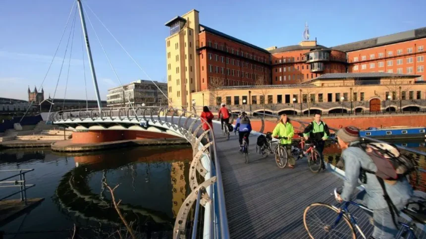
The route provides access to Bristol’s harbour and central waterfront environment. It is suitable for riders seeking a shorter urban journey rather than a long-distance excursion.
Festival Way
Festival Way provides a connection between central Bristol and Ashton Court. Better by Bike lists the route at approximately 7.5 miles and gives an estimated cycling time of about 50 minutes, with an easy difficulty classification.
Ashton Court Estate is also associated with mountain biking, making this corridor relevant to both general cyclists and riders seeking off-road recreation.
Whitchurch Way
Whitchurch Way forms part of Bristol’s southern cycling network. The Whitchurch Railway Path is a traffic-free shared-use route and forms part of National Cycle Network Route 3. Historical monitoring recorded commuting peaks on this connection.
Portway and western connections
The Bristol cycle map identifies the Portway as part of the signed cycling network. It provides an important western connection toward Avonmouth and the wider network.
These routes demonstrate the range of cycling opportunities around Bristol, from short city-centre loops to regional journeys.
How does the Bristol and Bath Railway Path work for cyclists?
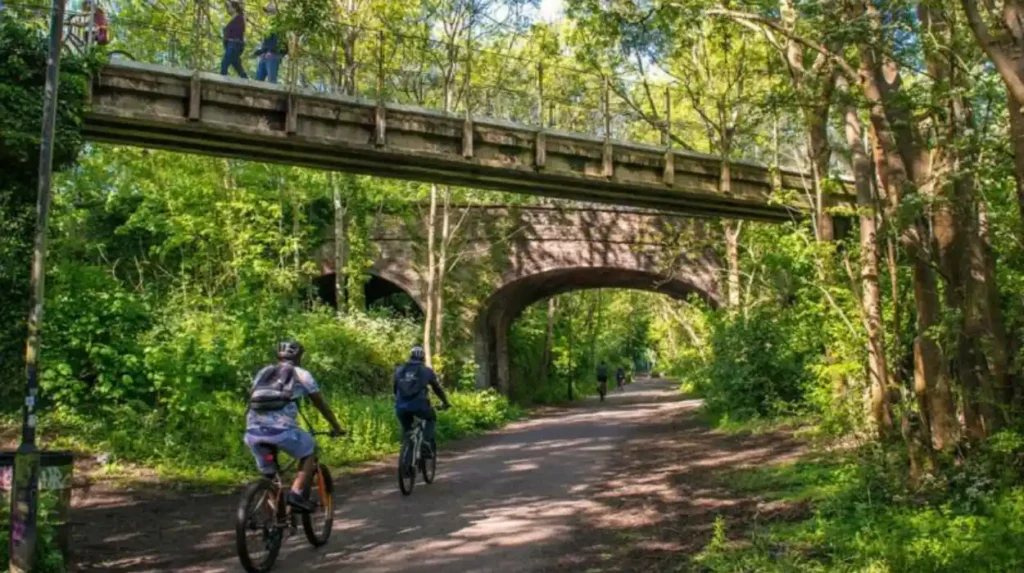
The Bristol and Bath Railway Path is a 23-kilometre shared-use corridor following a former railway alignment and forming part of National Cycle Network Route 4, connecting Bristol with Bath through several urban and semi-rural communities.
The path is significant because its railway alignment creates a continuous regional corridor away from much of the main-road network.
The route is not simply a tourist trail. Historical monitoring recorded strong weekday use, including higher weekday counts than weekend counts at several Bristol locations. This pattern is consistent with commuter and utility cycling.
The route also provides access to communities outside Bristol. Riders can use it for longer recreational journeys or combine sections with other local roads and cycle routes.
The path has a shared-use function. Cyclists therefore need to consider pedestrians and other users, especially at busy access points.
Sustrans identifies the Bristol and Bath Railway Path as a National Cycle Network route and notes that conditions can change over time. Weather can also affect path surfaces.
For visitors, the route provides one of the clearest ways to experience cycling between Bristol and Bath without relying on the main road network for the entire journey.
Which Bristol cycling routes are suitable for beginners?
Beginners can start with shorter traffic-free or lower-complexity routes, including the Bristol Docks Loop, Festival Way and suitable sections of the Bristol and Bath Railway Path, before progressing to longer or hillier journeys.
Route selection should consider distance, surface, traffic exposure and gradient.
The Bristol Docks Loop is relatively short at 4.8 kilometres. It provides a manageable distance for riders developing confidence in an urban environment.
Festival Way is listed by Better by Bike at approximately 7.5 miles and rated easy. Its length makes it suitable for riders who already manage moderate recreational distances.
The Bristol and Bath Railway Path also works well when ridden as a shorter section rather than as a complete Bristol-to-Bath journey. Riders can choose a convenient access point and turn around when the planned distance is reached.
Beginners should distinguish between a route being classified as easy and every individual section being free of traffic or other hazards. Shared-use paths still contain pedestrians, junctions, crossings and access points.
Bristol’s hills also require route planning. A short route with a steep climb can require more physical effort than a longer route on a flatter former railway alignment.
How does Bristol’s cycling infrastructure support everyday journeys?
Bristol’s cycling infrastructure supports everyday travel through cycleways, traffic-free paths, route connections, cycle parking, quieter streets and planned improvements designed to reduce gaps between residential areas, employment centres, public transport hubs and destinations.
The city’s cycle network is designed around connectivity.
Bristol City Council states that developments should provide safe and connected cycle routes, high-quality cycle parking and facilities such as showers, changing rooms and lockers where appropriate.
Cycle hangars provide secure residential cycle storage. Bristol City Council operates cycle hangars at locations throughout the city.
The council also operates an online route-planning service that helps cyclists identify shorter and safer routes.
Infrastructure improvements have continued in different parts of the city. Bristol’s 2024 air-quality report records cycling schemes involving the Filwood Quietway, Malago Greenway, Deanery Road and Old Market Quietway. The same report records walking and cycling improvements at Park Row and Old Market.
The Bedminster Green programme includes a new segregated cycle route on Whitehouse Lane as part of a wider £11 million transport improvement programme.
These projects demonstrate the importance of connecting individual cycle facilities into wider transport corridors.
How many people cycle in Bristol?
Cycling is established as a significant travel mode in Bristol, with 15% of residents who travelled to work cycling in 2024 and 24% of residents reporting that they ride a bike at least once a week.
Bristol’s 2025 Key Facts report provides recent indicators of cycling participation.
In 2024, 36% of Bristol residents travelling to work used active travel. Active travel includes walking and cycling. Within that figure, 15% cycled to work and 20% walked.
The same report states that 24% of Bristolians ride a bike at least once a week. In the most deprived areas, the reported figure was 20%.
These figures show that cycling is used for both commuting and general mobility.
Bristol also recorded 3.18 million shared-mobility rental trips in 2024 across Bristol and South Gloucestershire, covering approximately 7.17 million kilometres. The shared-mobility figure includes e-scooter and e-bike rentals, so it does not represent conventional privately owned bicycle use alone.
Cycling participation therefore exists within a wider active-travel system that includes walking, e-bikes, shared mobility and public transport.
What should cyclists know about Bristol’s hills and geography?
Bristol’s cycling network must account for steep streets, river crossings, dense urban areas and major roads, so cyclists should select routes based on gradient, traffic conditions, crossings and surface quality rather than distance alone.
Bristol’s physical geography strongly affects cycling.
The city includes elevated districts around Clifton, Kingsdown, Cotham and other northern and western areas. Lower areas include the Harbourside, central waterfront and parts of the Avon valley.
A route planner therefore provides more useful information than a simple straight-line distance.
Former railway routes are particularly valuable because railway corridors were engineered with controlled gradients. The Bristol and Bath Railway Path follows a disused railway alignment and provides a long-distance connection through the eastern side of Bristol and into South Gloucestershire and Bath.
River crossings also influence route choice. Bristol contains the River Avon and the Avon Gorge, creating physical barriers that require specific crossing points.
The city’s historic transport planning documents specifically identify topography and river crossings as barriers that cycling infrastructure needs to address.
Electric bicycles provide an additional transport option for riders who need assistance on gradients. Bristol’s wider active-travel policies also include support for cycling and electric-bike use.
How should cyclists plan a route around Bristol?
Cyclists should plan Bristol journeys by checking the official route planner, identifying traffic-free sections, assessing gradients and crossings, confirming access conditions, checking route changes and selecting equipment appropriate for distance, weather and surface conditions.
Better by Bike operates an official regional route planner for Bristol, Bath, North Somerset and South Gloucestershire. It allows users to enter starting points and destinations and identify cycling routes.
The service also provides regional cycle maps and pre-planned leisure rides. These resources cover different route lengths and cycling abilities.
Route planning should begin with the journey objective.
A commuter travelling between residential and employment areas needs a direct route with reliable connections. A leisure cyclist can prioritise traffic-free paths, parks, countryside and points of interest.
Distance is the next consideration. A 5-mile urban route with repeated junctions and hills has a different physical and technical profile from a 10-mile traffic-free railway path.
Cyclists should also check route conditions before departure. Sustrans states that cycling and walking routes change over time and that weather conditions affect path surfaces.
For longer rides, carrying water, basic repair equipment, lights and weather-appropriate clothing provides practical preparation.
What cycling safety rules apply in Bristol?
Cyclists in Bristol must follow the Highway Code, obey traffic signs and signals, use cycle infrastructure correctly, maintain control, remain visible and take additional care at junctions, crossings, shared paths and busy roads.
Cycling safety depends on both infrastructure and rider behaviour.
The Highway Code provides the national rules applying to cyclists in England. These include requirements and guidance covering road positioning, junctions, crossings, signals, lights and interaction with other road users.
Cycle lanes and cycle tracks have different legal characteristics. Riders should follow the markings and signs displayed at each location.
Shared-use paths require particular attention because pedestrians and cyclists occupy the same space. Speed should be controlled when approaching pedestrians, entrances, junctions and restricted sections.
Night riding requires appropriate lighting and reflectors. Cyclists should ensure that equipment meets the legal requirements before travelling after dark.
Bristol’s transport planning places road safety alongside active travel. The Bristol Transport Strategy identifies improved road safety as one of its core objectives.
The safest route is therefore not necessarily the shortest route. A route with better separation, fewer complex junctions and clearer crossings can provide a more manageable cycling environment.
How does cycling connect with Bristol’s environmental and transport policies?
Cycling forms part of Bristol’s wider sustainable-transport strategy, supporting reduced car dependence, lower transport emissions, improved air quality, active travel and more efficient use of urban street space.
Bristol’s transport policy links active travel with environmental objectives.
The Bristol Transport Strategy aims to support sustainable growth, reduce carbon emissions, improve air quality and make better use of streets.
The city also operates a Clean Air Zone. Bristol City Council reports that its financial-support package includes £5.9 million to support public transport, walking and cycling, including free electric-bike loans and cycle training.
The environmental importance of cycling extends beyond emissions from individual journeys. A shift from private car travel to cycling reduces the number of motor vehicles occupying road space and contributes to lower congestion.
Bristol’s air-quality reporting continues to identify transport as an important environmental issue. The council reported that nitrogen dioxide levels still exceeded legal limits at some city-centre locations despite improvements associated with the Clean Air Zone.
Cycling therefore remains relevant to both individual mobility and city-wide transport planning.
Explore More Area Guide
Bristol Bus Guide: Routes, Fares & Travel Tips 2026
Parking in Bristol: Car Parks, Charges and Rules 2026
What future developments are relevant to cycling around Bristol?
Future cycling in Bristol is centred on completing network connections, improving route quality, integrating cycling with public transport and development, expanding secure cycle parking and supporting active travel as part of wider regional transport investment.
Bristol’s cycling network continues to develop through local and regional investment.
The council’s design guidance identifies removal of gaps in the existing cycle network as an ongoing objective. It also calls for additional links serving new developments.
Recent projects show how this approach operates in practice. Bristol’s air-quality programme identifies schemes such as the Malago Greenway, Filwood Quietway, Deanery Road and Old Market Quietway.
The city-centre network is also undergoing significant change. Bristol’s 2025 Key Facts report states that new cycle lanes, pedestrianisation and other transport improvements are transforming the central network, with the objective of making movement by walking, wheeling, cycling and public transport easier.
Regional funding is also important. Bristol City Council reports West of England City Region Sustainable Transport Settlement allocations exceeding £108 million annually for 2023/24 through 2026/27, with funding supporting highways and integrated transport responsibilities across the region.
The long-term direction is therefore based on network integration rather than individual cycle lanes.
What makes cycling around Bristol different from ordinary city transport?
Cycling around Bristol combines everyday commuting, regional travel and leisure riding within one network, supported by historic railway paths, modern cycleways, urban waterfront routes, regional connections and policies designed to increase active and sustainable transport.
Bristol’s cycling identity comes from the combination of history, infrastructure and participation.
The city became the UK’s first Cycling City, established a substantial network of traffic-free and signed routes, and developed links extending beyond the administrative boundary.
The Bristol and Bath Railway Path demonstrates this regional character particularly clearly. Its 23-kilometre alignment connects Bristol with Bath while passing through several communities.
The city’s cycling network also connects urban districts with destinations such as Ashton Court, Leigh Woods, Whitchurch and Avonmouth. The official Bristol cycle map identifies routes across these areas.
Cycling participation statistics reinforce the importance of the network. Fifteen percent of Bristol residents travelling to work cycled in 2024, while almost one quarter of residents reported cycling at least weekly.
For visitors, cycling provides access to central Bristol and surrounding landscapes. For residents, it provides an alternative to private-car travel. For transport planners, it forms part of a wider strategy addressing congestion, air quality, road safety and sustainable growth.
The most effective approach is to treat Bristol cycling as a complete transport network. Route selection, infrastructure quality, road safety, secure parking, public transport integration and regional connections all contribute to how successfully people can travel by bicycle.
Is Bristol a good city for cycling?
Yes. Bristol is one of the UK’s leading cycling cities, with traffic-free paths, dedicated cycleways, signed routes and regional connections. The city became the UK’s first Cycling City in 2008 and continues to invest in cycling infrastructure.