Easton is an inner-east Bristol neighbourhood known for Stapleton Road, multicultural communities, Victorian and Edwardian housing, independent businesses, parks, community facilities and strong transport connections. The area combines historic streets with active regeneration, making it an important part of Bristol’s urban landscape.
- What is Easton in Bristol?
- How did Easton develop historically?
- What is Stapleton Road known for?
- What types of homes are found in Easton?
- What makes Easton culturally diverse?
- What parks and green spaces are near Easton?
- How good are Easton’s transport connections?
- What community facilities are available in Easton?
- What regeneration is taking place in Easton?
- What should visitors explore around Easton?
- How is Easton likely to develop in the future?
What is Easton in Bristol?
Easton is an inner-east Bristol neighbourhood centred around Stapleton Road, Easton Way, Chelsea Road and nearby residential streets. It sits close to the city centre and combines historic housing, independent shops, community facilities, green spaces and strong rail and bus connections.
Easton is within Bristol, the largest city in South West England. Bristol City Council describes Bristol as the largest city in the South West, with an estimated population of 495,300 in mid-2025. The wider city contains more than 287 recorded ethnic groups, people born in more than 185 countries and more than 90 languages.
The name Easton refers to a historic settlement area that developed east of Bristol’s central districts. Modern Easton is an urban neighbourhood rather than a separate town or city.
The present Easton ward had 14,167 residents at the 2021 Census. The figure included 2,461 people aged 15 or under, 1,259 aged 16 to 24, 3,489 aged 25 to 34, 3,752 aged 35 to 49, 2,038 aged 50 to 64 and 1,168 aged 65 or over.
Easton’s character is strongly connected to Stapleton Road. Bristol City Council describes Stapleton Road as a busy thoroughfare and local shopping street serving a diverse community. The road contains independent businesses, housing, community venues, faith facilities and access to Easton Leisure Centre.
The neighbourhood also has direct access to parks and recreation areas. Owen Square Park, Netham Park and nearby green spaces provide play, sport, walking and community facilities.
Easton’s location makes it useful for people travelling between Bristol city centre, north-east Bristol and surrounding neighbourhoods.
How did Easton develop historically?
Easton developed from a historic route and rural settlement into a dense urban neighbourhood during Bristol’s industrial and population expansion. Stapleton Road became an important route, while Victorian and Edwardian terraces created the residential structure that remains visible across Easton today.
Stapleton Road provides important evidence of Easton’s development. Bristol City Council’s historical character study identifies it as a historic route from Bristol towards Stapleton and Gloucester. Development remained scattered within an agricultural landscape until the early nineteenth century.
Urban development accelerated during the nineteenth century. By 1855, densely packed terraces had begun appearing between Stapleton Road and Easton Road. These houses reflected the rapid expansion of Bristol’s residential districts as the city grew.
By 1974, the area had developed a regular street grid dominated by terraced housing. Stapleton Road had also become a local shopping street serving the surrounding residential population.
The area’s architecture still records different stages of development.
Historic buildings on Stapleton Road include late eighteenth-century, early nineteenth-century and Victorian structures. No. 268 Stapleton Road is a Grade II listed late-eighteenth-century house. Nos. 332 and 334 are Grade II listed early-nineteenth-century terraced houses.
The Black Swan public house at 438 Stapleton Road is another important historic building. Historic England records it as a Grade II listed building with seventeenth-century origins and later alterations.
Kensington Baptist Chapel on Stapleton Road dates from 1885. The building uses limestone and Pennant stone and has a Neoclassical design. Historic England lists it at Grade II.
Another distinctive historic feature is the gazebo at No. 349 Stapleton Road. Historic England identifies it as an early nineteenth-century tower that originally formed part of the garden of Easton House, which has since been demolished.
These buildings demonstrate that Easton’s built environment is not exclusively Victorian. Earlier structures remain alongside nineteenth-century terraces and later redevelopment.
What is Stapleton Road known for?
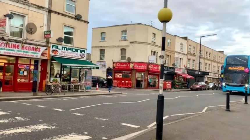
Stapleton Road is Easton’s principal commercial and transport corridor, linking residential streets with Old Market, Easton Way and north-east Bristol. It contains independent food businesses, shops, community facilities, faith venues, housing, bus routes and Stapleton Road railway station.
Stapleton Road runs north-east from Old Market and forms the central route through Easton. Bristol City Council identifies the road as a historic connection between Bristol, Stapleton and Gloucester.
The street has changed considerably since the nineteenth century. Its surviving historic buildings sit alongside twentieth-century redevelopment.
A major redevelopment period occurred during the 1960s. Parts of the eastern side of Stapleton Road were demolished and replaced with residential, industrial and warehouse development.
The modern commercial environment is largely independent. Bristol City Council’s recent Stapleton Road assessment identifies food-related independent shops as a major part of the retail offer. The street also contains community venues, faith facilities and local services.
Stapleton Road also functions as a community space rather than simply a transport route. The Love Stapleton Road project brings residents, businesses, community organisations, Bristol City Council and other partners together around local priorities.
The programme has addressed issues involving waste, environmental conditions, business support, community development, young people’s activities, parking and public-space improvements.
Recent improvements include pavement work, shop-shutter cleaning, lighting and bollard funding, park improvements and funding for new CCTV. Bristol City Council reported these as key achievements of the project in 2025.
The council’s 2026 proposals also include pedestrian-safety measures on Stapleton Road, including protective bollards and zebra-crossing improvements.
These projects demonstrate the continuing importance of Stapleton Road to Easton’s future.
What types of homes are found in Easton?
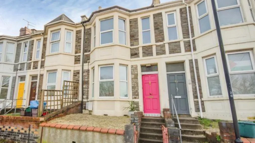
Easton’s housing is dominated by urban terraces alongside later flats, converted properties and newer residential developments. Victorian and Edwardian housing remains a defining feature, particularly around Stapleton Road and the surrounding grid of residential streets.
Terraced housing expanded rapidly during the nineteenth century as Bristol’s population increased. The historic street pattern remains visible in many parts of Easton.
The housing stock reflects several development periods. Older properties include compact terraced houses and larger historic buildings. Later development introduced flats, social housing and modern residential buildings.
The architecture varies between streets. Some properties have rendered fronts, while others retain exposed brick, Pennant stone details, sash windows and traditional roof forms.
The 2021 Census provides detailed information about housing type, tenure, occupancy and household composition across Bristol. Bristol City Council makes these datasets available through its Census Data Profiles.
Property conditions also vary between individual streets and buildings. Historic properties often require maintenance associated with older construction, while newer developments follow different building standards.
Easton’s housing location is closely connected to its transport network. Homes near Stapleton Road station and major bus routes provide straightforward access to employment, education and services elsewhere in Bristol.
The area therefore combines older urban housing with modern residential needs.
What makes Easton culturally diverse?
Easton’s cultural diversity is reflected in its residents, businesses, food outlets, community organisations, faith venues and everyday public life. Stapleton Road functions as a particularly visible centre of this diversity, with independent businesses serving different communities.
Bristol has a highly diverse population. Bristol City Council records more than 287 ethnic groups, more than 185 countries of birth, at least 45 religions and more than 90 languages across the city.
Easton forms part of this wider multicultural urban environment.
Stapleton Road’s business community includes food shops and other independent retailers serving different cultural and dietary traditions. Bristol City Council describes the street as a vibrant, multicultural area with a thriving business community.
Faith buildings also contribute to the area’s cultural structure. Kensington Baptist Chapel is one example of Easton’s historic religious architecture. Other faith venues operate within and around the wider Stapleton Road area.
Community organisations provide another layer of local identity. The Love Stapleton Road programme includes community meetings where residents, local organisations, Bristol City Council and Avon and Somerset Police discuss local priorities.
Cultural diversity therefore operates at several levels. It appears in the population, commercial activity, religious institutions, community organisations and public events.
This diversity is an important part of Easton’s current identity.
What parks and green spaces are near Easton?
Easton has several accessible green spaces, including Owen Square Park and Netham Park, while nearby St George Park provides a larger Victorian park setting. These spaces support children’s play, sport, walking, recreation and community activities.
Owen Square Park is directly within Easton on Chelsea Road. Bristol City Council identifies it as a neighbourhood park beside the Bristol to Bath cycle way. The park has a multi-use games court and children’s play area.
The play area includes climbing equipment, swings, a slide and inclusive equipment. The park is open and accessible around the clock.
Netham Park provides a larger recreational space in east Bristol. Facilities include football pitches, a cricket pitch, a floodlit multi-use games area, a children’s playground and a measured 500-metre walking, jogging and running route.
Netham Park also has particular links with cricket. Bristol City Council identifies the site as home to the Bristol Pakistani Cricket Club and provides three artificial cricket pitches for casual bookings.
St George Park is another significant nearby destination. The Victorian suburban park has a lake, mature trees, tennis courts, a bowling green, a wheels park, playground facilities and a café kiosk.
The wider park network gives Easton residents access to different types of outdoor space, from small neighbourhood play areas to larger sports and recreation grounds.
How good are Easton’s transport connections?
Easton has strong public transport connections through Stapleton Road railway station, frequent bus services and nearby major roads. Its location near Old Market and the city centre also supports walking and cycling, with the Bristol to Bath cycle route passing nearby.
Stapleton Road railway station is a key transport asset. Bristol City Council identifies the station as serving local rail services and describes several bus routes along Stapleton Road.
The station connects Easton with Bristol’s wider rail network. Its position also supports journeys towards Bristol Temple Meads and destinations in north-east Bristol.
Bus travel is equally important. Stapleton Road carries several bus services, while Easton’s proximity to Old Market creates additional access to routes serving central Bristol.
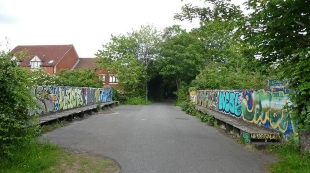
Cycling is supported by the Bristol to Bath cycle way. Owen Square Park sits next to this route, providing a direct connection between recreation space and active travel infrastructure.
Easton’s location near the M32 also gives road access to wider Bristol and the regional motorway network.
The council is also developing active-travel initiatives across east Bristol. Its East Bristol Liveable Neighbourhood programme includes walking, cycling and public-transport support, including cycle loans, cycle training and bus and train travel offers.
Transport therefore forms a central part of Easton’s relationship with the rest of Bristol.
What community facilities are available in Easton?
Easton has community facilities covering leisure, libraries, children’s activities, education, health, faith and local organisations. Easton Leisure Centre, Junction 3 Library and Learning Centre, community centres and parks provide services within or close to the neighbourhood.
Easton Leisure Centre is an important local facility located close to Stapleton Road. The area also contains community venues and organisations serving residents.
Junction 3 Library and Learning Centre is located at Baptist Mills in Easton. Bristol City Council states that Stapleton Road railway station is approximately five minutes’ walk away.
The facility provides library resources, computers, Wi-Fi, meeting space and children’s activities. Its meeting room can accommodate different layouts, including conference arrangements for up to 35 people.
Easton also has access to children’s recreation facilities. Felix Road Adventure Playground is located on Felix Road and provides an established community play facility for children.
Community organisations are involved in local improvement programmes. The Love Stapleton Road project includes a community steering group and Stapleton Road business group.
These facilities support daily life without requiring every journey to reach Bristol city centre.
What regeneration is taking place in Easton?
Regeneration in Easton focuses on public-realm improvements, safer streets, business support, green infrastructure, community facilities and better connections. Current projects include Stapleton Road improvements, Frome Gateway development and local park and active-travel initiatives.
Regeneration is an important part of Easton’s current development.
The Love Stapleton Road programme is focused on physical and community improvements along the area’s main commercial corridor. Work includes improvements to pavements, lighting, bollards, shop fronts, parking lines, parks and safety infrastructure.
Bristol City Council’s wider high-street programme also identifies Stapleton Road as a priority area. Planned measures include street-scene improvements, greening, seating, bins, recycling facilities, pocket parks, trees and planters.
The Frome Gateway regeneration framework also has implications for the wider Easton and St Philip’s area. The framework includes proposals for improved walking routes, public spaces, urban greening, active travel and connections around the River Frome.
The framework identifies Stapleton Road as part of the wider movement network and proposes improvements to pedestrian connectivity.
Local park improvements are also part of current investment. Bristol City Council’s 2026 proposals include potential improvements to Owen Square Park and community facilities associated with the surrounding area.
Regeneration therefore extends beyond individual buildings. It involves streets, transport, parks, businesses and community infrastructure.
Explore More Area Guide
St George Bristol Area Guide: Parks, History and Local Life
Totterdown Area Guide: History, Homes, Food and Transport
What should visitors explore around Easton?
Visitors exploring Easton can focus on Stapleton Road’s historic buildings and independent businesses, Owen Square Park, nearby Netham Park, local community spaces and connections towards Bristol city centre. The neighbourhood works best as part of a wider east Bristol itinerary.
Stapleton Road provides the clearest introduction to Easton’s historic and contemporary character.
Historic buildings such as No. 268, the Black Swan and Kensington Baptist Chapel show different periods of architectural development.
The commercial street provides access to independent food businesses and local shops. Its diverse retail environment reflects Easton’s multicultural population.
Owen Square Park offers a smaller green-space stop close to the Bristol to Bath cycle way. Netham Park provides a larger outdoor setting with sports facilities and a 500-metre measured route.
Visitors interested in Bristol’s wider history can continue towards central Bristol. Bristol Museums & Archives holds extensive collections covering archaeology, art, social history, industrial history, maritime history and world cultures.
M Shed provides another useful destination for understanding Bristol’s history. Its Bristol Places gallery examines how the city developed, how people moved around it and how communities shaped the urban environment.
Easton therefore works particularly well for visitors interested in urban history, architecture, food, community life and the changing structure of Bristol.
How is Easton likely to develop in the future?
Easton’s future is closely connected to investment in Stapleton Road, active travel, public spaces, housing, community facilities and wider east Bristol regeneration. Current council programmes provide the framework for continued improvements to streets, parks, transport links and local services.
Easton’s future development is tied to both local and citywide planning.
Stapleton Road remains a major focus. The Love Stapleton Road project continues community meetings and business engagement, while the council’s 2026 proposals include additional pedestrian-safety measures.
Active travel is another major theme. The Frome Gateway framework prioritises walking, cycling, public-space improvements and greener streets.
The council’s East Bristol Liveable Neighbourhood programme also supports alternative travel through cycling, walking, buses and trains.
Green-space investment is expected to remain important. Owen Square Park and Netham Park already provide recreational infrastructure, while local proposals seek to improve community use and facilities.
Easton’s historic environment also provides a long-term planning consideration. Listed buildings such as No. 268 Stapleton Road, the Black Swan and Kensington Baptist Chapel remain protected through the statutory listed-building system.
The neighbourhood therefore combines heritage protection with urban regeneration.
For residents, visitors and businesses, Easton’s future is shaped by the interaction between its historic street pattern, diverse community, transport network, independent commercial activity, public spaces and continuing investment.
Where is Easton in Bristol?
Easton is an inner-east Bristol neighbourhood located close to Bristol city centre. Stapleton Road, Easton Way, Chelsea Road and nearby residential streets form key parts of the area.