Bristol provides access to a wide range of hiking routes across South West England. Walkers can explore woodland trails, limestone gorges, riverside paths, rolling hills and long-distance countryside routes within convenient travelling distance of the city. Popular destinations include the Mendip Hills, Cheddar Gorge, Leigh Woods, the Cotswolds and the surrounding countryside of South Gloucestershire.
- What Are the Best Hiking Routes Near Bristol?
- Why Is Bristol a Good Base for Hiking in South West England?
- Which Hiking Routes Are Best for Beginners Near Bristol?
- Where Can Hikers Find the Best Views Near Bristol?
- What Are the Best Long-Distance Hiking Routes Near Bristol?
- Which Woodland Hiking Trails Near Bristol Are Worth Exploring?
- Which Hiking Routes Near Bristol Are Best for Families?
- When Is the Best Time to Go Hiking Near Bristol?
- How Should You Prepare for Hiking Near Bristol?
- What footwear and equipment are necessary?
- How can hikers navigate safely?
- What are the countryside access rules?
- How Can You Reach the Best Hiking Routes Near Bristol?
- Why Are Hiking Routes Near Bristol Important for Nature and Wellbeing?
- Which Hiking Route Near Bristol Should You Choose First?
The best hiking routes near Bristol suit different abilities and interests. Short woodland walks provide accessible outdoor recreation, while hilltop trails offer panoramic views and more demanding terrain. Longer routes connect villages, historic landmarks, nature reserves and protected landscapes.
Bristol’s location between Somerset, Gloucestershire and the wider West Country makes it a useful starting point for exploring the countryside on foot. Choosing a suitable route depends on walking distance, elevation, transport, ground conditions and the time available.
What Are the Best Hiking Routes Near Bristol?
The best hiking routes near Bristol include Leigh Woods, the Mendip Hills, Cheddar Gorge, the Cotswold Way and the countryside around Goblin Combe. These destinations offer woodland walks, challenging climbs, limestone landscapes and longer trails for different fitness levels.
The surrounding region contains several distinctive walking environments. Leigh Woods offers woodland paths opposite the Avon Gorge. The Mendip Hills provide open countryside, limestone scenery and elevated viewpoints. Cheddar Gorge features steep-sided cliffs and demanding ascents, while the Cotswold Way crosses a broader landscape of villages, fields and escarpments.
The right route depends on the experience a walker wants. Beginners generally benefit from shorter, clearly marked paths with limited elevation gain. Experienced hikers often prefer routes with sustained climbs, uneven surfaces and longer distances.
Which route suits each walking ability?
- Beginners: Leigh Woods, with shorter woodland circuits and paths near the city.
- Families: Selected trails around Ashton Court Estate, with route length adjusted to children’s abilities.
- Intermediate walkers: Mendip Hills routes and longer countryside walks around Goblin Combe.
- Experienced hikers: Cheddar Gorge and longer sections of the Cotswold Way, where elevation, distance and exposed terrain require preparation.
These categories are practical guides rather than official trail classifications. Weather, fitness and ground conditions influence the difficulty of every walk.
Why Is Bristol a Good Base for Hiking in South West England?
Bristol is a practical base for hiking because it sits close to protected landscapes, woodland estates, limestone hills and rural walking networks. Local public transport, road connections and established footpaths help walkers reach countryside destinations across Somerset and Gloucestershire.
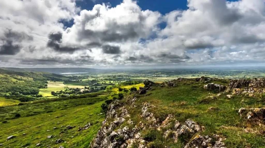
Bristol lies near the River Avon and the Severn Estuary, with the Mendip Hills to the south and the Cotswolds to the northeast. This geography creates access to varied terrain without requiring a long-distance journey for every walk.
The city’s surrounding landscape also reflects centuries of settlement, agriculture and industry. Historic lanes connect villages and farms, former transport corridors provide walking opportunities, and woodland estates preserve habitats close to urban neighbourhoods.
How do local landscapes influence hiking?
The region’s geology affects walking conditions. Limestone areas contain rocky tracks, exposed slopes and distinctive landforms. Clay-rich soils become muddy after prolonged rain, while woodland paths collect fallen leaves and tree roots.
Elevation also changes the experience. Routes along lowland rivers often remain relatively level, whereas walks across the Mendip Hills and Cotswold escarpment involve climbs and descents. Exposed hilltops experience stronger winds than sheltered city parks.
These differences make route selection important throughout the year. A trail suitable for a dry summer afternoon can become slippery and physically demanding during winter.
Which Hiking Routes Are Best for Beginners Near Bristol?
Beginner-friendly hiking routes near Bristol include the short woodland circuits at Leigh Woods, accessible paths around Ashton Court Estate and selected trails through the countryside near Cheddar. These walks offer opportunities to build stamina without committing to a demanding full-day hike.
Leigh Woods woodland wander
Leigh Woods National Nature Reserve lies southwest of Bristol, overlooking the Avon Gorge. The National Trust’s woodland wander is a circular route of approximately 1 mile (1.6 kilometres), usually taking 30–45 minutes. The walk passes woodland, grassy clearings and Stokeleigh Camp, an Iron Age hillfort.
The trail includes surfaced sections, grass paths and uneven rocky ground. Wet weather makes some areas slippery, so suitable footwear remains important even on this short route.
Ashton Court Estate
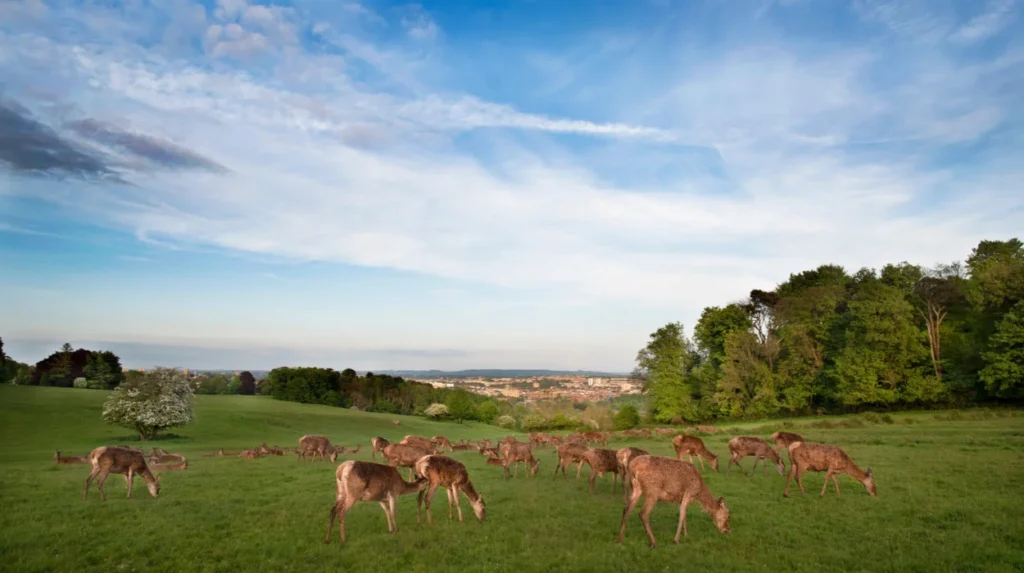
Ashton Court Estate covers extensive parkland and woodland west of Bristol. Its open landscapes provide space for shorter walks, longer circuits and wildlife observation. Visitors encounter mature trees, grassland, deer park landscapes and views towards the city.
Walkers should choose a clearly mapped circuit before setting out because the estate contains numerous intersecting paths. The estate’s open parkland also suits people who want to combine walking with a picnic or a visit to the surrounding countryside.
Black Rock, Cheddar
Black Rock offers a quieter introduction to the limestone scenery of the Mendip Hills. The National Trust describes its limekiln walk as an easy route of approximately 1 mile (1.6 kilometres) through a limestone valley.
The area combines geological features with grassland and woodland habitats. It provides an alternative to the steeper paths around the main Cheddar Gorge cliffs, although muddy surfaces and uneven ground still require attention.
Where Can Hikers Find the Best Views Near Bristol?
The best panoramic hiking routes near Bristol include Cheddar Gorge, Crook Peak, Wavering Down and the Cotswold escarpment. These elevated locations provide views across Somerset, the Bristol Channel and surrounding countryside, with visibility depending on weather and atmospheric conditions.
Cheddar Gorge
Cheddar Gorge is one of Somerset’s best-known geological landmarks. The limestone gorge extends approximately 3 miles (4.8 kilometres) and reaches a depth of nearly 400 feet (122 metres). Its steep cliffs, rocky outcrops and surrounding hills create a dramatic landscape for walking.
The National Trust’s Cheddar Gorge walking trail covers approximately 4 miles (6.4 kilometres). Hikers should prepare for steep sections and exposed terrain rather than treating it as a simple village stroll.
The elevated sections provide views across the gorge and the surrounding Mendip countryside. Wind, rain and poor visibility affect the experience, particularly on exposed paths close to cliff edges.
Crook Peak and Wavering Down
Crook Peak and Wavering Down form part of the western Mendip landscape. Crook Peak is a distinctive limestone hill with rocky outcrops and extensive views over Somerset. The surrounding grassland supports wildlife adapted to limestone habitats.
The National Trust identifies both hills as walking destinations with panoramic views towards Glastonbury Tor and Brean Down. Routes from nearby villages, including Winscombe and Axbridge, connect walkers to this upland landscape. National Trust
These hills suit walkers who want a countryside ascent without undertaking a multi-day expedition. The route distance depends on the chosen starting point and whether the walk includes a return through neighbouring paths.
The Cotswold escarpment
The Cotswolds lie northeast of Bristol and feature rolling farmland, wooded valleys and a prominent limestone escarpment. Elevated paths provide views over villages and agricultural landscapes, while lower routes pass through fields and sheltered woodland.
The Cotswold Way is the region’s principal long-distance walking trail. Hikers seeking shorter excursions can follow selected sections and return to their starting point using a mapped circular route or suitable public transport.
What Are the Best Long-Distance Hiking Routes Near Bristol?
The best long-distance hiking routes near Bristol include the Mendip Way, the Cotswold Way and the River Avon Trail. These established routes connect countryside, villages, river valleys and historic landscapes, offering options for full-day walks and multi-day hiking trips.
Mendip Way
The Mendip Way is a long-distance footpath crossing the Mendip Hills in Somerset. The National Trust describes it as a route of approximately 50 miles (80 kilometres), extending between Uphill, near Weston-super-Mare, and Frome. National Trust
The trail crosses varied landscapes, including limestone grassland, wooded valleys, open hills and rural settlements. Walkers encounter changes in elevation and surface conditions, so appropriate footwear and navigation equipment are essential.
Hikers can divide the Mendip Way into shorter stages. A single section suits a day trip, while completing the route requires advance planning for accommodation, transport and food.
Cotswold Way
The Cotswold Way is a National Trail running between Bath and Chipping Campden. It crosses the Cotswolds National Landscape, a protected area known for limestone villages, historic sites, farmland and broad views from the escarpment.
The complete trail is commonly described as approximately 102 miles (164 kilometres). Its length makes it more suitable for multi-day hiking or carefully selected sections than an ordinary afternoon walk.
Walkers based in Bristol can travel to a convenient access point and explore part of the route. Bath provides a particularly useful starting location for the southern end, while other access points allow hikers to select shorter sections based on fitness and transport arrangements.
River Avon Trail
The River Avon Trail follows sections of the River Avon between the Bristol area and Bath. Its riverside paths and adjoining countryside provide a different hiking experience from the exposed hills of the Mendips.
The route connects urban edges with open green spaces, riverbanks and historic settlements. Walkers should check the selected section before leaving, because access points, surface conditions and transport connections differ along the route.
A linear walk requires a return-journey plan. Public transport between suitable start and finish points can reduce the need to retrace the entire route, but current services and walking connections should be verified before departure.
Which Woodland Hiking Trails Near Bristol Are Worth Exploring?
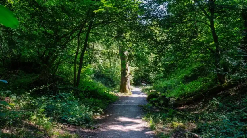
Leigh Woods, Goblin Combe and woodland paths around the Mendip Hills provide some of the most rewarding forest and nature walks near Bristol. These routes combine shaded trails, mature trees, limestone habitats and opportunities to observe local wildlife throughout the year.
Leigh Woods National Nature Reserve
Leigh Woods is a woodland reserve beside the Avon Gorge, close to the Clifton Suspension Bridge. Its paths pass through broadleaf woodland, grassland and former wood pasture. Veteran oak trees and uncommon whitebeam species contribute to its ecological significance.
The reserve changes with the seasons. Spring brings woodland flowers, summer provides shade, and autumn transforms the tree canopy with red and golden foliage. The mix of habitats also supports birds, invertebrates and other woodland wildlife.
Walkers should follow marked paths, respect wildlife and keep dogs under control. Some access routes descend steeply towards the River Avon, while uneven ground becomes muddy after rainfall.
Goblin Combe
Goblin Combe is a wooded limestone valley near Cleeve, southwest of Bristol. The landscape contains rocky slopes, woodland and habitats associated with limestone geology. It offers a countryside alternative for hikers seeking a combination of nature observation and uneven woodland paths.
The terrain is less uniform than a surfaced park walk. Visitors should use a current route map, check local access information and allow enough time for the chosen circuit. Seasonal vegetation and muddy ground can make narrow paths harder to follow.
How should hikers protect woodland habitats?
Woodland reserves contain sensitive plants, fungi, insects and nesting birds. Hikers protect these habitats by staying on established paths, avoiding damage to vegetation and carrying litter out of the reserve.
Dogs should remain under effective control, particularly near livestock and wildlife. Visitors should also observe temporary closures and site notices intended to protect habitats or manage forestry work.
Which Hiking Routes Near Bristol Are Best for Families?
Family-friendly hiking near Bristol includes selected paths at Ashton Court Estate, short woodland circuits at Leigh Woods and easier countryside trails around Cheddar. These locations provide opportunities for outdoor exploration, wildlife watching and picnics without requiring a full-day walking commitment.
Families should select routes according to children’s ages, walking confidence and the terrain. A short circular walk with clear waymarkers usually provides a more manageable outing than a long route with steep climbs.
Ashton Court Estate provides open parkland and woodland for flexible walks. Families can shorten their outing when children become tired and use open areas for breaks. Visitors should supervise children around deer, uneven ground and shared cycling routes.
Leigh Woods offers a defined 1-mile (1.6-kilometre) circular woodland walk. Its natural play area and historic hillfort add points of interest, although rocky sections require care in wet weather.
Cheddar’s Black Rock limekiln walk provides another short option. Families interested in geology can explore the limestone landscape while learning about the area’s natural history. The path remains a countryside trail rather than a fully surfaced urban promenade.
What should families pack for a hike?
A family hiking bag should include drinking water, weather-appropriate layers, snacks, a basic first-aid kit and a charged mobile phone. Waterproof jackets and footwear with good grip are particularly useful in the changeable South West England climate.
Adults should check the complete route distance, estimated duration, toilet facilities and transport arrangements before departure. Short breaks help children maintain energy, while a planned turnaround time prevents a family walk from extending into darkness.
When Is the Best Time to Go Hiking Near Bristol?
Spring and summer provide longer daylight hours for hiking near Bristol, while autumn offers woodland colour and clear-day views. Winter remains suitable for selected routes, but shorter days, wet ground, strong winds and reduced visibility require additional preparation.
The region’s walking conditions change throughout the year. Choosing the right season depends on the route’s elevation, exposure, surface and the type of scenery a visitor wants to experience.
Spring: March to May
Spring brings fresh woodland growth, wildflowers and increasing daylight. Leigh Woods is particularly suitable for observing woodland flowers, including bluebells in season. Countryside trails also become attractive for birdwatching and nature photography.
Rain remains common, and shaded paths can stay muddy. Waterproof footwear and a weather forecast check help walkers prepare for changing conditions.
Summer: June to August
Summer provides longer days for hill walks, extended countryside routes and long-distance trail sections. Early morning departures help walkers avoid the warmest part of the day, especially on exposed routes around Cheddar Gorge and the Mendip Hills.
Hikers should carry sufficient water, apply sun protection and avoid approaching cliff edges for photographs. Popular destinations also experience greater visitor pressure during school holidays.
Autumn: September to November
Autumn brings changing foliage in woodland areas and attractive conditions for countryside photography. Leigh Woods provides mature trees and shaded paths, while the Mendip Hills offer open views across the changing rural landscape.
Wet leaves can conceal slippery roots and stones. Daylight decreases as the season progresses, so hikers should begin longer routes earlier and carry a reliable torch.
Winter: December to February
Winter hiking requires careful route selection. Lower-level paths and shorter woodland circuits provide alternatives to exposed hilltops during poor weather.
Strong winds, heavy rain, frost and occasional ice increase the risk of slips and navigation errors. Walkers should avoid exposed or flooded paths when conditions deteriorate and postpone trips when official weather warnings indicate dangerous conditions.
How Should You Prepare for Hiking Near Bristol?
Preparing for a hike near Bristol involves checking the route, assessing weather conditions, selecting suitable footwear, carrying water and planning transport. Walkers should also review access restrictions, estimate walking time and take navigation equipment before entering unfamiliar countryside.
Preparation becomes more important as route length and elevation increase. A short woodland circuit requires less equipment than a full-day hill walk, but both need suitable clothing and awareness of changing conditions.
What footwear and equipment are necessary?
Walking shoes with good grip suit maintained woodland paths and shorter countryside routes. Waterproof hiking boots provide additional protection on rocky, muddy or uneven trails, particularly around the Mendip Hills.
A practical hiking kit includes:
- Waterproof jacket and insulating layers.
- Drinking water and food appropriate to the route.
- A paper map or offline digital map.
- Charged mobile phone and portable battery.
- Small first-aid kit and personal medication.
- Torch, particularly for longer walks or winter outings.
Equipment should match the conditions rather than the distance alone. A short route through slippery woodland sometimes requires more careful footwear than a longer walk on a dry, surfaced path.
How can hikers navigate safely?
Walkers should use recognised maps, waymarkers and established footpaths. Before departure, identify the starting point, route junctions, expected finish time and an alternative exit where available.
Mobile signal varies across rural valleys and wooded areas. Downloading an offline map prevents navigation from depending entirely on a live internet connection.
Hikers should tell someone their planned route and expected return time when undertaking longer or more remote walks. If conditions worsen, turning back is safer than continuing towards an exposed summit or unfamiliar path.
What are the countryside access rules?
Public rights of way provide legally established access across parts of the English countryside. Footpaths, bridleways and other access routes have different permitted uses, so walkers should follow local signs and the relevant access rules.
The Countryside Code advises visitors to respect other people, protect the natural environment and enjoy the outdoors responsibly. Hikers should close gates, avoid disturbing livestock, remove litter and keep dogs under control.
Some sites have additional restrictions relating to conservation, livestock management, forestry operations or temporary hazards. Checking notices from the land manager before travelling helps prevent access problems.
How Can You Reach the Best Hiking Routes Near Bristol?
Hikers can reach many routes near Bristol by car, bus, train and on foot, depending on the destination. Leigh Woods sits close to the city, while Cheddar Gorge and the wider Mendip Hills require more detailed transport planning.
Transport affects the choice of route, especially for linear walks where the finishing point differs from the starting point. Before setting out, confirm the latest bus and train timetables, parking arrangements and walking connections.
Leigh Woods is approximately 2 miles southwest of Bristol by road. The National Trust identifies bus connections along the A369 corridor and access from the River Avon Trail. Bristol Temple Meads and Clifton Down stations provide rail access to the wider area, followed by onward travel.
Cheddar Gorge lies approximately 8 miles northwest of Wells. Road access is available from the A371 and A38, while public transport options include bus services to Cheddar village. Visitors travelling from Bristol should check the current timetable and connections before departure.
For longer routes such as the Mendip Way and Cotswold Way, walkers should identify convenient access points and confirm the return journey. Where direct public transport is limited, a shorter circular route can provide a more straightforward alternative.
Parking availability, charges and opening arrangements differ between destinations. Check official visitor information before travelling, especially during weekends, school holidays and periods of poor weather.
Explore More Area Guide
Best Cycling Routes in Bristol: Paths, Trails and Scenic Rides
Best Running Routes in Bristol: Parks, Harbourside and Trails
Why Are Hiking Routes Near Bristol Important for Nature and Wellbeing?
Hiking routes near Bristol support outdoor recreation, physical activity and contact with nature. Woodland reserves, river paths and protected landscapes also provide habitats for wildlife, conserve geological features and connect urban communities with the surrounding countryside.
Walking provides a practical form of physical activity that can be adapted to different fitness levels. Short woodland circuits offer a manageable starting point, while longer hill walks provide opportunities to develop endurance and walking confidence.
Natural landscapes also have ecological importance. Leigh Woods supports veteran trees and rare whitebeam species, while the Mendip Hills contain limestone grassland, wooded ravines and habitats for species including horseshoe bats, dormice and adders. These features make responsible access essential. National Trust+1
Hiking also connects visitors with the region’s history. Stokeleigh Camp preserves evidence of an Iron Age hillfort above the Avon Gorge, while historic paths across Somerset and Gloucestershire reflect centuries of agriculture, settlement and movement between communities.
Protecting these places requires cooperation between visitors, conservation organisations, landowners and local communities. Staying on established paths, following access guidance and respecting wildlife helps maintain walking opportunities for future generations.
Which Hiking Route Near Bristol Should You Choose First?
Leigh Woods suits a short woodland walk, Cheddar Gorge offers dramatic limestone scenery, Crook Peak provides elevated countryside views, and the Mendip Way suits longer-distance hikers. The best starting route depends on fitness, available time, transport and current trail conditions.
For a first hiking trip, Leigh Woods provides a clearly defined circular walk close to Bristol. Its woodland paths, views of the Avon Gorge and historic hillfort create a varied experience without requiring a long day outdoors.
Walkers seeking a more demanding excursion can explore Cheddar Gorge or the Mendip Hills. Those interested in multi-day adventures can plan sections of the Mendip Way or Cotswold Way, using official trail information to organise distances and transport.
The region’s varied landscapes make it possible to progress from short local walks to longer countryside hikes without travelling far from Bristol. Careful route selection, appropriate equipment and respect for the environment make these trails more enjoyable and safer throughout the year.
What are the best hiking routes near Bristol?
The best hiking routes near Bristol include Leigh Woods, Cheddar Gorge, the Mendip Hills, Crook Peak and the Cotswold Way. These destinations offer woodland trails, panoramic viewpoints, limestone landscapes and long-distance countryside walks.