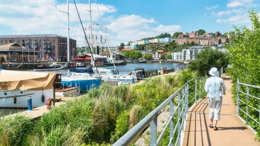
Bristol offers a wide range of walking routes, from historic harbour paths and riverside trails to woodland tracks, green urban spaces and countryside walks on the city’s outskirts. The best walks in Bristol provide access to local heritage, wildlife, architecture and outdoor recreation without requiring a long journey from the city centre.
- What are the best walks in Bristol?
- Where can visitors enjoy the best riverside walks in Bristol?
- Which Bristol walks offer the best views?
- Which woodland walks near Bristol are best for nature?
- Which Bristol park walks are suitable for families?
- Which historic walks help visitors discover Bristol’s heritage?
- Which long-distance walking routes start in or near Bristol?
- Where can walkers find quieter green spaces in Bristol?
- When is the best time to go walking in Bristol?
- How should walkers plan a safe and accessible Bristol walking route?
- Check distance and terrain
- Consider accessibility
- Prepare for changing conditions
- Plan transport and facilities
- Why are Bristol’s walking routes important for health and the environment?
- Which walking route should you choose for your next Bristol outing?
For residents and visitors, walking is a practical way to explore Bristol’s neighbourhoods, public parks and waterways. Routes such as the Bristol Harbourside, the River Avon Trail, the Clifton Suspension Bridge area and Leigh Woods offer different experiences, including accessible urban promenades, historic landmarks and woodland paths.
Choosing the right walk depends on distance, terrain, transport links, accessibility and the amount of time available. Short city-centre routes suit casual outings, while longer trails provide opportunities for exercise, wildlife observation and exploration of the surrounding countryside.
What are the best walks in Bristol?
The best walks in Bristol include the Harbourside, the River Avon Trail, the Clifton Suspension Bridge area, Leigh Woods, the Bristol and Bath Railway Path, and Ashton Court Estate. These routes combine waterfront scenery, historic landmarks, woodland, parks and opportunities for walking throughout the year.
Bristol’s walking routes reflect its geography and development. The River Avon and Floating Harbour shape the city’s waterfront, while the surrounding hills, historic estates and former railway corridors provide additional walking opportunities. Some paths pass through busy urban areas, whereas others offer quieter surroundings close to the city.
The Bristol Harbourside is a useful starting point for visitors who want a relatively level route near museums, cafés and historic buildings. The Clifton Suspension Bridge area offers elevated views across the Avon Gorge. Leigh Woods provides woodland trails on the opposite side of the gorge, and Ashton Court Estate has extensive parkland and established paths.
The Bristol and Bath Railway Path follows a former railway corridor and provides a largely traffic-free route for walking and cycling. The River Avon Trail connects Bristol with surrounding settlements and countryside, making it suitable for walkers seeking a longer-distance experience.
Each route serves a different purpose. A central harbour walk focuses on urban heritage, a woodland route offers contact with nature, and a longer trail supports sustained exercise and exploration beyond the city centre.
Where can visitors enjoy the best riverside walks in Bristol?
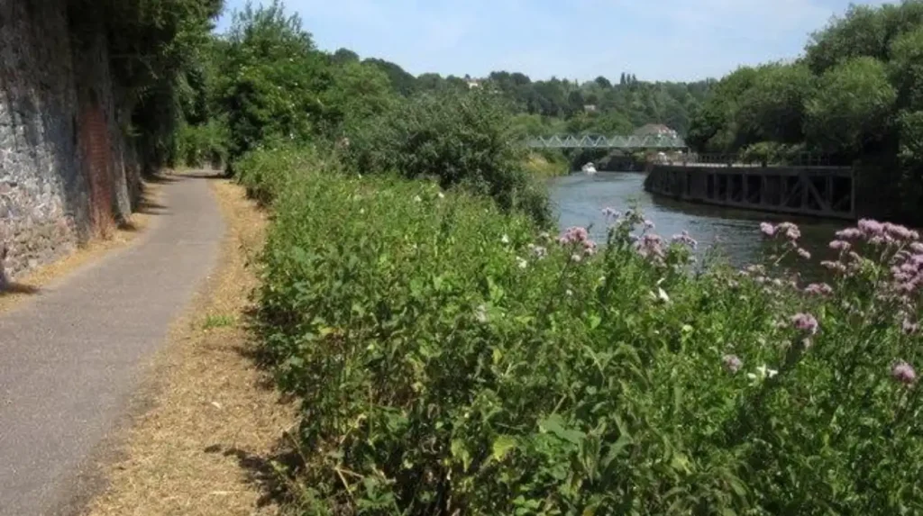
Bristol’s best riverside walks follow the Floating Harbour, the River Avon and sections of the Avon Gorge. These routes provide views of historic quays, working waterways, bridges and riverside architecture, with options ranging from short city-centre strolls to longer countryside walks.
Bristol’s waterways are central to its history and walking landscape. The River Avon connects the city with the Bristol Channel, while the Floating Harbour is a historic dock system that enabled ships to remain afloat despite changes in the river’s water level.
Bristol Harbourside
The Harbourside is one of the most convenient walking areas in Bristol. Paths connect the waterfront with Millennium Square, historic dockside buildings, museums and pedestrian sections around the harbour basin.
The route suits visitors who want a flexible walk with frequent places to stop. Walkers can combine the waterfront with a visit to M Shed, a museum exploring Bristol’s history, or the surrounding cultural attractions. The relatively level sections also make the Harbourside a practical option for people who prefer to avoid steep hills.
The route length depends on the chosen starting point and the sections included. A short out-and-back walk provides a quick introduction to the waterfront, while a longer circuit explores more of the harbour’s public paths.
River Avon Trail
The River Avon Trail is a long-distance walking route following sections of the River Avon between Bristol and Bath. It passes through a changing landscape of riverside paths, settlements, open countryside and historic structures.
Walkers should plan the route according to their available time, because the trail is substantially longer than a typical city-centre stroll. Checking current route information before setting out helps identify access points, surface conditions and sections suitable for a particular walking ability.
Avon Gorge
The Avon Gorge is a steep-sided river valley west of central Bristol. Walking routes around the gorge provide views of exposed limestone cliffs, wooded slopes and the River Avon below.
The Clifton Suspension Bridge is the best-known landmark in this landscape. Walkers can combine viewpoints around Clifton with paths on the Leigh Woods side of the gorge. The terrain varies considerably, so visitors should distinguish between paved viewpoints and woodland trails with uneven surfaces.
Which Bristol walks offer the best views?
The best walks for views in Bristol include the Clifton Suspension Bridge viewpoints, the Avon Gorge, Brandon Hill, Cabot Tower and elevated paths around Ashton Court. These locations provide perspectives across the city, river valley, historic architecture and surrounding green spaces.
Bristol’s varied landscape creates opportunities to see the city from different elevations. The river valley provides dramatic views, while parks and hilltop landmarks offer wider panoramas across rooftops, church towers and green spaces.
Clifton Suspension Bridge
The Clifton Suspension Bridge spans the Avon Gorge and links Clifton in Bristol with Leigh Woods in North Somerset. Designed by engineers including Isambard Kingdom Brunel, the bridge opened in 1864.
The surrounding public viewpoints are popular for photography and sightseeing. Walkers can observe the bridge’s suspension structure, the gorge’s limestone cliffs and the river below. The bridge itself also has pedestrian access, although visitors should check official information for current access arrangements and any temporary restrictions.
Brandon Hill and Cabot Tower
Brandon Hill is a historic public park near Bristol city centre. Cabot Tower, completed in 1898, stands on the hill and commemorates the voyage of John Cabot from Bristol towards North America in 1497.
Paths through Brandon Hill provide a short walk with a mixture of landscaped greenery, mature trees and city views. The tower’s viewing opportunities depend on its opening arrangements, so visitors should check current information before planning a visit specifically to climb it.
Ashton Court Estate
Ashton Court Estate lies west of Bristol and contains extensive parkland, woodland and open grassland. Its paths suit walkers looking for a landscape that feels more rural than the central waterfront.
The estate’s open areas provide views across Bristol and the surrounding countryside. Route choice affects both walking distance and terrain, making the estate suitable for short recreational walks as well as longer outings. Visitors should follow posted guidance around livestock, conservation areas and estate facilities.
Which woodland walks near Bristol are best for nature?
Leigh Woods, Blaise Castle Estate, Snuff Mills and Oldbury Court Estate are among the best woodland walking destinations near Bristol. They offer tree-lined paths, river corridors, historic features and opportunities to observe local wildlife throughout the changing seasons.
Woodland walks provide a different experience from Bristol’s central waterfront. Tree cover creates shaded paths, while streams, uneven ground and seasonal vegetation add variety to the landscape. Some woodland routes also connect with historic estates and open parkland.
Leigh Woods
Leigh Woods is a woodland area across the Avon Gorge from Clifton. Managed in part by the National Trust, it contains established paths through trees and offers viewpoints across the gorge and towards the Clifton Suspension Bridge.
The woodland supports habitats for birds, insects and other wildlife. Spring brings fresh foliage and woodland flowers, while autumn provides opportunities to observe changing leaf colours. Visitors should stay on appropriate paths to protect sensitive habitats and avoid disturbing wildlife.
Walkers can combine Leigh Woods with a visit to the suspension bridge or extend their outing towards Ashton Court. These longer combinations require more time and attention to route planning than a short woodland circuit.
Blaise Castle Estate
Blaise Castle Estate is a large historic parkland in north-west Bristol. Bristol City Council identifies the estate as covering approximately 650 acres and recognises its Grade II* registered parkland status.
The estate combines woodland, open grassland, historic landscape features and paths around Blaise Castle. The castle itself is a small picturesque folly rather than a defensive medieval fortress. The surrounding landscape makes the estate suitable for visitors interested in both heritage and outdoor recreation.
Walkers can select shorter paths near the main facilities or explore longer routes through the grounds. Terrain and gradients vary, so choosing a route that matches personal fitness and mobility is important.
Snuff Mills and Oldbury Court Estate
Snuff Mills sits beside the River Frome in north-east Bristol. The area includes woodland paths, historic mill features and riverside scenery. Nearby Oldbury Court Estate extends the walking experience through landscaped parkland and additional green space.
The river corridor provides opportunities to observe birds and aquatic habitats. Walkers should take particular care after heavy rain because riverside surfaces become slippery and water levels can rise.
A walk linking Eastville Park, Snuff Mills and Oldbury Court creates a longer outing with a combination of open parkland, wooded paths and riverside sections. Visitors should check local path conditions before following the entire route.

Which Bristol park walks are suitable for families?
Bristol’s family-friendly walks include Ashton Court Estate, Blaise Castle Estate, Brandon Hill, Castle Park and sections of the Harbourside. These locations provide opportunities for short walks, outdoor play, picnics and sightseeing without requiring a full-day hiking commitment.
Family walking routes work best when they offer clear paths, manageable distances and convenient facilities. Parks allow families to shorten a walk when children become tired or extend it when time permits.
Castle Park
Castle Park is a central green space close to Bristol’s shopping districts and historic streets. It provides a convenient place to take a break during a city-centre walking itinerary.
Visitors can combine a park visit with nearby historic buildings and streets. Its central location makes it particularly useful for families travelling by public transport or staying in the city centre.
Queen Square and College Green
Queen Square is a Georgian square surrounded by historic architecture. College Green sits near Bristol Cathedral and other major civic landmarks.
Both locations provide opportunities for short urban walks. Their open spaces offer a contrast with the surrounding streets, and their central positions make them easy to include in a wider sightseeing route.
Families should remain aware of nearby traffic and pedestrian crossings. These are urban walking areas rather than enclosed countryside trails, so supervision is essential around roads and busy junctions.
Ashton Court Estate
Ashton Court Estate is particularly useful for families who want more space. Bristol City Council lists facilities including picnic areas, cafés, toilets and deer parks.
The estate has woodland and grassland paths, allowing families to select a short walk or spend several hours exploring. Children can learn about parkland habitats, mature trees and the relationship between historic estates and modern public recreation.
Deer and other wildlife should be observed from a respectful distance. Follow estate signs, avoid feeding animals and keep dogs under control wherever restrictions apply.
Which historic walks help visitors discover Bristol’s heritage?
Bristol’s historic walking routes include the Old City Heritage Trail, King Street, Queen Square, College Green and the Clifton neighbourhood. These routes connect medieval streets, Georgian architecture, maritime heritage and major landmarks within walkable parts of the city.
Bristol’s built environment reflects centuries of trade, engineering, religious life and urban expansion. Walking makes it easier to understand how historic streets connect with the waterfront and later residential districts.
Old City Heritage Trail
The Old City Heritage Trail explores Bristol’s historic centre, including surviving street patterns and locations associated with the city’s medieval development.
Visitors can explore Corn Street, historic market areas and streets around Bristol Bridge. Bristol Bridge has an important place in the city’s development because it connects historic areas on opposite sides of the River Avon.
A self-guided walk allows visitors to stop at buildings and landmarks that interest them. Official walking maps and interpretation help explain architectural features and historical context.
King Street and Queen Square
King Street is known for historic buildings, traditional public houses and Bristol’s theatrical heritage. It connects with the wider Old City and Harbourside walking area.
Queen Square provides an example of Georgian town planning. Its open central space and surrounding architecture reflect a period when Bristol expanded as a major commercial city.
Combining these locations creates a compact walk through streets associated with trade, entertainment and urban development. Visitors should respect residents, businesses and pedestrian access while exploring historic streets.
Clifton and Park Street
Clifton contains Georgian architecture, residential crescents, independent shops and routes leading towards the Clifton Suspension Bridge. Park Street connects central Bristol with the elevated area around the university and Brandon Hill.
These routes include hills and sloping pavements, so they are more physically demanding than the central Harbourside. However, they provide a useful way to explore Bristol’s architectural history and changing urban landscape in one outing.
For a more structured experience, visitors can follow a published self-guided route with mapped stops and historical explanations.
Which long-distance walking routes start in or near Bristol?
Long-distance options include the 33-mile Bristol Ring, the 23-mile River Avon Trail and the Bristol and Bath Railway Path. These routes connect urban neighbourhoods with rivers, parks, nature reserves and surrounding settlements, offering different levels of challenge.
Longer routes allow walkers to explore Bristol beyond its most familiar attractions. They require more planning than a short park walk because distance, transport, daylight and access conditions affect the overall experience.
Bristol Ring
The Bristol Ring is a circular walking route approximately 33 miles long. Travelwest describes it as a route divided into six sections, with public transport access to each section.
The route connects a variety of landscapes and landmarks, including Troopers Hill Nature Reserve, the Clifton Suspension Bridge, Nightingale Valley, Ashton Court Estate, Stoke Park Estate and the River Frome at Snuff Mills.
Walking the route in sections allows people to complete it over several outings rather than attempting the entire distance in one day. Official route guidance also identifies shorter and step-free alternatives for people who need different access arrangements.
Bristol and Bath Railway Path
The Bristol and Bath Railway Path follows a former railway corridor between the two cities. It is approximately 13 miles long and is largely off-road, making it a popular option for walking and cycling.
The path offers a relatively continuous route through urban and suburban landscapes. Its former railway alignment generally avoids the steep gradients associated with some of Bristol’s hillier walking routes.
Walkers should remember that cyclists also use the path. Keep to the appropriate side where marked, remain alert at junctions and avoid blocking the route when stopping.
The path can be completed as a long-distance outing or explored in shorter sections using nearby access points and public transport. Anyone planning to walk the full route should allow sufficient time for the return journey.
South Bristol Circular Walk
The South Bristol Circular Walk is approximately 23 miles long and follows a route around the southern edge of the city. Bristol Ramblers describes it as a walk connecting green spaces, the Avon Valley, local nature reserves, Ashton Court and central Bristol.
The route is divided into four sections, making it more manageable for walkers who prefer shorter outings. Its varied landscape provides opportunities to explore less familiar parts of the city rather than focusing only on central attractions.
Because route conditions and local access arrangements change, check current maps before setting out. A long circular walk also requires suitable footwear, water, food and a plan for returning to the starting point.
Where can walkers find quieter green spaces in Bristol?
Quieter walking options include Troopers Hill Nature Reserve, Stoke Park Estate, the Frome Valley Walkway and selected paths around Frenchay Moor. These locations provide open views, woodland, riverside scenery and opportunities to explore Bristol beyond its busiest tourist areas.
Bristol has an extensive network of parks, nature reserves and green corridors. These spaces provide places for exercise and relaxation while supporting habitats within the urban environment. The best option depends on whether a walker prefers open grassland, woodland or a path beside running water.
Troopers Hill Nature Reserve
Troopers Hill is an elevated green space in east Bristol known for its views across the surrounding area and its industrial heritage. Its landscape includes grassland, heathland and scrub habitats.
The hill provides an alternative to the more heavily visited viewpoints around Clifton. Paths cross sloping terrain, so visitors should wear footwear suited to uneven ground. The elevated position also creates opportunities for landscape photography and observing changes in the weather.
Frome Valley Walkway
The Frome Valley Walkway follows sections of the River Frome through north-east Bristol and neighbouring areas. It connects riverside landscapes, green spaces and settlements, providing a route for people interested in both nature and local geography.
Sections around Snuff Mills and Oldbury Court Estate are particularly useful for walkers who want to combine woodland and river scenery. Other sections extend beyond these parks, so a map helps identify the most suitable distance and access point.
Stoke Park Estate
Stoke Park Estate is a historic landscape in north-east Bristol, recognised for its open parkland and views across the surrounding area. Its walking routes offer a contrast with the compact paths of central parks.
Visitors should follow public access guidance and respect any restrictions affecting particular areas. Weather conditions influence the experience, especially on exposed grassland paths during winter and after heavy rain.
When is the best time to go walking in Bristol?
Spring and summer offer longer daylight hours and opportunities to observe wildflowers, while autumn provides colourful woodland scenery. Winter suits shorter urban walks and clear-day viewpoints, provided walkers check daylight, weather forecasts and surface conditions before departure.
Bristol’s walking routes remain useful throughout the year, but seasonal conditions affect comfort, visibility and wildlife activity.
Spring: Woodland paths and parks develop fresh foliage, while wildflowers appear in suitable habitats. Mud remains common on unpaved trails after rainfall.
Summer: Longer daylight supports extended walks on the Bristol Ring and River Avon Trail. Popular viewpoints and the Harbourside tend to attract more visitors during good weather.
Autumn: Leigh Woods, Ashton Court and other tree-covered areas provide seasonal colour. Falling leaves conceal slippery surfaces, so walkers should pay attention to roots, steps and slopes.
Winter: The Harbourside and central heritage routes provide alternatives when woodland paths become muddy. Short daylight hours make route timing especially important for long-distance outings.
Bristol’s weather can change quickly. Checking the forecast before leaving helps walkers choose appropriate clothing and decide whether an exposed viewpoint or a longer rural route is suitable.
How should walkers plan a safe and accessible Bristol walking route?
Walkers should check route length, elevation, surfaces, public transport, weather and daylight before setting out. Official council maps and local walking guides help identify accessible sections, facilities and current restrictions, reducing the risk of choosing an unsuitable route.
Route planning improves both safety and enjoyment. A route that appears short on a map can become demanding when it includes steep hills, uneven woodland tracks or long sections without facilities.
Check distance and terrain
Choose a route that matches your walking ability. The central Harbourside suits a shorter, relatively level outing, while the Avon Gorge and longer circular trails involve more varied terrain.
Use a current route map rather than relying entirely on a general description. Check the starting point, expected distance, likely walking time and available exit points.
Consider accessibility
Not every Bristol walking route is suitable for wheelchairs, pushchairs or people with limited mobility. Even within a public park, paths can include cobbles, steep gradients, steps and uneven surfaces.
Bristol City Council notes that Ashton Court’s terrain and topography create difficulties for some wheelchair users and visitors with restricted mobility or visual impairments. The level stables courtyard offers a more manageable area, although its cobbled surface still affects access.
Check official accessibility information for the specific entrance, path and facilities you intend to use. A park’s general accessibility does not guarantee that every route within it is step-free.
Prepare for changing conditions
Wear footwear suitable for the route and carry water on longer walks. A charged phone, offline map and basic first-aid supplies are useful on countryside paths.
Stay on public paths, follow signs and respect wildlife habitats. Keep dogs under control around livestock and sensitive conservation areas, and observe any local restrictions.
Plan transport and facilities
Bristol’s central walking routes are generally convenient for public transport, while some countryside trails require additional planning. Check bus and train services before departure, especially when walking a one-way route.
Identify toilets, refreshments and suitable stopping points in advance. On longer walks, plan a realistic finishing time and avoid relying on the last available public transport service without checking its timetable.
Explore More Area Guide
Best Photography Spots in Bristol | Scenic Locations
Best Dog Walks Near Bristol: Parks and Woodland Trails
Why are Bristol’s walking routes important for health and the environment?
Walking routes support everyday physical activity, outdoor recreation and contact with nature. Bristol’s parks, waterways and green corridors also provide habitats, connect neighbourhoods and help residents reach open spaces without travelling far from home.
Walking offers a practical way to incorporate movement into daily life. Short journeys on foot connect residential areas with shops, public transport, workplaces and public spaces, while longer recreational routes encourage people to explore their surroundings.
Green spaces also have environmental value. Woodland, grassland, riverside vegetation and nature reserves provide habitats for wildlife and contribute to the city’s network of green infrastructure. Protecting these areas helps maintain their value for both people and nature.
Responsible walking reduces pressure on sensitive habitats. Visitors can support conservation by avoiding littering, keeping to designated paths where requested and following instructions around nesting birds, livestock and protected areas.
Bristol’s developing walking network also supports local tourism. Historic routes connect visitors with museums, architecture and the waterfront, while longer trails encourage exploration of neighbourhoods and settlements outside the city centre.
Which walking route should you choose for your next Bristol outing?
Choose the Harbourside for an easy city-centre stroll, Brandon Hill for elevated views, Leigh Woods for woodland, and Ashton Court for extensive parkland. Select the Bristol Ring or River Avon Trail when you want a longer, more demanding walking experience.
The most suitable route depends on available time, preferred scenery and physical ability. Visitors with limited time can explore the Harbourside or Old City, while people seeking woodland can head to Leigh Woods or Blaise Castle Estate.
Walkers who prefer a longer challenge can complete individual sections of the Bristol Ring, South Bristol Circular Walk or River Avon Trail. These routes reveal a broader picture of the city’s geography and connect urban landmarks with natural landscapes.
Before leaving, confirm access arrangements, check weather conditions and download a current map. These simple steps help make a walk more enjoyable and reduce the chance of unexpected difficulties.
Bristol’s walking network offers options for different interests and abilities, from short historic strolls to full-day trails. Exploring these routes provides a practical way to discover the city’s waterfront, architecture, green spaces and surrounding countryside on foot.
What are the best walks in Bristol?
The best walks in Bristol include the Harbourside, Clifton Suspension Bridge, Leigh Woods, Ashton Court Estate, Brandon Hill and the Bristol Ring Walk. These routes offer riverside scenery, woodland, historic landmarks and countryside views.