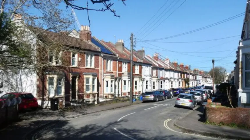
Bristol is a large city in South West England with a diverse mix of historic neighbourhoods, Victorian suburbs, modern housing developments, parks, schools and transport corridors. The city combines an urban centre with extensive residential districts, making location an important factor for families choosing where to stay, move or spend extended time.
- What makes an area family-friendly in Bristol?
- Which Bristol areas are particularly suitable for families seeking established suburban neighbourhoods?
- Is Bishopston and Redland a good area for families in Bristol?
- Why do families choose Clifton and Clifton Down despite their urban character?
- Which Bristol areas work well for families wanting parks and outdoor space?
- Is Southville a family-friendly area of Bristol?
- What makes Bedminster and Brislington useful family areas?
- Does Horfield suit families looking for practical access to schools and amenities?
- How important are schools when choosing a family area in Bristol?
- Which Bristol family areas offer the strongest combination of transport and local services?
- How should families compare Bristol neighbourhoods before moving?
- How does Bristol’s history influence its family neighbourhoods?
- What should families know about Bristol’s future neighbourhood development?
The term family-friendly area refers to a neighbourhood that provides practical access to schools, green space, everyday shops, healthcare, leisure facilities, public transport and safe routes for walking or cycling. Bristol City Council identifies neighbourhood design, public spaces, transport access and local facilities as important components of liveable communities.
Bristol’s neighbourhoods differ considerably. Westbury-on-Trym and Henleaze have established suburban character. Stoke Bishop has large green spaces and access to the Downs. Bishopston and Redland provide dense urban amenities. Southville and Bedminster combine residential streets with city-centre access. Brislington and Horfield provide different housing and transport connections.
The city also has a detailed system of ward profiles and Census data covering household composition, housing, bedrooms, car availability, travel, qualifications and other indicators. These datasets are useful when assessing a neighbourhood rather than relying only on general descriptions.
What makes an area family-friendly in Bristol?
A family-friendly Bristol neighbourhood combines suitable housing, schools, parks, everyday services, transport links, walkable streets and community facilities. The strongest practical choice depends on household needs, children’s ages, school admissions, commuting patterns, budget and preferred residential environment.
Family suitability has several measurable components. Housing determines whether a household can access enough bedrooms, outdoor space and suitable layouts. Schools influence daily journeys and admission planning. Parks provide outdoor recreation. Shops and services reduce the need for longer journeys.
Transport is another important factor. Bristol’s transport strategy identifies neighbourhood connectivity as a priority, including access to employment, education, leisure and healthcare without relying entirely on private cars.
Green space is particularly significant for families with young children. Bristol City Council manages parks and estates ranging from neighbourhood parks to large historic landscapes. Examples include St Andrews Park, Redland Green, Canford Park, Victoria Park, Oldbury Court Estate, Blaise Castle Estate and The Downs.
School location also requires careful checking. Bristol City Council publishes information on school priority areas, admission arrangements and planned admission numbers. A neighbourhood name alone does not guarantee access to a particular school. The exact home address and the relevant admission policy determine the position.
Which Bristol areas are particularly suitable for families seeking established suburban neighbourhoods?
Westbury-on-Trym, Henleaze and Stoke Bishop provide established north-west Bristol residential environments with schools, parks, local centres and access to major green spaces. Their suburban structure suits households seeking quieter streets while retaining connections with central Bristol and surrounding employment areas.
Westbury-on-Trym is an established residential district in north-west Bristol. It has a village-like local centre surrounded by residential streets. The area includes independent shops, services, schools and community facilities.
Henleaze sits close to Westbury-on-Trym and Stoke Bishop. Its residential environment includes traditional housing, local shopping streets and access to open space. Bristol City Council has produced a character assessment for Henleaze, reflecting the area’s distinct architectural and neighbourhood characteristics.
Stoke Bishop provides another suburban option. It sits close to The Downs, a major open-space area on the western side of Bristol. The Downs provides space for walking, exercise, informal recreation, picnics and organised activities.
The three areas also form part of Bristol’s current primary-school planning structure. The council’s proposed relevant-area information includes Elmlea Infant School, Elmlea Junior School, Henleaze Infant School, Henleaze Junior School, Sea Mills Primary School, Stoke Bishop Church of England Primary School and Westbury Park Primary School within the relevant planning area.
These neighbourhoods therefore combine several characteristics that matter to families: established housing, local services, green space and a concentration of education facilities.
Is Bishopston and Redland a good area for families in Bristol?
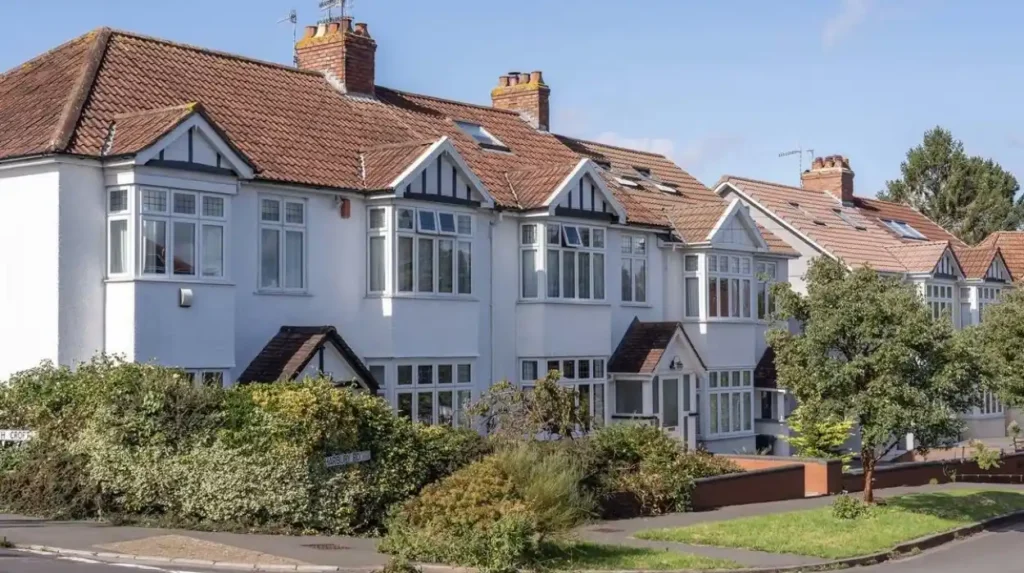
Bishopston and Redland combine family housing, schools, parks, independent businesses and strong access to central Bristol. The districts suit families seeking an urban residential environment where everyday services, education facilities, green spaces and city-centre destinations remain relatively close together.
Bishopston and Redland occupy a central-northern position between the city centre and northern suburbs. Their built environment contains substantial Victorian and Edwardian housing, with terraces, larger properties and converted homes.
The area has a strong local-centre structure. Gloucester Road provides a major commercial corridor with shops, cafés, restaurants and everyday services. Residential streets branch from this corridor, creating a combination of urban convenience and established housing.
Green space is another important component. Redland Green provides a neighbourhood park with a children’s playground and grassy areas. St Andrews Park is another major Victorian neighbourhood park with lawns, mature planting and recreation space. Both are identified by Bristol City Council within its parks portfolio.
Education is also strongly represented. Bristol’s primary-school planning information places Bishopston and Ashley Down, Cotham and Redland within a relevant planning area containing Ashley Down Primary School, Bishop Road Primary School, Brunel Field Primary School, Cotham Gardens Primary School and St Bonaventure’s Catholic Primary School.
Families considering this area need to distinguish proximity from guaranteed admission. Bristol’s school system uses individual admission policies and priority areas. Checking the exact property against current admissions information is therefore essential.
Why do families choose Clifton and Clifton Down despite their urban character?
Clifton and Clifton Down provide families with established housing, major green spaces, schools, cultural attractions and central-city access. The districts suit households prioritising walkability, local amenities and proximity to employment and leisure destinations over a conventional outer-suburban environment.
Clifton is one of Bristol’s best-known historic districts. Its architectural character includes Georgian and Victorian buildings, terraces, villas and landscaped streets. The neighbourhood sits west of Bristol city centre and connects directly with Clifton Down and surrounding districts.
The area benefits from access to Clifton Down, a substantial open landscape adjoining the wider Downs. The open space provides opportunities for walking, informal recreation, exercise and family outings.
Clifton also has access to local schools. Bristol City Council’s school-planning information lists Clifton within a primary-school relevant area containing Cathedral Primary School, Christ Church Church of England Primary School, Hotwells Primary School, St Johns Church of England Primary School in Clifton and other local schools.
The main distinction between Clifton and outer residential districts is urban density. Housing is frequently terraced or multi-storey, and gardens vary substantially. Families prioritising large private gardens and modern layouts need to assess individual properties carefully.
For families who value walking to shops, restaurants, parks, schools and cultural attractions, Clifton provides a compact urban environment. Its location also reduces the distance to Bristol city centre.
Which Bristol areas work well for families wanting parks and outdoor space?
Families prioritising outdoor recreation can consider Stoke Bishop, Westbury-on-Trym, Henleaze, Southville, Brislington, Horfield and areas near major parks. These neighbourhoods provide access to different combinations of playgrounds, playing fields, woodland, riverside routes and larger open spaces.
Bristol has an extensive network of public parks and open spaces. The council’s parks portfolio includes large estates, Victorian parks, neighbourhood greens and historic landscapes. Examples include Blaise Castle Estate, Ashton Court Estate, Oldbury Court Estate, St George Park, Victoria Park, Redcatch Park and The Downs.
Blaise Castle Estate is particularly significant for north-west Bristol. The council identifies it as a 650-acre Grade II* registered parkland containing a children’s play area, museum and castle.
Ashton Court Estate covers 850 acres of woodland and grassland. It provides a major outdoor destination west of the city centre and supports multiple recreational activities.
Oldbury Court Estate combines parkland, woodland, riverside paths and a children’s play area. It serves residential communities in east Bristol and provides a different outdoor environment from the open landscapes of The Downs.
For families, proximity to green space has practical value. A nearby playground supports short daily outings. A larger park supports longer walks, cycling, sport and weekend activities. The type of green space therefore matters as much as its overall size.
Is Southville a family-friendly area of Bristol?
Southville combines residential streets, local businesses, schools, parks and convenient access to central Bristol. Its position south of the River Avon provides families with an established urban neighbourhood that supports walking, local shopping, outdoor recreation and relatively short city-centre journeys.
Southville forms part of south Bristol and sits close to Bedminster, the harbourside and the city centre. Its housing includes traditional terraces and streets with strong residential character.
The neighbourhood has a prominent local high-street environment around North Street. Shops, cafés, restaurants and independent businesses create a concentration of everyday services.
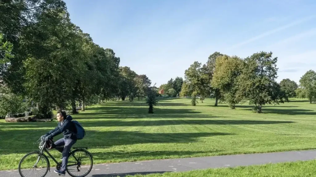
Southville also benefits from access to Victoria Park, located close to the neighbourhood. Bristol City Council describes Victoria Park as a large Victorian park with a children’s play area and extensive grassy space.
Transport and street design are central to Southville’s future development. Bristol City Council’s South Bristol Liveable Neighbourhood programme focuses particularly on Totterdown, Southville and Bedminster East in its first phase. The programme addresses walking, cycling, local transport, high streets, roads, parking and areas around schools.
This makes Southville relevant for families who value proximity to central Bristol without living directly in the city centre.
What makes Bedminster and Brislington useful family areas?
Bedminster and Brislington provide practical family environments with established housing, schools, local shopping, parks and connections to wider Bristol. Bedminster offers stronger inner-city accessibility, while Brislington provides a more suburban setting with access to major roads and extensive local amenities.
Bedminster is immediately south of Bristol city centre. Its main commercial areas include East Street and West Street, while North Street connects Bedminster with Southville.
The neighbourhood provides access to local schools, parks and everyday services. Its position also places families close to central Bristol, the harbourside and major employment areas.
Brislington lies farther east and has a more suburban structure. The district contains established residential streets, schools, shopping areas and access to green spaces.
Bristol City Council identifies Brislington East and Brislington West within its area committee structure, alongside Knowle and Stockwood. This administrative structure supports local decision-making and community funding.
The council’s parks information includes Arnos Vale Cemetery, Brandon Hill, Redcatch Park and other green destinations across the wider city. Redcatch Park in Knowle contains a children’s playground, tennis courts and football pitches.
Families comparing Bedminster and Brislington should therefore assess the daily journey rather than simply the distance to Bristol city centre. School location, workplace, parking requirements, bus routes and access to parks can produce very different daily patterns.
Does Horfield suit families looking for practical access to schools and amenities?
Horfield suits families seeking a northern Bristol residential area with schools, local services, green spaces and transport connections. Its position between central Bristol and northern employment areas gives households access to education, shopping, recreation and major transport corridors.
Horfield is a north Bristol residential district located close to Filton and the wider northern Bristol employment area. Its housing stock includes established terraces and later residential development.
The area benefits from local education facilities. Bristol’s primary-school planning information includes Horfield within a planning area containing Filton Avenue Primary School, Glenfrome Primary School and Horfield Church of England Primary School, alongside other schools serving nearby neighbourhoods.
Horfield also provides access to Horfield Common, a significant local recreational space. The wider north Bristol area contains additional parks and open spaces, making it possible to combine residential convenience with outdoor recreation.
Its location is relevant for families whose daily journeys extend toward Filton, South Gloucestershire or the University of the West of England area. It also provides routes toward central Bristol.
Horfield therefore fits households prioritising practical connectivity and everyday amenities rather than a purely village-style residential setting.
How important are schools when choosing a family area in Bristol?
Schools are a major location factor for Bristol families, but neighbourhood reputation does not determine admission. Parents need to check the exact address, current admission policy, priority area, planned places and application timetable before choosing a property around a particular school.
Bristol City Council publishes detailed school-admission information. Secondary-school data includes planned admission numbers, school type, age range, current roll, applications, priority areas and admission policies.
For example, the council’s current secondary-school information lists schools such as Ashton Park School, Bedminster Down School and Blaise High School with different admission numbers and age ranges. These figures demonstrate why families need school-specific information rather than relying on a general neighbourhood label.
Primary education also follows defined relevant areas. Bristol’s published planning information groups schools by geographical areas such as Bishopston and Ashley Down, Central and Clifton, and Stoke Bishop, Westbury-on-Trym and Henleaze.
School admissions are therefore a process rather than a simple location feature. Families should check:
The exact property address.
The relevant school priority area.
The current admissions policy.
The child’s age and year group.
The school’s planned admission number.
The application deadline.
Any distance or priority criteria.
These factors are particularly important when a family is moving to Bristol specifically for education.
Which Bristol family areas offer the strongest combination of transport and local services?
Areas with established local centres and multiple transport options reduce the number of daily car journeys required by families. Bishopston, Redland, Clifton, Southville, Bedminster, Horfield, Henleaze and Westbury-on-Trym each provide different combinations of buses, walking routes, cycling connections, shops and local services.
Transport access affects family routines because school, work, shopping and leisure trips often occur at different times of the day.
Bristol City Council’s transport strategy identifies improved access to education, employment, leisure and healthcare as a neighbourhood objective. It also emphasises safer walking and cycling and better connections through public transport.
The city’s current Liveable Neighbourhoods programme follows a similar principle. Bristol City Council defines liveable neighbourhoods around safer streets, better green spaces, walking, cycling, public transport and reduced through traffic.
South Bristol provides a current example. The council’s programme focuses on Totterdown, Southville and Bedminster East, with measures relating to parking, traffic movements, public transport, roads, high streets and areas near schools.
For families, transport suitability should therefore be measured through the actual daily itinerary. A household with children at a local school has different requirements from a household commuting to Filton, the city centre or Bristol Airport.
How should families compare Bristol neighbourhoods before moving?
Families should compare Bristol neighbourhoods using the exact property address, school admissions, housing layout, green-space access, transport connections, local services and household budget. Bristol City Council’s ward profiles, Census data, maps and neighbourhood information provide useful evidence for this assessment.
The first step is defining the household’s requirements. A family with toddlers prioritises nurseries, playgrounds and short walking routes. A family with secondary-school children prioritises school admissions and independent transport. A commuting household prioritises reliable travel connections.
The second step is checking the exact address. Bristol City Council’s My Neighbourhood service allows residents to search an address and identify information such as school catchment areas, resident parking schemes and nearby community facilities.
The third step is examining local statistics. Bristol’s ward profiles were updated in May 2026 and allow comparisons across subjects including child poverty, children’s services, adult social care, life expectancy and benefits.
The fourth step is checking housing and household information. The 2021 Census datasets provide information about housing type, tenure, household composition, occupancy, bedrooms and car availability.
The fifth step is checking environmental and planning information. Bristol’s local information systems include conservation areas, schools, transport information, parking zones and planning data. Know Your Place also provides historical maps and information about the heritage of neighbourhoods.
This process produces a more accurate comparison than relying on a single label such as “family-friendly”.
Explore More Area Guide
Best Areas to Live in Bristol: Top Neighbourhoods
Best Places for a Night Out in Bristol
How does Bristol’s history influence its family neighbourhoods?
Bristol’s family neighbourhoods reflect several periods of urban development, including historic villages, Georgian expansion, Victorian terraces, twentieth-century suburbs and modern housing developments. This layered history explains differences in street layout, property type, green space, density and access to local centres.
Bristol expanded through multiple phases of residential development. Older districts contain historic streets and buildings, while later suburbs introduced different housing layouts and larger planned estates.
Bristol City Council’s character assessments explain neighbourhood identity through topography, landscape, views, layout, architecture, materials, land use and social development.
Victorian and Edwardian districts such as Bishopston, Redland and parts of Southville contain substantial terraced housing. These properties often provide strong access to established streets and local centres but have different layouts from modern suburban houses.
North-west districts such as Henleaze, Westbury-on-Trym and Stoke Bishop contain a mixture of older homes and later suburban development. Their location near major open spaces contributes to their residential character.
Modern developments introduce another housing pattern. Newer neighbourhoods often include contemporary layouts, planned public spaces and different transport infrastructure.
The historical structure therefore remains relevant to family life. Housing age influences room layouts and gardens. Street design affects walking. Historic local centres support shops and services. Older parks provide established recreational infrastructure.
What should families know about Bristol’s future neighbourhood development?
Bristol’s future neighbourhood development focuses on housing quality, public spaces, transport, green infrastructure, walking, cycling and community facilities. Current council strategies place families within broader plans for safer neighbourhoods, improved services, affordable housing and better connections across the city.
Bristol City Council’s Corporate Strategy 2025 to 2030 identifies safe and healthy neighbourhoods, good-quality homes, public spaces and improved transport as major priorities. It also places emphasis on education, family health and wellbeing.
The council’s Liveable Neighbourhood programme is another important development. It aims to create areas where walking, cycling and public transport become easier while improving public spaces and reducing through traffic.
Housing is also part of the city’s planning agenda. Bristol’s strategy includes work with partners to deliver affordable housing and improve the quality and safety of existing homes.
For families choosing a neighbourhood, this means current conditions are not the only relevant factor. Planned transport changes, new housing, public-space improvements and local regeneration can influence future accessibility.
The most suitable Bristol area therefore depends on the household’s own requirements. Westbury-on-Trym, Henleaze and Stoke Bishop provide established suburban environments. Bishopston and Redland offer dense urban amenities and parks. Clifton provides historic housing and central access. Southville and Bedminster combine inner-city connectivity with residential communities. Brislington and Horfield provide different suburban and transport options.
Bristol’s official data systems provide the tools to test these characteristics at neighbourhood and address level. The council publishes Census information, ward profiles, school data, park information, transport information and planning resources.
For a family choosing where to live, stay or spend extended time in Bristol, the strongest assessment comes from matching schools, housing, parks, transport, services and daily travel patterns to the household rather than relying on a single citywide ranking.
What are the best areas for families in Bristol?
Popular family-oriented areas include Westbury-on-Trym, Henleaze, Stoke Bishop, Bishopston, Redland, Clifton, Southville, Bedminster, Brislington and Horfield. Each area offers a different combination of housing, schools, parks, transport and local amenities.