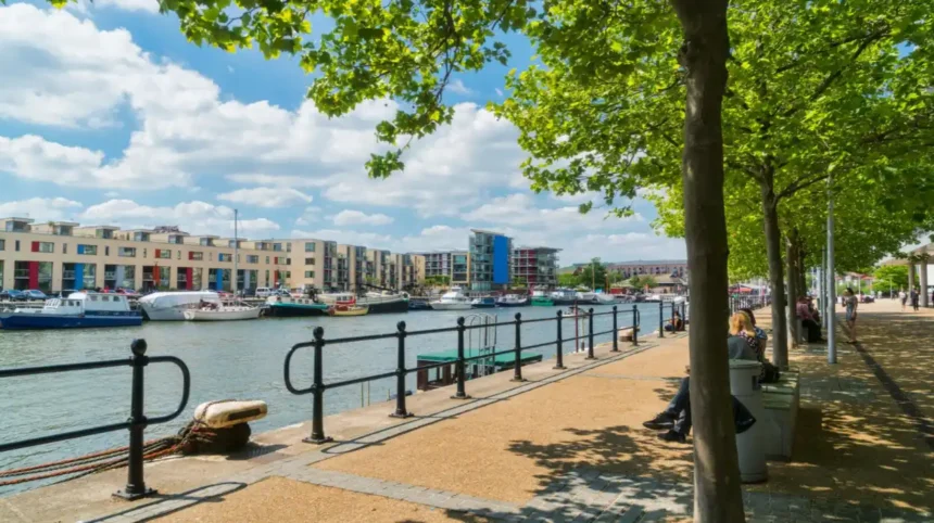
Bristol is one of the best cities in South West England for exploring riverside landscapes on foot. Its waterways connect historic harbours, industrial heritage, urban parks, wildlife habitats and residential neighbourhoods. The River Avon, Bristol Floating Harbour, New Cut and River Frome provide different walking environments, ranging from accessible city-centre promenades to longer countryside routes.
- What Makes Riverside Walks in Bristol Worth Exploring?
- How do Bristol’s waterways shape its walking routes?
- What types of riverside landscapes can walkers discover?
- Where Can You Enjoy the Best Riverside Walk Around Bristol Harbour?
- What landmarks can you see along Bristol Harbour?
- How long does the Bristol Harbour walk take?
- Why is Bristol Harbour suitable for different walking abilities?
- Where Can You Walk Along the River Avon in Bristol?
- What can you explore around Cumberland Basin?
- Why is the Avon Gorge important for riverside walking?
- Can you extend a River Avon walk towards Leigh Woods?
- Which Riverside Walks in Bristol Are Best for Families?
- Is Castle Park suitable for a riverside family walk?
- What makes Wapping Wharf convenient for families?
- Which harbour attractions can children explore?
- Where Can You Find Quiet Riverside Walks and Wildlife in Bristol?
- Which birds can you observe near Bristol’s waterways?
- How does the River Frome contribute to Bristol’s natural environment?
- What environmental benefits do Bristol’s riverside paths provide?
- What Is the History Behind Bristol’s Riverside Walking Routes?
- Why was Bristol’s Floating Harbour constructed?
- What role did Underfall Yard play in Bristol’s maritime development?
- How did Bristol’s harbour become a public walking destination?
- Are There Longer Riverside Walking Routes Near Bristol?
- What is the Bristol and Bath Railway Path?
- Can you explore riverside scenery towards Saltford?
- Which routes are suitable for experienced walkers?
- Which Bridges and Waterfront Landmarks Can You See on Bristol Riverside Walks?
- What makes Pero’s Bridge an important waterfront landmark?
- Why should walkers visit Castle Bridge?
- Where can you see Clifton Suspension Bridge?
- When Is the Best Time to Enjoy Riverside Walks in Bristol?
- What can you expect during spring?
- Why is summer popular for Bristol waterfront walks?
- What makes autumn and winter suitable for riverside exploration?
- How Can You Plan a Safe and Accessible Riverside Walk in Bristol?
- Which facilities are available along Bristol’s waterfront?
- How can visitors choose accessible walking routes?
- What safety precautions should walkers follow near rivers?
- How can you reach Bristol’s riverside walks using public transport?
- How Are Bristol’s Riverside Areas Changing Through Urban Regeneration?
- How has regeneration changed Bristol Harbour?
- Why is biodiversity important to Bristol’s waterfront?
- What is the future importance of riverside walking routes?
- Which Riverside Walking Itinerary Should You Choose in Bristol?
- What is a suitable short Bristol Harbourside itinerary?
- How can you plan a longer harbour and Hotwells walk?
- Which itinerary is best for nature enthusiasts?
- Why Should You Explore Riverside Walks in Bristol?
Riverside walks in Bristol offer opportunities for sightseeing, exercise, wildlife observation, photography and historical exploration. Popular routes pass landmarks such as the SS Great Britain, M Shed, Underfall Yard, Clifton Suspension Bridge and Castle Park. Other paths follow quieter sections of the River Avon towards Leigh Woods, Pill and the surrounding countryside.
The city’s waterfront also reflects its industrial development. Former commercial docks now accommodate museums, cultural venues, residential developments, independent businesses and public spaces. These changes make Bristol’s riverside an important part of its tourism, recreation and urban regeneration.
This guide explores the best riverside walks in Bristol, their locations, historical backgrounds, accessibility, natural features and practical considerations for visitors and residents.
What Makes Riverside Walks in Bristol Worth Exploring?
Riverside walks in Bristol combine historic waterways, accessible pedestrian routes, architectural landmarks and natural environments. They connect the city centre with harbour districts, green spaces and surrounding countryside, giving walkers opportunities to explore maritime heritage, local wildlife, recreation facilities and Bristol’s changing urban landscape.
Bristol’s geographical position makes its waterways central to the city’s identity. The River Avon flows through the city before reaching the Severn Estuary and Bristol Channel. Its tidal characteristics influenced Bristol’s development as a major trading port.
The Bristol Floating Harbour provides another important walking environment. Unlike the tidal River Avon, the harbour maintains a relatively constant water level because an engineered system of locks separates it from the tidal river.
These waterways create different experiences for pedestrians. The Floating Harbour offers level paths, historic buildings and cultural attractions. The Avon Gorge provides dramatic geological scenery and wooded surroundings. The New Cut reveals another part of Bristol’s maritime engineering history.
How do Bristol’s waterways shape its walking routes?
Bristol’s riverside walking network follows natural rivers, artificial waterways and former industrial docklands.
The principal waterways include:
- River Avon: A major river connecting Bristol with Bath and the Severn Estuary.
- Bristol Floating Harbour: A historic enclosed waterway surrounded by pedestrian promenades and attractions.
- New Cut: A tidal channel constructed to divert the River Avon around the Floating Harbour.
- River Frome: A tributary of the Avon that historically supported Bristol’s industrial development.
- Feeder Canal: An artificial waterway connecting the Floating Harbour with the River Avon.
Each waterway provides a different landscape and walking environment. Their connections create opportunities for shorter urban strolls and longer routes through Bristol’s surrounding green spaces.
What types of riverside landscapes can walkers discover?
Bristol’s waterfront includes several landscape types. Examples include urban promenades around the Floating Harbour, wooded riverbanks near Leigh Woods, open recreational spaces around Baltic Wharf and historic dockside environments around Wapping Wharf.
These environments support different activities. Families use accessible promenades for short outings, photographers explore bridges and waterfront architecture, and longer-distance walkers follow paths towards neighbouring settlements.
The combination of urban and natural environments makes Bristol’s waterways relevant throughout the year.
Where Can You Enjoy the Best Riverside Walk Around Bristol Harbour?
Bristol Harbour offers one of the city’s most accessible riverside walking experiences. Its pedestrian paths connect Narrow Quay, Welsh Back, Castle Park, Wapping Wharf, M Shed and Hotwells, providing opportunities to explore maritime history, museums, bridges, waterfront restaurants and historic dockside architecture.
The Bristol Harbour walk is a central route for visitors who want to understand the city’s relationship with water. The Floating Harbour forms the main feature of this landscape.
The route passes several important districts, including the Old City, Queen Square, Harbourside and the western docklands. Pedestrian walkways run alongside the water, with bridges providing connections between different sections.
What landmarks can you see along Bristol Harbour?
The harbour walk passes several important cultural and historical attractions.
M Shed is a museum dedicated to Bristol’s history, people, industries and cultural development. Its waterfront position makes it a useful stopping point during a harbour walk.
SS Great Britain is the historic passenger steamship designed by engineer Isambard Kingdom Brunel. Launched in Bristol in 1843, the vessel represents an important development in maritime engineering.
Wapping Wharf is a regenerated dockside district featuring independent food businesses, shops and residential developments. Its location provides convenient access to the waterfront promenade.
Arnolfini is a contemporary arts centre situated in a former warehouse beside the harbour. Its location connects Bristol’s industrial architecture with its modern cultural identity.
How long does the Bristol Harbour walk take?
The walking time depends on the starting point, route direction and number of stops. A short central harbour stroll takes approximately 30–45 minutes, while a more extensive circuit with museum visits and waterfront breaks requires two to three hours.
A practical route starts at Narrow Quay, continues towards Welsh Back and Castle Park, follows the waterfront towards Queen Square and M Shed, and then proceeds towards Wapping Wharf and the SS Great Britain.
Walkers can extend the route towards Hotwells and Underfall Yard before returning to the city centre.
Why is Bristol Harbour suitable for different walking abilities?
The central harbour paths are generally level and include wide pedestrian areas. Several sections have convenient access to cafes, public facilities, attractions and public transport.
However, surfaces, bridge approaches, crossings and construction works vary. Visitors using wheelchairs or mobility aids should check the accessibility of individual sections before travelling.
The harbour is also busy during weekends, festivals and major city events. Pedestrians should remain aware of cyclists and other waterfront users.
Where Can You Walk Along the River Avon in Bristol?
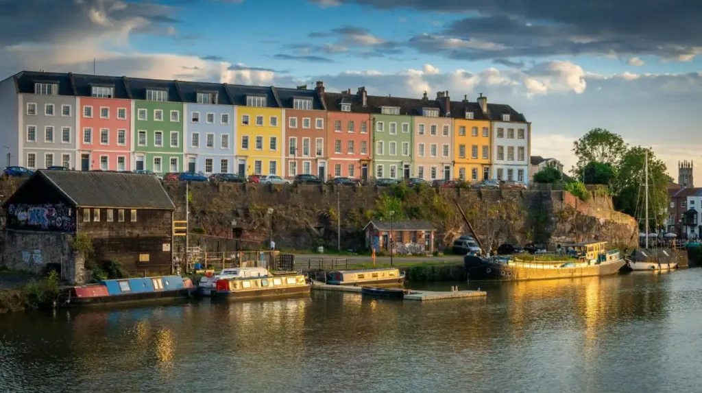
The River Avon provides several riverside walking opportunities around Bristol, particularly near Hotwells, Cumberland Basin, the Avon Gorge and surrounding green spaces. These routes combine river scenery, historic infrastructure, woodland views and connections towards nearby countryside and neighbouring communities.
The River Avon is one of Bristol’s most important geographical features. It connects the city with Bath upstream and the Severn Estuary downstream. Its tidal character influenced the development of Bristol’s port and the engineering projects that transformed its waterfront.
Unlike the Floating Harbour, the tidal River Avon experiences significant changes in water level. This creates a distinctive landscape, particularly around Cumberland Basin and the Avon Gorge.
What can you explore around Cumberland Basin?
Cumberland Basin is situated at the western end of Bristol’s Floating Harbour. It forms an important connection between the harbour, tidal River Avon and New Cut.
The area contains historic lock infrastructure, bridges, waterways and dockside structures. Walkers can observe how Bristol’s engineers controlled water movement to support commercial shipping.
The surrounding paths also provide views of boats, harbour entrances and nearby waterfront buildings. The basin connects naturally with Hotwells and the riverside areas approaching the Avon Gorge.
Why is the Avon Gorge important for riverside walking?
Avon Gorge is a limestone gorge through which the River Avon flows between Bristol and North Somerset. Its steep wooded slopes and exposed rock formations create one of the region’s most recognisable natural landscapes.
The famous Clifton Suspension Bridge crosses the gorge and provides an important viewpoint over the river and surrounding landscape.
Although the bridge itself is a crossing rather than a riverside footpath, it forms an excellent landmark for a walking itinerary. Nearby public paths and viewpoints offer opportunities to explore the gorge from different elevations.
Walkers should distinguish between routes directly beside the water and elevated paths overlooking the river. The terrain around the gorge includes steep gradients and uneven surfaces, making route selection important.
Can you extend a River Avon walk towards Leigh Woods?
Leigh Woods is a woodland area on the western side of the Avon Gorge, managed by the National Trust.
The woodland provides access to walking trails, mature trees and viewpoints overlooking the gorge. It offers a quieter environment than Bristol’s central harbour promenades.
Walkers can combine woodland exploration with views towards Clifton Suspension Bridge. Different paths have different gradients and surfaces, so suitable footwear is important.
Leigh Woods also provides an opportunity to understand the relationship between Bristol’s urban environment and its surrounding natural landscape.
Which Riverside Walks in Bristol Are Best for Families?
Family-friendly riverside walks in Bristol include the central Floating Harbour, Castle Park waterfront, Wapping Wharf and sections around the harbourside. These locations offer relatively level walking surfaces, nearby refreshments, public attractions and opportunities for shorter outings with children.
Families generally benefit from routes with manageable distances, convenient facilities and accessible public spaces. Bristol’s central waterfront offers several options that meet these requirements.
Is Castle Park suitable for a riverside family walk?
Castle Park is a central public park situated beside the Floating Harbour and the River Frome area.
The park combines open lawns, mature trees, historic remains and pedestrian routes. It provides a convenient break from the surrounding shopping streets and commercial areas.
Visitors can explore the remains of St Peter’s Church, which was heavily damaged during the Second World War. The surviving structure provides an important historical feature within the park.
Castle Park also connects with Bristol’s central waterfront, allowing families to combine green-space recreation with a short harbour walk.
What makes Wapping Wharf convenient for families?
Wapping Wharf provides a mixture of waterfront access, independent food businesses and public walking areas.
Its position near M Shed and the SS Great Britain makes it suitable for combining outdoor activities with educational visits. Families can observe historic ships, boats and harbour operations while exploring the surrounding promenade.
The area also offers refreshments and places to take breaks. Parents should supervise children around the water because the harbour has open edges and operational boat areas.
Which harbour attractions can children explore?
Several attractions provide educational opportunities during a family walking trip.
- M Shed: Exhibitions about Bristol’s transport, industries, people and social history.
- SS Great Britain: Maritime engineering, shipbuilding and Victorian travel history.
- We The Curious: A science and discovery centre with interactive educational experiences.
- Bristol Aquarium: Exhibitions featuring marine and freshwater environments.
These attractions are concentrated around the central harbour, making it possible to combine walking with indoor activities.

Where Can You Find Quiet Riverside Walks and Wildlife in Bristol?
Quieter riverside environments around Bristol include Leigh Woods, the Avon Gorge, sections of the New Cut and green corridors near the River Frome. These locations provide opportunities to observe birds, vegetation, river habitats and changing seasonal landscapes.
Bristol’s waterways support a range of habitats. Riverbanks, woodland edges, wetlands and planted waterfront spaces provide food and shelter for wildlife.
Wildlife sightings depend on season, weather, habitat conditions and human activity. Early mornings generally provide quieter conditions for observation.
Which birds can you observe near Bristol’s waterways?
Birds commonly associated with British rivers and waterways include:
- Grey herons: Tall wading birds frequently observed standing near shallow water.
- Cormorants: Fish-eating waterbirds that use rivers and harbours for feeding.
- Mallards: Familiar ducks found around urban waterways and sheltered water.
- Kingfishers: Colourful birds associated with suitable riverside habitats and clear fishing areas.
- Mute swans: Large waterbirds frequently seen around Bristol Harbour and other sheltered waters.
The presence of particular species varies between locations. The quieter sections of the River Avon and nearby green spaces provide different habitats from the heavily visited central harbour.
How does the River Frome contribute to Bristol’s natural environment?
The River Frome is a tributary of the River Avon. Historically, it supported industrial activity and water-powered development in Bristol.
Much of the central River Frome was culverted or built over during urban development. Culverting refers to enclosing a watercourse within an underground structure.
However, sections remain visible in Bristol’s wider landscape. The river and its tributaries contribute to the city’s wider drainage network and provide opportunities for riverside environmental improvements.
Walkers exploring visible sections should look for connections with nearby green spaces and public footpaths rather than assuming that the entire river has an accessible continuous promenade.
What environmental benefits do Bristol’s riverside paths provide?
Riverside paths encourage outdoor recreation while connecting people with urban nature. Vegetated riverbanks support habitat diversity, provide shade and contribute to the wider urban green infrastructure network.
These corridors also help people access green spaces without relying entirely on motorised transport.
Bristol City Council’s Harbour Strategy 2026–2031 identifies sustainability, biodiversity, flood resilience and inclusive community engagement as important priorities for the waterfront’s future development.
The strategy makes environmental management an important consideration for the future of Bristol’s riverside areas.
What Is the History Behind Bristol’s Riverside Walking Routes?
Bristol’s riverside walking routes reflect centuries of maritime trade, industrial engineering and urban redevelopment. The Floating Harbour opened in 1809, supported commercial shipping until 1975, and subsequently became a major public waterfront destination containing museums, cultural venues and recreational spaces.
Bristol’s waterways developed alongside the city’s growth as a trading and manufacturing centre. The River Avon provided access to inland markets and maritime connections through the Bristol Channel.
However, the river’s tidal characteristics created significant challenges for commercial shipping.
Why was Bristol’s Floating Harbour constructed?
During the 18th century, Bristol’s port experienced increasing pressure from commercial shipping. Changes in water levels made it difficult for vessels to remain afloat when the tide receded.
Engineer John Smeaton proposed an early non-tidal harbour scheme in 1765. Later, civil engineer William Jessop developed the design that eventually transformed the waterfront.
Construction began in 1804, and the Floating Harbour officially opened on 1 May 1809.
The project enclosed a section of the tidal River Avon and created a controlled waterway where ships remained afloat regardless of the external tide.
The New Cut provided a tidal bypass, allowing the river to continue flowing around the enclosed harbour.
What role did Underfall Yard play in Bristol’s maritime development?
Underfall Yard is a historic working dockyard beside the Floating Harbour.
Its engineering infrastructure helped maintain the harbour and support dock operations. The site includes historic hydraulic equipment and engineering structures associated with Bristol’s maritime history.
The hydraulic engine house dates from the late 19th century. The system powered equipment such as cranes, bridges and locks.
Today, Underfall Yard remains an important heritage location. Its visitor facilities and surrounding waterfront make it a valuable stopping point on a longer riverside walk.
How did Bristol’s harbour become a public walking destination?
Bristol’s central docks gradually lost their commercial importance as larger port facilities developed downstream.
The Floating Harbour ceased operating as a commercial dock in 1975. This created opportunities to redevelop former industrial waterfront land.
Subsequent projects introduced museums, cultural venues, public spaces, residential buildings and leisure facilities.
Important developments included:
- 1971: The first Bristol Harbour Festival.
- 1975: Closure of the central commercial docks.
- 2000: Opening of the science attraction originally known as @Bristol, now We The Curious.
- 2011: Opening of M Shed.
- 2017: Opening of Castle Bridge, connecting Finzels Reach with Castle Park.
These changes transformed the harbour into a central recreational and cultural district. Bristol City Council+2
Are There Longer Riverside Walking Routes Near Bristol?
Longer riverside walks near Bristol include routes along the River Avon, countryside paths around Leigh Woods and connections towards neighbouring communities. The Bristol and Bath Railway Path also provides an extended walking option, although much of its alignment follows a former railway rather than a riverbank.
Walkers looking for longer outings can explore routes beyond the central Floating Harbour. These walks offer more countryside scenery and opportunities to experience Bristol’s surrounding landscape.
What is the Bristol and Bath Railway Path?
Bristol and Bath Railway Path is a shared walking and cycling route connecting Bristol and Bath.
The route covers approximately 13.9 miles (23.3 kilometres) and follows the alignment of a former railway line. It is predominantly flat, traffic-free and surfaced, making it suitable for walking, cycling and running.
The route is managed by Walk Wheel Cycle Trust, formerly known as Sustrans. Its railway heritage and connections with surrounding communities make it an important recreational corridor.
Although it is not exclusively a riverside route, walkers can connect with other paths and explore waterways around the wider Bristol and Bath area.
Can you explore riverside scenery towards Saltford?
Saltford is a village between Bristol and Bath beside the River Avon.
The area provides access to countryside landscapes, riverside views and recreational walking opportunities. Its position along the River Avon makes it relevant to people exploring the wider regional waterway network.
Walkers can combine nearby sections of the Bristol and Bath Railway Path with local footpaths. However, these routes should be planned separately because the railway path does not continuously follow the river.
Which routes are suitable for experienced walkers?
Experienced walkers can explore longer sections of the River Avon corridor and countryside routes around North Somerset.
The wider River Avon Trail connects communities and landscapes along the river. It provides a broader regional walking opportunity rather than a single continuous city-centre promenade.
Longer walks require advance planning. Walkers should check route maps, public rights of way, river crossings, surface conditions and transport arrangements before setting out.
Which Bridges and Waterfront Landmarks Can You See on Bristol Riverside Walks?
Bristol’s riverside walks pass historic bridges, dockside structures and engineering landmarks. Important examples include Pero’s Bridge, Castle Bridge, Prince Street Bridge, Clifton Suspension Bridge and the harbour’s historic cranes, which illustrate the city’s maritime, architectural and industrial development.
Bridges are important features of Bristol’s waterfront. They connect different harbour districts while providing viewpoints over boats, historic buildings and pedestrian promenades.
What makes Pero’s Bridge an important waterfront landmark?
Pero’s Bridge is a pedestrian bridge crossing the Floating Harbour near the Arnolfini and Queen Square.
Its distinctive horn-shaped counterweights make it recognisable within Bristol’s central waterfront.
The bridge was named after Pero Jones, an enslaved African man who lived in Bristol during the late 18th century. Its name forms part of the city’s wider engagement with its maritime and slavery-related history.
Walkers use the crossing to move between important cultural attractions and harbour-side public spaces.
Why should walkers visit Castle Bridge?
Castle Bridge is a pedestrian and cycling bridge opened in 2017.
The bridge spans 91 metres and connects Finzels Reach with Castle Park. It provides an important connection between the eastern part of Bristol’s Floating Harbour and the city-centre green space.
Its location makes it useful for walkers exploring Castle Park, Bristol Bridge and the regenerated waterfront around Finzels Reach.
Where can you see Clifton Suspension Bridge?
Clifton Suspension Bridge is one of Bristol’s most recognisable engineering landmarks.
Designed by Isambard Kingdom Brunel, the bridge opened in 1864. It crosses the Avon Gorge and connects Clifton with Leigh Woods.
The surrounding viewpoints provide impressive views of the River Avon and its steep wooded banks. The bridge also offers a useful landmark for walkers planning routes around the gorge.
Visitors should remember that the bridge crossing involves an elevated route rather than a direct riverside promenade.
When Is the Best Time to Enjoy Riverside Walks in Bristol?
Spring and summer provide longer daylight hours and opportunities to enjoy Bristol’s waterfront attractions, gardens and wildlife. Autumn offers changing woodland colours, while winter provides quieter walking conditions. Weather, river levels, daylight and route conditions should guide every visit.
Bristol’s riverside environments remain accessible throughout the year, but the experience changes with the seasons.
What can you expect during spring?
Spring brings fresh vegetation, flowering plants and increasing bird activity around suitable riverside habitats.
Wooded areas near Leigh Woods provide opportunities to observe seasonal changes. The harbour also becomes more active as outdoor cafes and waterfront attractions attract more visitors.
Mild weather generally supports longer walks, although rain can leave woodland and unpaved paths slippery.
Why is summer popular for Bristol waterfront walks?
Summer provides extended daylight hours and more opportunities for outdoor recreation.
Visitors can combine harbour walks with boat trips, outdoor dining and cultural attractions. The waterfront also becomes a major location for public events.
The Bristol Harbour Festival is an established annual event celebrating the city’s relationship with its harbour. Its programme includes maritime activities, performances and community events.
Popular areas become crowded during festivals and weekends. Early morning and weekday visits provide quieter walking conditions.
What makes autumn and winter suitable for riverside exploration?
Autumn brings changing foliage around woodland paths and riverside green spaces. The Avon Gorge and Leigh Woods provide opportunities to observe seasonal colours.
Winter offers quieter promenades and different photographic conditions. However, shorter daylight hours, rain, wind and slippery surfaces require additional preparation.
Walkers should check weather forecasts and plan routes that finish before darkness.
How Can You Plan a Safe and Accessible Riverside Walk in Bristol?
Planning a riverside walk in Bristol involves checking route distances, pedestrian access, surface conditions, weather, public transport and available facilities. Walkers should consider mobility requirements, river safety, daylight hours and local access notices before choosing a route.
Bristol offers walking environments with different accessibility characteristics. Central harbour promenades generally provide easier walking conditions than woodland paths and elevated routes around the Avon Gorge.
Which facilities are available along Bristol’s waterfront?
The central Floating Harbour provides convenient access to several visitor facilities.
Examples include:
- Cafes and restaurants around Wapping Wharf and the Harbourside.
- Museums and cultural attractions around Millennium Square and M Shed.
- Public transport connections near central Bristol.
- Seating areas and public spaces along sections of the waterfront.
- Boat services connecting selected harbour destinations.
Facilities become less frequent on longer countryside routes. Walkers should plan refreshments, toilet stops and rest breaks before leaving central Bristol.
How can visitors choose accessible walking routes?
Visitors with mobility requirements should prioritise level, surfaced paths and routes with suitable crossing facilities.
The central Harbourside is a practical starting point because several sections have relatively flat pedestrian access.
The Bristol and Bath Railway Path also offers a predominantly surfaced and traffic-free route. Walk Wheel Cycle Trust reports that approximately 99.7% of its surface is asphalt. However, accessibility conditions vary along the wider route.
Woodland paths around Leigh Woods and elevated routes near the Avon Gorge require additional consideration because of gradients and uneven surfaces.
Before travelling, check current access information and any temporary restrictions.
What safety precautions should walkers follow near rivers?
Riverside environments require awareness of water, changing conditions and other users.
Important precautions include:
- Keep children under close supervision around open water.
- Remain on designated pedestrian routes.
- Avoid climbing onto harbour walls, lock structures or restricted dock infrastructure.
- Keep a safe distance from water edges, particularly in wet or windy conditions.
- Wear suitable footwear on muddy and uneven paths.
- Check weather conditions before longer countryside walks.
- Follow signs around bridges, locks and working harbour facilities.
The River Avon is tidal, while the Floating Harbour maintains a controlled water level. These different conditions make it important to understand the type of waterway being explored.
How can you reach Bristol’s riverside walks using public transport?
Bristol’s central waterfront is accessible from the city’s main transport network.
Bristol Temple Meads railway station provides a major arrival point for visitors travelling by train. From there, pedestrians can continue towards Castle Park, the Floating Harbour and central attractions.
Local bus services connect the city centre with areas such as Clifton, Hotwells and other neighbourhoods near the waterways.
Bristol also has ferry services operating on selected harbour routes. These provide an alternative way to travel between some waterfront destinations.
Visitors should check current public transport timetables and service information before setting out.
How Are Bristol’s Riverside Areas Changing Through Urban Regeneration?
Bristol’s riverside areas are changing through waterfront regeneration, environmental improvements, cultural development and public-space investment. The city’s Harbour Strategy 2026–2031 identifies biodiversity, flood resilience, sustainability and inclusive access as important considerations for the harbour’s future.
Waterfront regeneration refers to the redevelopment of former industrial or commercial waterfront land for new uses. In Bristol, this process has transformed parts of the historic docks into public spaces, residential areas and cultural destinations.
How has regeneration changed Bristol Harbour?
The closure of the central commercial docks in 1975 created opportunities to reuse former industrial buildings and dockside land.
Projects introduced new residential developments, museums, restaurants, galleries and public spaces.
Areas such as Finzels Reach, Wapping Wharf and the wider Harbourside demonstrate how former dockland environments have developed into mixed-use urban districts.
These changes have increased the importance of walking routes as connections between residential neighbourhoods, employment areas and visitor attractions.
Why is biodiversity important to Bristol’s waterfront?
Biodiversity refers to the variety of living organisms within an environment, including plants, animals and microorganisms.
Urban waterways support biodiversity through river habitats, vegetation, floating structures and nearby green spaces.
Bristol’s Harbour Strategy highlights the importance of improving biodiversity and creating a more sustainable waterfront. The installation of planted floating islands at Capricorn Quay in 2024 represents an example of habitat-enhancing activity within the harbour.
These initiatives connect waterfront recreation with environmental management.
What is the future importance of riverside walking routes?
Riverside paths contribute to sustainable urban movement by providing opportunities for walking between residential, commercial and recreational destinations.
They also improve access to public spaces and encourage physical activity.
Future waterfront development will need to balance recreation, biodiversity, heritage protection, flood management and the operational requirements of Bristol Harbour.
This balance will influence how residents and visitors experience Bristol’s riverside environments in the coming years.
Explore More Area Guide
Circular Walks Near Bristol: Best Countryside and Woodland Routes
Long Walks in Bristol: Best Trails and Scenic Walking Routes
Which Riverside Walking Itinerary Should You Choose in Bristol?
The best Bristol riverside itinerary depends on walking time, interests and physical ability. The central Floating Harbour suits short sightseeing trips, Cumberland Basin and Hotwells suit waterfront exploration, while Leigh Woods and the Avon Gorge provide more demanding natural landscapes.
The following suggested itineraries help walkers select suitable starting points and destinations.
What is a suitable short Bristol Harbourside itinerary?
A short walk provides an introduction to Bristol’s waterfront without requiring extensive preparation.
Suggested route:
- Start at Narrow Quay.
- Walk towards the Arnolfini.
- Cross Pero’s Bridge.
- Continue towards M Shed.
- Explore the Wapping Wharf waterfront.
- Return towards the city centre.
Suggested duration: 45–75 minutes, depending on stops.
This itinerary is suitable for visitors interested in maritime heritage, photography and waterfront architecture.
How can you plan a longer harbour and Hotwells walk?
A longer walk introduces more of Bristol’s historic dock infrastructure.
Suggested route:
- Begin around Bristol’s central Harbourside.
- Visit the SS Great Britain.
- Continue towards Underfall Yard.
- Explore the surrounding waterfront near Baltic Wharf.
- Proceed towards Cumberland Basin.
- Continue towards Hotwells.
- Return through the harbour area.
Suggested duration: 2–3 hours, depending on route choices and stops.
This route is particularly relevant to visitors interested in Bristol’s industrial and maritime history.
Which itinerary is best for nature enthusiasts?
Nature enthusiasts can explore the Avon Gorge and Leigh Woods area.
A suitable outing combines woodland paths, designated viewpoints and opportunities to observe local wildlife.
Walkers should check the chosen trail’s distance and gradient before setting out. This area is less suitable for visitors seeking a completely level promenade.
Why Should You Explore Riverside Walks in Bristol?
Riverside walks in Bristol provide an opportunity to understand the city’s geography, history, architecture and natural environment. The Floating Harbour offers accessible urban promenades, historic museums and waterfront attractions, while the River Avon and Avon Gorge introduce more varied landscapes.
Castle Park, Wapping Wharf, Underfall Yard, Cumberland Basin and Leigh Woods each provide different experiences. Visitors can select short sightseeing routes, family-friendly walks or longer countryside explorations according to their interests.
Bristol’s waterways also demonstrate how historic industrial infrastructure can become an important part of modern urban life. Waterfront regeneration, environmental improvements and public access continue to shape the city’s relationship with its rivers.
Exploring these walking routes provides a practical way to discover Bristol beyond its main streets while experiencing the waterways that have influenced its development.
Where are the best riverside walks in Bristol?
Some of the best riverside walks in Bristol include Bristol Floating Harbour, the River Avon Trail, Cumberland Basin, Hotwells, Avon Gorge and Leigh Woods. These locations offer historic waterfront scenery, woodland paths, wildlife habitats and views of Clifton Suspension Bridge.