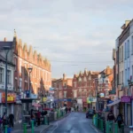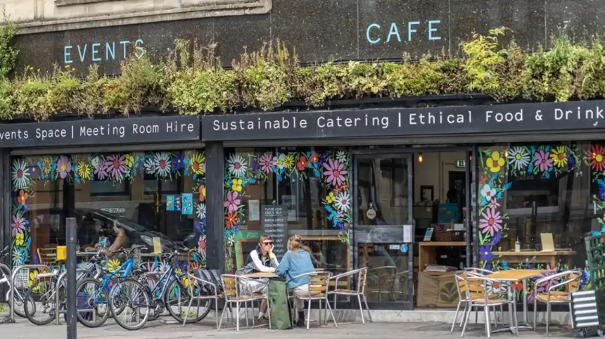
Bishopston is a residential and commercial neighbourhood in north Bristol, centred on the Gloucester Road corridor. It sits between established inner suburbs and the northern districts of Bristol. The area is known for Victorian and Edwardian housing, independent businesses, community facilities, green spaces and convenient access to central Bristol.
- Where is Bishopston in Bristol?
- What is Bishopston known for?
- How did Bishopston develop historically?
- What is Gloucester Road like in Bishopston?
- What types of homes are found in Bishopston?
- Which parks and green spaces are near Bishopston?
- What food and drink can visitors find in Bishopston?
- What shopping is available in Bishopston?
- What community facilities are available in Bishopston?
- How easy is Bishopston to reach?
- What architecture should visitors look for in Bishopston?
- How does Bishopston compare with nearby Bristol neighbourhoods?
- Is Bishopston suitable for visitors exploring Bristol?
- Why does Bishopston remain relevant to Bristol today?
Bishopston is closely associated with Gloucester Road, one of Bristol’s best-known independent shopping streets. The road runs through several neighbouring districts, including St Andrews, Bishopston and Horfield. This creates a continuous urban corridor rather than a high street confined to one administrative neighbourhood. Visit Bristol describes Gloucester Road as one of the longest stretches of independent shops in Europe.
The area also has a strong architectural identity. Much of the built environment developed during Bristol’s Victorian suburban expansion. Terraced streets, traditional shopfronts, churches and mature residential streets remain important parts of the local townscape.
Bishopston is also part of the wider Bishopston and Ashley Down ward. Bristol City Council’s current ward profile uses Office for National Statistics data and records 9,785 residents aged 16–64, 1,171 aged 65 or over and a substantial population aged 0–15 within the ward profile. These figures describe the entire ward rather than Bishopston alone, so they should not be treated as a standalone Bishopston population figure.
Where is Bishopston in Bristol?
Bishopston is in north Bristol, around the Gloucester Road corridor, between areas including Redland, St Andrews and Horfield. Its central commercial spine connects residential streets with shops, restaurants, services, parks and routes towards Bristol city centre.
Bishopston occupies a strategically connected position in north Bristol. Gloucester Road forms its most recognisable commercial corridor. The neighbourhood is close to Redland to the south, St Andrews towards the southwest and Horfield farther north.
The exact boundary of Bishopston depends on the purpose of the map being used. Neighbourhood names, postal districts, conservation areas and electoral wards do not use identical boundaries. The Bishopston and Ashley Down ward is an electoral division used by Bristol City Council, while Bishopston is a commonly used neighbourhood name.
This distinction matters when interpreting statistics. Bristol City Council publishes data by official wards and other statistical geographies. Its Census 2021 system provides detailed information for smaller areas, while ward profiles provide broader administrative comparisons.
Bishopston is commonly associated with the BS7 and BS6 postcode areas, although postcode boundaries do not precisely define the neighbourhood. Gloucester Road itself continues beyond Bishopston into surrounding districts.
The neighbourhood’s position gives visitors access to a dense network of shops and services without requiring a journey into the central shopping district. It also places residents within reach of wider north Bristol destinations.
What is Bishopston known for?
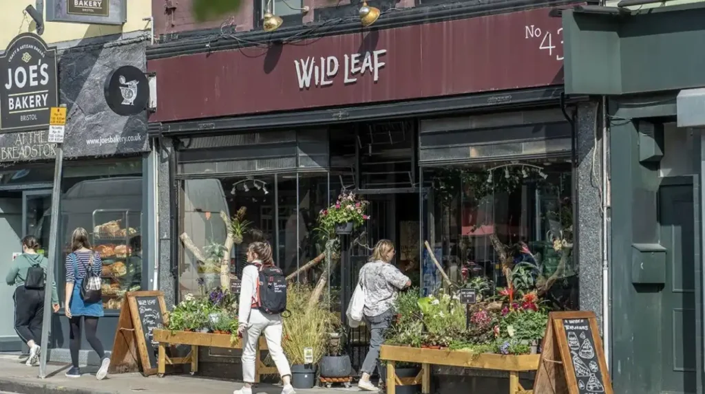
Bishopston is best known for Gloucester Road, Victorian residential streets, independent shops, cafés, restaurants, community facilities and nearby green spaces. The neighbourhood combines established suburban housing with a busy local commercial corridor and strong connections to surrounding north Bristol districts.
Gloucester Road is the defining commercial feature. Visit Bristol identifies the road as a major independent shopping destination containing cafés, restaurants, bars, food shops, vintage businesses, galleries and other locally operated enterprises.
The street is not exclusively within Bishopston. It passes through several neighbourhoods, which explains why descriptions of Gloucester Road often refer to a larger area than Bishopston itself.
Bishopston’s identity also comes from its residential streets. Victorian terraces form a substantial part of the housing stock, particularly around streets developed during the late nineteenth-century expansion of Bristol.
The area has a practical local-service structure. Shops provide food, household goods, specialist products and everyday services. Restaurants and cafés create activity throughout the day. Community facilities provide additional functions beyond commercial activity.
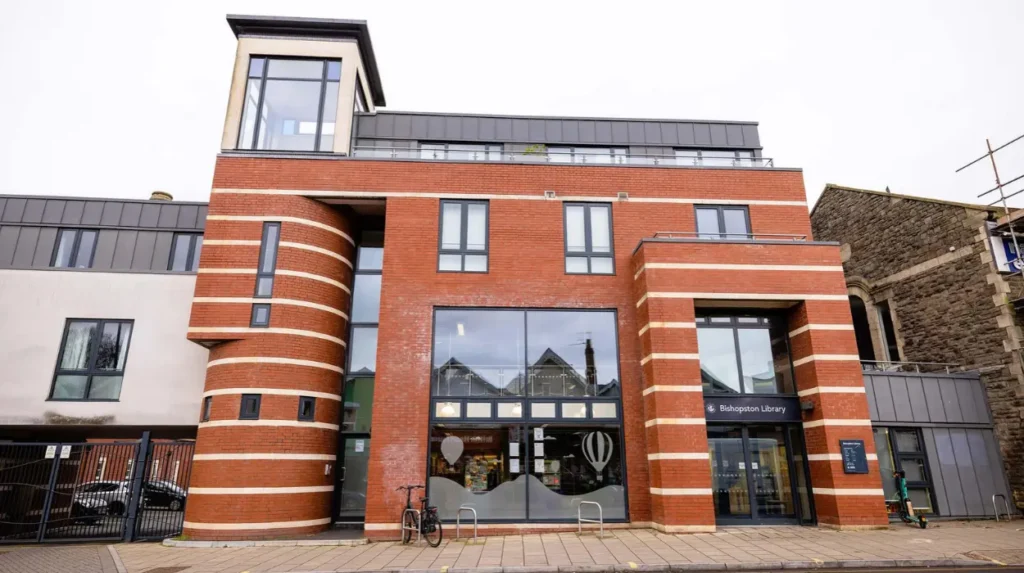
Bishopston Library is located directly on Gloucester Road at BS7 8BN. Bristol City Council lists it as a public library with Wi-Fi and community support through the Friends of Bishopston Library group.
This mixture of residential streets and a substantial independent high street makes Bishopston different from districts that function mainly as residential suburbs or mainly as city-centre commercial areas.
How did Bishopston develop historically?
Bishopston developed substantially during Bristol’s nineteenth-century suburban expansion. Smallholdings and scattered properties were progressively replaced by dense Victorian streets, while Gloucester Road developed into an important route and commercial corridor connecting northern suburbs with central Bristol.
The historical development of Bishopston is closely linked to Gloucester Road. Bristol City Council’s Gloucester Road Conservation Area Character Appraisal documents the transformation of the area through historic maps and surveys.
In the 1840s, the surrounding landscape had relatively limited development. The Horfield Tithe Map showed smallholdings and individual dwellings alongside the Gloucester Road route. The area had not yet acquired the dense suburban character visible today.
By the 1880s, development had accelerated. Bristol City Council records that many properties existing within the assessed area date from this period. Earlier smallholdings were replaced by terraced streets, including Raglan Road, Wolseley Road and Shadwell Road.
This transformation reflected wider changes in Bristol. Industrial growth, population growth and improved urban transport increased demand for housing outside the historic centre.
The resulting street pattern remains visible today. Rows of terraced houses line streets running away from the principal roads. Their consistent scale and repeated architectural features create a coherent nineteenth-century suburban character.
The area also retained historic religious and civic buildings. Horfield Baptist Church on Gloucester Road was built in 1900 and is listed at Grade II by Historic England. Its associated institute dates from 1921 and is also listed at Grade II.
These buildings provide physical evidence of the institutions that supported the expanding suburban population.
What is Gloucester Road like in Bishopston?
Gloucester Road is Bishopston’s principal commercial corridor and one of Bristol’s major independent shopping destinations. It contains food shops, cafés, restaurants, pubs, specialist retailers, vintage businesses and everyday services across a long north-south urban route.
Gloucester Road operates as a continuous commercial environment rather than a small neighbourhood parade.
Visit Bristol describes the wider Gloucester Road as one of the longest stretches of independent shops in Europe. Its businesses include clothing shops, food retailers, cafés, restaurants, gift shops, vintage stores and specialist services.
The road’s commercial character has historical depth. The present businesses occupy a street pattern that developed alongside nineteenth-century suburban growth.
The variety of shops supports different types of local activity. Residents use the road for routine shopping. Visitors use it for food, independent retail and exploration. Workers use cafés and food businesses during the day.
Gloucester Road also functions as a transport corridor. Its linear structure links several neighbourhoods and provides access towards Bristol city centre and northern Bristol.
The street environment changes along its length. Businesses, building styles and surrounding residential streets differ between Bishopston and neighbouring districts. This is why a Gloucester Road visit can involve several distinct neighbourhood environments without leaving the same main road.
The commercial area also connects with smaller streets and local facilities. Bishopston Library, for example, sits directly on Gloucester Road.
What types of homes are found in Bishopston?
Bishopston contains substantial numbers of Victorian and Edwardian terraces alongside converted homes, flats and other residential properties. The housing pattern reflects late nineteenth-century suburban expansion, with streets of repeated terraces surrounding the Gloucester Road commercial corridor.
Housing is one of the clearest indicators of Bishopston’s historical development.
The neighbourhood’s older residential streets largely reflect the period when Bristol expanded beyond its historic core. Terraced houses provided relatively dense accommodation close to major routes and employment areas.
Many streets use repeated house plans and consistent building materials. This creates a recognisable architectural rhythm. Front doors, bay windows, brickwork, rooflines and narrow front gardens frequently form part of the streetscape.
Some larger houses have been divided into flats. Other properties remain family houses. The exact mix varies between individual streets.
The wider Cotham and Redland conservation area provides useful context for north Bristol’s residential architecture. Bristol City Council describes surrounding neighbourhoods as containing substantial semi-detached villas, tightly planned terraces and detached dwellings, with development ranging from eighteenth-century terraces through Victorian expansion to later suburban growth.
Bishopston’s residential architecture therefore forms part of a broader north Bristol pattern.
Housing should also be considered alongside conservation policy. Bristol currently has 33 conservation areas. Conservation areas are designated because of special architectural or historic character, and development within them is subject to additional planning controls.
Which parks and green spaces are near Bishopston?
Bishopston has access to several nearby green spaces, with St Andrews Park and Horfield Common among the better-known recreational areas. These spaces provide walking routes, open lawns, informal recreation and outdoor settings close to dense residential streets.
Green space is an important part of the wider Bishopston environment.
St Andrews Park sits close to Bishopston and provides a substantial landscaped open space for walking, recreation and everyday outdoor use. Its location makes it particularly accessible from surrounding residential districts.
Horfield Common is farther north and provides another large open setting. Bristol City Council lists community facilities around Horfield Common, including the Ardagh Community Centre and a community toilet location on Kellaway Avenue.
Redland Green is another important nearby open space. Bristol City Council’s Cotham and Redland conservation appraisal describes Redland Green and its allotments as an informal open space forming a green edge towards Bishopston, Henleaze and Westbury Park.
These spaces serve different purposes. Formal parks provide landscaped environments. Commons provide more open recreational landscapes. Allotments support local food growing and community activity.
The proximity of these spaces also affects how the neighbourhood is experienced. A visitor can move from a busy commercial street into a quieter residential environment and then into a public green space within a relatively short distance.
What food and drink can visitors find in Bishopston?
Bishopston has a broad independent food and drink scene concentrated around Gloucester Road and surrounding streets. Cafés, restaurants, takeaways, pubs, bakeries, delis and specialist food shops serve everyday meals, international cuisines and locally sourced products.
Food is a major part of Bishopston’s commercial identity.
Visit Bristol’s local guide to Bishopston highlights independent cafés, restaurants, food shops and specialist retailers. Examples include Eat a Pitta, The Nectar House, Scoopaway, The Fish Shop and Bishopston Hardware as part of the wider local shopping environment.
The range extends beyond restaurants. Specialist food retailers provide ingredients and products for home cooking. Delis and independent food shops contribute to the area’s local shopping economy.
Gloucester Road and Stokes Croft together contain more than two miles of independent eateries according to Visit Bristol, with cuisines ranging across international food traditions.
Visitors therefore have several ways to experience the local food scene. A short visit can focus on a café or takeaway. A longer visit can combine independent shopping with a restaurant meal.
The food economy also reflects the broader diversity of Bristol. International cuisines are represented alongside traditional British food businesses, bakeries, cafés and specialist retailers.
Business details change over time, so visitors should check current opening hours directly before travelling.
What shopping is available in Bishopston?
Shopping in Bishopston centres on independent businesses along Gloucester Road. The area includes food retailers, vintage shops, clothing businesses, gift stores, specialist shops and practical services, creating a local high street that combines everyday needs with specialist shopping.
Gloucester Road has an unusually high concentration of independent businesses.
Visit Bristol identifies Gloucester Road as a key location for independent shopping, including delis, vintage clothing shops, record stores and businesses selling locally produced gifts and creative products.
The shopping offer covers both practical and discretionary purchases.
Food shops support regular household shopping. Specialist retailers provide products that are less common in conventional retail centres. Vintage and independent fashion businesses attract visitors interested in second-hand and distinctive clothing.
Sustainable shopping is also represented. Visit Bristol identifies businesses on Gloucester Road associated with ethical, refill and lower-waste retail, including Preserve Foods and other independent operators.
This creates a shopping environment that differs from a conventional shopping centre. Businesses are distributed along an urban street, with cafés and restaurants located between retail premises.
The independent nature of the high street is also significant for the local economy. Small businesses provide employment, services and specialist products while contributing to the visual character of the area.
What community facilities are available in Bishopston?
Bishopston has community facilities that support learning, information, local activity and everyday services. Bishopston Library is a central public facility, while schools, churches, community organisations, parks and local businesses contribute to the wider neighbourhood infrastructure.
Bishopston Library is one of the area’s most identifiable public facilities.
The library is operated by Bristol City Council and is located on Gloucester Road. Its services include access to library resources and Wi-Fi. The Friends of Bishopston Library group provides additional community support.
The library also demonstrates how community facilities can operate within a commercial high street rather than in a separate civic centre.
Bristol City Council lists Bishopston Library among its libraries with meeting spaces that can be booked for events, meetings and exhibitions.
Education is another major component of the wider neighbourhood. Bristol’s 2026–27 school admissions arrangements list Bishop Road Primary School among the community schools using the local authority’s determined admission arrangements.
The wider area also contains churches and historic religious buildings. Horfield Baptist Church on Gloucester Road is an example of a listed community building associated with the area’s twentieth-century institutional development.
These facilities support the daily functions of the neighbourhood beyond retail and leisure.
How easy is Bishopston to reach?
Bishopston is connected to central and northern Bristol through major roads, bus routes, cycling connections and Gloucester Road. Its position along a major north-south corridor makes the neighbourhood accessible from surrounding districts and provides direct connections towards the city centre.
Transport in Bishopston is strongly influenced by Gloucester Road.
The road is a major traditional approach into Bristol city centre. Bristol City Council’s conservation appraisal identifies it as an important route through Bishopston and St Andrews, with the main retail frontage forming a distinctive part of the urban corridor.
Bus services are an important part of local transport. Bishopston Library’s official information directs visitors to TravelWest for current bus planning information.
Cycling and walking are also relevant because the neighbourhood has a relatively dense street pattern. Short trips between homes, shops, parks and community facilities can often be made without crossing large undeveloped areas.
Road conditions and public transport arrangements change over time. Current journey planning should therefore use live transport information rather than historical timetables.
The neighbourhood’s location also provides access to neighbouring districts. Gloucester Road continues north into Horfield and south towards St Andrews and the city-centre approach.
What architecture should visitors look for in Bishopston?
Visitors can identify Victorian terraces, traditional shopfronts, historic churches, residential streets and later alterations across Bishopston. The architecture reflects nineteenth-century suburban growth and the gradual conversion of former rural land into a dense urban neighbourhood.
Architecture provides a direct way to understand Bishopston’s development.
The Victorian terrace is one of the most important building types. Repeated house forms created efficient residential streets during rapid urban expansion.
The Gloucester Road Conservation Area appraisal records the transition from smallholdings in the 1840s to dense development by the 1880s. Streets such as Raglan Road, Wolseley Road and Shadwell Road developed over former house-and-garden plots.
Visitors can also identify religious architecture. Horfield Baptist Church was built in 1900 in a Free Perpendicular Revival style using Pennant rubble and limestone dressings. Historic England lists the building at Grade II.
The surrounding streets show how commercial and residential architecture developed together. Shops occupy ground floors along parts of the main road, while terraced houses dominate many side streets.
Historic building protection remains relevant. Bristol’s conservation-area framework aims to preserve or enhance areas with special character and appearance. It considers historic road patterns, plots, building materials, green spaces, trees and distinctive views.
How does Bishopston compare with nearby Bristol neighbourhoods?
Bishopston shares characteristics with Redland, St Andrews and Horfield but has a distinct identity centred on Gloucester Road. Redland has extensive villa and conservation-area architecture, St Andrews has strong residential and park connections, while Horfield extends the Gloucester Road corridor northward.
Bishopston should be understood as part of a connected group of north Bristol neighbourhoods.
Redland lies to the south and is known for substantial Victorian and later residential development. Bristol City Council’s conservation appraisal identifies villas, terraces and larger detached properties across the Cotham and Redland area.
St Andrews sits close to Gloucester Road and St Andrews Park. Its streets connect directly with Bishopston’s southern environment.
Horfield extends farther north. Gloucester Road continues through Horfield, creating a long commercial and transport corridor rather than a sharp boundary between neighbourhood economies.
These areas also share access to the wider north Bristol urban network.
The distinction between neighbourhood names is therefore important for property searches, local statistics and travel planning. A business described online as being on Gloucester Road can sit in Bishopston, St Andrews, Redland or Horfield depending on its precise location.
This connected structure is one reason Bishopston works well as a starting point for exploring north Bristol.
Explore More Area Guide
Redland Area Guide: History, Food, Homes and Things to Do
Clifton Area Guide: Village, Bridge, History & Attractions
Is Bishopston suitable for visitors exploring Bristol?
Bishopston provides a practical base for visitors interested in independent shopping, local food, historic residential architecture, parks and neighbourhood life. Its Gloucester Road location connects these experiences with surrounding north Bristol districts and routes towards the city centre.
Bishopston offers a different experience from Bristol’s central tourist core.
Its main attractions are distributed through the neighbourhood rather than concentrated inside a single visitor complex. Gloucester Road provides shopping and food. Residential streets provide architectural interest. Parks provide outdoor space. Community facilities provide insight into everyday local life.
Visit Bristol specifically identifies Gloucester Road as an important area for independent businesses and local exploration.
A visitor interested in architecture can combine the Gloucester Road Conservation Area with surrounding Victorian streets. Someone focused on food can explore independent restaurants, cafés and specialist shops. Visitors looking for outdoor space can continue towards St Andrews Park or other nearby green areas.
The neighbourhood is also useful for understanding how Bristol functions beyond its historic centre. Its identity comes from ordinary residential streets, local businesses and community institutions developed over more than a century.
Why does Bishopston remain relevant to Bristol today?
Bishopston remains relevant because its historic housing, independent commercial economy, public facilities, green spaces and transport connections continue to support daily urban life. Its established built environment also links Bristol’s Victorian expansion with the city’s modern neighbourhood economy.
Bishopston’s importance is based on the combination of several functions.
Its housing stock provides a substantial residential environment close to central Bristol. Gloucester Road supports independent retail, food and services. Public facilities such as Bishopston Library provide community infrastructure. Parks and open spaces provide recreational resources.
The neighbourhood also retains historical evidence from Bristol’s suburban expansion. The change from smallholdings in the 1840s to dense Victorian development in the 1880s is documented through Bristol City Council’s conservation research.
The local economy continues to evolve. Visit Bristol’s current material highlights independent retail, food businesses and sustainable shopping on Gloucester Road.
Planning policy also gives historic character continuing relevance. Bristol’s conservation-area framework recognises historic road patterns, buildings, green spaces and other features as components of local character.
For visitors, residents and researchers, Bishopston therefore provides a clear example of an established Bristol suburb where nineteenth-century urban form continues to support twenty-first-century community and commercial activity.
Bishopston Area Guide: Key Takeaway
Bishopston is a north Bristol neighbourhood defined by its connection to Gloucester Road, Victorian residential architecture, independent businesses, community facilities and nearby green spaces. Its history is closely tied to Bristol’s nineteenth-century suburban expansion.
The neighbourhood sits within a wider network of Redland, St Andrews and Horfield. Its commercial centre is not isolated from those districts but forms part of a continuous north Bristol corridor.
For visitors, the most useful way to explore Bishopston is to combine Gloucester Road with the surrounding residential streets, public facilities and nearby parks. This approach reveals both the commercial identity and historical structure of the neighbourhood.
Bristol City Council’s ward and census resources should be used when precise demographic information is required because official statistical boundaries do not always match the everyday neighbourhood boundary called Bishopston.
The result is a neighbourhood with a clearly documented historical foundation and an active contemporary local economy. Bishopston remains an important part of Bristol’s north-side urban landscape.
What is Bishopston in Bristol?
Bishopston is a residential and commercial neighbourhood in north Bristol. It is centred around Gloucester Road and is known for Victorian housing, independent shops, restaurants, cafés, community facilities and nearby green spaces.