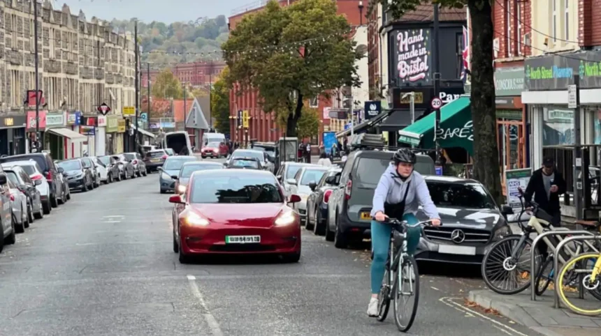
Bristol is one of the UK’s most established cycling cities, with a network of traffic-free paths, residential cycle routes, greenways and dedicated mountain biking trails. The city offers cycling opportunities for commuters, families, recreational riders and visitors who want to explore its neighbourhoods without relying on a car. Areas such as Southville, Bedminster, Clifton, Easton, Fishponds, Harbourside and Ashton Court provide different cycling environments, from convenient urban connections to peaceful riverside routes.
- What Makes an Area Bike-Friendly in Bristol?
- Dedicated Cycling Infrastructure
- Quiet Residential Streets
- Access to Everyday Destinations
- Secure Bicycle Parking
- Which Areas of Bristol Have the Best Cycling Infrastructure?
- Is Southville a Good Area for Everyday Cycling?
- Why Is Bedminster Suitable for Cyclists?
- Is Easton One of Bristol’s Most Convenient Cycling Neighbourhoods?
- Why Is Fishponds Popular with Recreational Cyclists?
- Is St George a Bike-Friendly Area in East Bristol?
- Is Bristol Harbourside Suitable for Cycling?
- Is Clifton a Good Neighbourhood for Cycling?
- Why Is Ashton Court a Popular Cycling Destination?
- Is Leigh Woods Suitable for Off-Road Cycling?
- Which Bristol Areas Offer the Best Traffic-Free Cycling Routes?
- How Does Bristol Support Cycling Infrastructure and Sustainable Transport?
- Bristol Walking and Cycling Index 2025
- Bicycle Loans and Cycle Training
- Regional Cycling Infrastructure
- Which Bristol Neighbourhoods Are Best for Beginner Cyclists?
- What Challenges Should Cyclists Consider When Choosing a Bristol Area?
- How Can Residents Choose the Right Bike-Friendly Area in Bristol?
- Consider Daily Commuting Requirements
- Assess Road Conditions
- Check Public Transport Connections
- Explore Routes Before Moving
- What Is the Future of Bike-Friendly Neighbourhoods in Bristol?
- Expansion of Connected Cycling Routes
- Liveable Neighbourhood Development
- Greater Public Transport Integration
- Inclusive Cycling Facilities
- Which Are the Best Bike-Friendly Areas in Bristol?
Bristol received recognition as England’s first Cycling City in 2008. This initiative strengthened the city’s focus on sustainable transport, cycling infrastructure and active travel. Today, Bristol combines historic streets, regenerated waterfront districts, residential neighbourhoods and extensive green spaces that support everyday cycling.
The city’s cycling network connects important destinations, including Bristol Temple Meads, the Floating Harbour, the Bristol and Bath Railway Path, Ashton Court Estate and the surrounding countryside. However, road conditions, gradients, traffic volumes and infrastructure quality vary between neighbourhoods.
Understanding which areas offer the most convenient cycling facilities helps residents, commuters and visitors choose suitable places to live, work and explore.
What Makes an Area Bike-Friendly in Bristol?
A bike-friendly area provides safe cycling infrastructure, convenient connections, accessible destinations and suitable road conditions. In Bristol, these features include traffic-free paths, protected cycleways, quieter residential streets, secure bicycle parking and connections to public transport.
Bike-friendly neighbourhoods make everyday journeys easier without requiring residents to depend entirely on private vehicles. Their infrastructure supports different cycling purposes, including commuting, shopping, school journeys, exercise and leisure activities.
Several characteristics determine whether an area is suitable for cycling.
Dedicated Cycling Infrastructure
Dedicated cycling infrastructure includes marked cycle lanes, physically separated cycle tracks and traffic-free routes. These facilities reduce direct interaction between cyclists and motor vehicles.
Physically separated cycleways provide greater separation from traffic than painted advisory lanes. Traffic-free greenways offer another option because cyclists travel along paths away from busy roads.
Quiet Residential Streets
Quiet residential streets provide alternative connections between neighbourhood destinations. Streets with lower vehicle speeds and reduced through-traffic create more comfortable conditions for everyday cyclists.
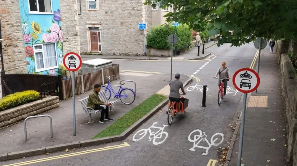
Bristol’s liveable neighbourhood initiatives aim to improve these environments through measures such as modal filters, traffic management and improved pedestrian and cycling access.
Access to Everyday Destinations
A bike-friendly neighbourhood connects residents with essential destinations. These include supermarkets, schools, workplaces, railway stations, healthcare facilities and parks.
Short distances between residential streets and local amenities make cycling practical for regular journeys.
Secure Bicycle Parking
Secure bicycle parking supports people who cycle to workplaces, shopping areas and transport interchanges. Bristol provides cycle parking facilities across railway and bus stations, alongside residential cycle hangars.
Which Areas of Bristol Have the Best Cycling Infrastructure?
Bristol has several neighbourhoods with useful cycling infrastructure, including Southville, Bedminster, Easton, Fishponds, St George, Harbourside and Clifton. Their advantages differ according to route access, road conditions, terrain and connections to major cycling corridors.
The best area depends on the type of cycling someone regularly undertakes. Commuters generally prioritise direct connections and convenient access to employment centres. Families often prefer traffic-free paths, while recreational cyclists value parks, greenways and countryside connections.
The following neighbourhoods offer different advantages within Bristol’s wider cycling network.
Is Southville a Good Area for Everyday Cycling?
Southville is a well-connected residential neighbourhood in south Bristol with access to local shops, quieter residential streets and nearby cycling corridors. Its position near Bedminster and the city centre makes it useful for shorter commuting and recreational cycling journeys.
Southville sits south of the Floating Harbour and has convenient connections towards Bedminster, Windmill Hill and central Bristol.
North Street is the neighbourhood’s main shopping and community corridor. Residents access independent shops, cafés, restaurants and everyday services within relatively short distances.
Cycling Connections Around Southville
The area benefits from its proximity to the Malago Greenway, a cycling and walking corridor connecting parts of south Bristol.
The greenway provides an alternative to some busier roads and supports local journeys between residential areas and central destinations.
Cyclists also use quieter streets to reach:
- Bedminster and its commercial centre.
- Ashton Gate and nearby residential areas.
- Bristol city centre through the wider south Bristol network.
- Local parks and community facilities.
South Bristol Liveable Neighbourhood Plans
Bristol City Council is developing plans for a South Bristol Liveable Neighbourhood covering Southville, Bedminster, Ashton Vale, Malago Vale, Perretts Park, Windmill Hill and Totterdown.
The project aims to create safer and quieter streets, improve cycling and walking access, support local high streets and reduce the effects of through-traffic.
The council identifies the Malago Greenway and Filwood Quietway as important existing active-travel connections. The project remains subject to planning and development decisions.
Why Is Bedminster Suitable for Cyclists?
Bedminster offers practical cycling connections between south Bristol residential streets, local shopping destinations and the city centre. Its proximity to Southville, Temple Meads and the wider Malago Greenway network supports commuting, shopping and short recreational journeys.
Bedminster is an established residential and commercial district south of the River Avon. Its location makes it an important connection point for people travelling between southern neighbourhoods and central Bristol.
Local Cycling Opportunities
East Street and North Street provide access to local services, although cyclists need to consider traffic conditions and pedestrian activity around busy shopping areas.
Residential streets offer alternative connections to nearby neighbourhoods.
Bedminster is particularly useful for reaching:
- Southville and Windmill Hill.
- Bristol Temple Meads.
- The Harbourside and city centre.
- Ashton Gate and Ashton Court approaches.
Future Transport Improvements
The South Bristol Liveable Neighbourhood project identifies Bedminster as part of a wider area requiring improvements to active-travel conditions.
New residential developments also increase the importance of providing convenient walking and cycling connections.
The council reports that 3,250 new homes have been approved in the planning system within Bedminster, Southville and Windmill Hill since 2010. This growth creates additional demand for sustainable transport infrastructure.
Is Easton One of Bristol’s Most Convenient Cycling Neighbourhoods?
Easton is a useful cycling neighbourhood because of its position near central Bristol, residential streets and connections towards East Bristol’s wider cycling network. Its location supports journeys towards Lawrence Hill, St George, Greenbank and neighbouring districts.
Easton is located east of Bristol city centre. It has a diverse residential community, local shopping streets and convenient connections towards several major destinations.
Stapleton Road is one of its best-known commercial streets. The surrounding residential roads provide connections to neighbouring districts and railway stations.
Cycling Around Easton
Cyclists use Easton’s residential network to reach central Bristol and East Bristol destinations.
Lawrence Hill railway station provides an additional public transport connection for people combining cycling with train journeys.
Nearby cycling destinations include:
- St George and its local parks.
- Greenbank and the railway path corridor.
- Bristol city centre.
- Lawrence Hill railway station.
- Fishponds and East Bristol residential districts.
Cyclists should assess individual streets rather than assume every road provides dedicated cycling infrastructure. Busy junctions and commercial streets require additional attention.
Why Is Fishponds Popular with Recreational Cyclists?
Fishponds is an attractive cycling neighbourhood because it provides access to the Bristol and Bath Railway Path, local residential streets and green spaces. Its connections support commuting, longer recreational journeys and cycling towards East Bristol and South Gloucestershire.
Fishponds is situated in north-east Bristol and has a strong connection to the Bristol and Bath Railway Path.
The railway path follows the former Midland Railway route between Bristol and Bath. Its conversion into a shared-use greenway created an important transport and recreation corridor.
Bristol and Bath Railway Path
The Bristol and Bath Railway Path forms part of National Cycle Network Route 4.
The route provides a mostly traffic-free connection between Bristol and Bath, with a relatively gentle gradient along much of its length.
It supports several activities, including:
- Everyday cycling between residential communities.
- Longer recreational bicycle journeys.
- Family cycling on suitable sections.
- Walking, running and wheeling.
Fishponds provides convenient access to this corridor, making it particularly useful for people who prefer cycling away from busy main roads.
Connections to Nearby Areas
Cyclists can use the wider railway path network to reach Staple Hill, Mangotsfield and Warmley.
The corridor also provides opportunities to continue towards Bath.
The route is shared with pedestrians and other users. Cyclists should maintain appropriate speeds, particularly around access points, crossings and busy sections.
Is St George a Bike-Friendly Area in East Bristol?
St George offers access to local residential cycling routes, parks and the wider East Bristol network. Its location near the Bristol and Bath Railway Path and connections towards central Bristol makes it practical for neighbourhood journeys and recreational cycling.
St George is an established residential district in east Bristol. Its neighbourhood streets connect with Easton, Redfield, Whitehall and other nearby communities.
St George Park provides an important local green space for outdoor recreation. Cyclists use surrounding streets to access the park and nearby residential destinations.
Cycling Connections
The area benefits from its wider East Bristol location and connections towards the Bristol and Bath Railway Path.
People cycling from St George can reach:
- Redfield and Easton.
- Fishponds and the railway path corridor.
- Central Bristol.
- Local schools, shops and parks.
Neighbourhood Improvements
The East Bristol Liveable Neighbourhood project has focused on improving conditions for walking, cycling and wheeling.
Bristol City Council’s monitoring information reports that motorised vehicle volumes across internal and external roads combined decreased by 26% on weekdays and 21% at weekends during the comparison period between October 2024 and October 2025.
On internal roads, the reported reductions were 77% on weekdays and 72% at weekends.
These figures relate to the monitored project area and do not represent every street in St George or East Bristol. The scheme’s future arrangements remain subject to council decisions.
Is Bristol Harbourside Suitable for Cycling?
Bristol Harbourside is a convenient central cycling destination because it connects waterfront attractions, cultural venues, commercial areas and nearby transport facilities. Its relatively level waterfront environment provides accessible cycling opportunities, although pedestrian activity requires careful riding.
Bristol Harbourside surrounds the historic Floating Harbour, a non-tidal dock system created to manage the River Avon’s substantial tidal range.
The waterfront has developed from a working maritime district into an important cultural, commercial and recreational destination.
Cycling Along the Floating Harbour
The waterfront provides opportunities for cycling between central destinations.
Cyclists travel around sections of the harbour to reach:
- Millennium Square.
- M Shed.
- Arnolfini.
- Queen Square.
- Wapping Wharf.
- Bristol Temple Meads through connecting streets.
The harbour’s relatively flat environment makes it suitable for leisurely rides and shorter journeys.
However, the Harbourside is a busy pedestrian destination. Walking routes, outdoor dining areas, public events and bridge crossings create shared spaces.
Cyclists should reduce speed around pedestrians and follow local signs where cycling restrictions apply.
Commuting Advantages
Harbourside provides connections to offices, restaurants, cultural venues and commercial developments.
Its location also makes it useful for people travelling between the city centre, Temple Meads and nearby residential districts.
The waterfront is particularly suitable for cyclists who combine short journeys with visits to local businesses and public attractions.
Is Clifton a Good Neighbourhood for Cycling?
Clifton offers attractive recreational cycling opportunities, historic streets and access to The Downs and nearby green spaces. However, its steep gradients, narrow roads and busy junctions make some everyday cycling journeys more demanding than routes in flatter Bristol neighbourhoods.
Clifton is one of Bristol’s most recognisable residential districts. Its historic architecture, independent businesses and proximity to the Clifton Suspension Bridge attract residents and visitors.
The neighbourhood provides access to several scenic cycling destinations.
Clifton Downs and Durdham Down
The Downs consist of two major open spaces: Clifton Down and Durdham Down.
These green spaces provide opportunities for outdoor recreation and access to scenic routes around north-west Bristol.
The surrounding road network connects Clifton with:
- Whiteladies Road.
- Stoke Bishop.
- Clifton Village.
- The Clifton Suspension Bridge.
- Leigh Woods.
Cyclists should recognise that The Downs are shared public spaces rather than continuous dedicated cycle tracks.
Understanding Clifton’s Hills
Clifton’s topography is an important consideration when choosing this neighbourhood for regular cycling.
Steep streets require greater physical effort, particularly for people riding standard bicycles.
Electric bicycles provide additional assistance on uphill sections, although riders still need to consider road gradients, traffic and junction conditions.
Clifton is therefore more suitable for confident cyclists who are comfortable navigating hilly urban streets.
Why Is Ashton Court a Popular Cycling Destination?
Ashton Court is one of Bristol’s leading outdoor cycling destinations because it combines extensive parkland, woodland trails and purpose-built mountain biking facilities. It provides recreational cycling opportunities for different experience levels close to the western edge of the city.
Ashton Court Estate is a historic estate located west of central Bristol.
Its open parkland, woodland and established outdoor facilities make it an important destination for cyclists.
Nova Mountain Bike Trails
The Nova Trails provide purpose-built mountain biking routes within Ashton Court Estate.
These trails offer opportunities for off-road cycling and skills development.
Riders can access different trail experiences depending on their ability and confidence.
Cycling Facilities
Ashton Court also benefits from nearby mountain bike hire and coaching services.
Pedal Progression operates from the estate and provides bicycle hire, maintenance and cycling instruction.
The surrounding estate is suitable for recreational rides, although cyclists should follow designated routes and respect walkers, horse riders and wildlife.
Who Benefits from Ashton Court?
The area is particularly suitable for:
- Mountain bikers developing technical skills.
- Recreational cyclists seeking woodland routes.
- Experienced riders looking for off-road trails.
- Families exploring appropriate park routes.
Ashton Court provides a different cycling environment from residential districts. It is primarily a leisure destination rather than a direct everyday commuting corridor.
Is Leigh Woods Suitable for Off-Road Cycling?
Leigh Woods offers woodland cycling opportunities near the Avon Gorge and Clifton Suspension Bridge. Its natural environment, designated trails and proximity to Bristol make it suitable for recreational riders seeking off-road experiences rather than conventional urban commuting.
Leigh Woods lies across the River Avon from Clifton and provides access to a large woodland environment.
The area is recognised for its natural landscape, walking routes and biodiversity.
Cycling Around Leigh Woods
Leigh Woods provides access to designated mountain biking routes and nearby cycling connections.
National Cycle Network Route 41 runs close to the woodland.
The surrounding area also connects with the Avon Gorge and countryside routes towards North Somerset.
Cyclists should use authorised cycling trails and respect restrictions within environmentally sensitive areas.
Environmental Considerations
Leigh Woods is an important nature conservation area. Its woodland habitats support wildlife and contribute to the wider ecological value of the Avon Gorge.
Responsible cycling includes staying on permitted trails, avoiding damage to vegetation and slowing down around pedestrians.
Which Bristol Areas Offer the Best Traffic-Free Cycling Routes?
Bristol’s strongest traffic-free cycling opportunities include the Bristol and Bath Railway Path, Malago Greenway, Frome Valley corridors and selected waterfront paths. These routes provide alternatives to busy roads and connect residential neighbourhoods with green spaces and destinations.
Traffic-free cycling routes are particularly important for people who prefer to avoid direct interaction with motor traffic.
They support recreational cycling, commuting and active travel.
Bristol and Bath Railway Path
The railway path connects Bristol with Bath and provides one of the region’s best-known shared-use cycling corridors.
Its relatively flat surface and former railway alignment make it useful for longer journeys.
Malago Greenway
The Malago Greenway provides an important active-travel connection in south Bristol.
It supports movement between residential districts and connects with the wider walking and cycling network.
Frome Valley Routes
The Frome Valley area in north and north-east Bristol provides riverside and greenway opportunities.
Routes around Snuff Mills, Oldbury Court and neighbouring green spaces offer recreational cycling options.
Some sections have uneven surfaces, narrow paths and shared pedestrian access, so route selection is important.
Harbourside Routes
The Floating Harbour provides a central waterfront cycling environment.
Its paths connect several cultural destinations, although pedestrian congestion makes some sections less suitable for fast cycling.
How Does Bristol Support Cycling Infrastructure and Sustainable Transport?
Bristol supports cycling through dedicated infrastructure, traffic-free paths, cycle training, bicycle loans, residential cycle parking and regional transport planning. Bristol City Council and the West of England Combined Authority coordinate improvements across the city’s wider active-travel network.
Cycling infrastructure includes physical facilities and services that make bicycle journeys practical.
Bristol’s approach combines infrastructure development with training and transport integration.
Bristol Walking and Cycling Index 2025
The 2025 Walking and Cycling Index provides important information about the city’s cycling infrastructure and residents’ attitudes towards active travel.
The report identifies:
- 52 miles of traffic-free cycle paths away from roads.
- 5 miles of cycle paths physically separated from traffic and pedestrians.
- 27 miles of shared-use footway.
- 658 cycle parking spaces across 14 railway and bus stations.
- 17% of households within 125 metres of traffic-free or physically separated cycle paths.
The report also identifies strong public support for additional infrastructure.
For example, 73% of residents said more traffic-free cycle paths would help them start cycling or cycle more. Another 73% identified physically separated cycle paths along roads as beneficial.
These findings demonstrate the importance of improving infrastructure beyond the existing network. Walk Wheel Cycle Trust
Bicycle Loans and Cycle Training
Bristol City Council provides opportunities for residents to experience cycling before purchasing a bicycle.
Its free four-week bicycle loan scheme includes standard, folding and electric bicycles.
The council also provides free one-to-one adult cycle training.
These services support beginners, returning cyclists and residents who want to improve their confidence on urban roads. Bristol City Council
Regional Cycling Infrastructure
The West of England Combined Authority coordinates wider transport planning across Bristol, Bath and North East Somerset, North Somerset and South Gloucestershire.
Its cycling infrastructure maps identify existing facilities and schemes in development or with funding allocated.
These regional connections are important because many residents travel between local authority areas for employment, education and recreation.
Which Bristol Neighbourhoods Are Best for Beginner Cyclists?
Beginner cyclists benefit from areas with quieter streets, accessible greenways, relatively flat routes and convenient traffic-free cycling facilities. Fishponds, selected sections of Harbourside, south Bristol greenways and suitable park routes provide useful starting points.
Beginners should choose routes according to their confidence, bicycle type and ability to manage traffic.
Traffic-free paths provide a suitable environment for developing basic cycling skills without navigating busy road junctions.
Suitable Starting Areas
Fishponds offers access to the Bristol and Bath Railway Path, which provides a relatively gentle cycling environment.
Harbourside offers comparatively flat waterfront sections, although busy pedestrian areas require slow riding.
South Bristol’s greenway connections provide opportunities for beginners to explore selected routes away from some busy roads.
Ashton Court offers recreational cycling opportunities on appropriate routes, although its varied terrain requires careful route selection.
Bristol Cycling Centre
Bristol Cycling Centre is located at the Old Whitchurch Athletics Track in south Bristol.
It provides a traffic-free environment for cycling skills development and inclusive cycling activities.
The centre supports people of different ages and abilities, including disabled riders who use specialist cycles.
It is particularly useful for people who want to develop confidence before cycling on public roads.
What Challenges Should Cyclists Consider When Choosing a Bristol Area?
Cyclists in Bristol need to consider steep gradients, busy junctions, mixed-use paths, road traffic and changing infrastructure. These conditions vary between neighbourhoods, so checking individual routes is essential before choosing a regular cycling journey.
Bristol’s cycling network has improved considerably, but the city still has geographical and transport challenges.
Steep Gradients
Bristol’s hilly geography affects cycling across several neighbourhoods.
Clifton, Totterdown and parts of South Bristol contain steep streets that require additional physical effort.
Electric bicycles provide assistance but do not remove the need for careful riding.
Busy Roads and Junctions
Some major roads carry substantial motor traffic.
Cyclists should pay particular attention to junctions, roundabouts, turning vehicles and busier commercial streets.
The presence of a painted cycle lane does not automatically mean a route is physically separated from traffic.
Shared-Use Paths
Shared-use paths accommodate different users, including cyclists, pedestrians and wheelchair users.
These routes require appropriate speeds and consideration for other people.
The Bristol and Bath Railway Path and sections of the Harbourside are examples of environments where cyclists share space with other users.
Weather and Surface Conditions
Rain, wet leaves and poor visibility affect cycling conditions.
Woodland paths and riverside routes can become slippery after rainfall.
Cyclists should use suitable lights, maintain their brakes and tyres, and check weather conditions before longer journeys.
How Can Residents Choose the Right Bike-Friendly Area in Bristol?
Residents should compare neighbourhoods according to commuting distances, cycling infrastructure, road gradients, access to everyday services and connections to traffic-free routes. The most suitable area is the one that provides safe and convenient access to their regular destinations.
Choosing a bike-friendly neighbourhood requires more than identifying the nearest cycle path.
A residential area should provide practical connections to workplaces, shops, schools and transport services.
Consider Daily Commuting Requirements
People commuting towards central Bristol should investigate routes from areas such as Bedminster, Southville, Easton and St George.
Residents travelling towards Bath can consider Fishponds and other neighbourhoods with access to the railway path.
Those working near the waterfront benefit from the central location of Harbourside.
Assess Road Conditions
Check whether a regular journey uses protected cycleways, advisory lanes, quiet residential roads or shared-use paths.
Look at junction layouts and crossing points, particularly where a route connects with major roads.
Check Public Transport Connections
Bicycle and public transport integration makes longer journeys more flexible.
Bristol’s railway stations provide cycle parking facilities, allowing some commuters to combine cycling with train travel.
Explore Routes Before Moving
Residents should test potential commuting routes at different times of day.
Morning and evening traffic conditions differ from quieter weekend periods.
The official Bristol City Council cycling page and Better By Bike provide route-planning information for exploring available infrastructure.
Explore More Area Guide
Cycling Routes for Beginners in Bristol: Best Easy Bike Paths
Bristol and Bath Railway Path: Route, History and Visitor Guide
What Is the Future of Bike-Friendly Neighbourhoods in Bristol?
Bristol’s cycling future depends on expanding connected cycleways, improving residential streets, integrating cycling with public transport and supporting sustainable urban development. Liveable neighbourhood projects and regional infrastructure planning remain important parts of this development.
Bristol’s population growth and changing transport requirements increase demand for reliable cycling infrastructure.
New housing developments need convenient connections to existing cycling corridors, railway stations, workplaces and local high streets.
Expansion of Connected Cycling Routes
Continuous cycle routes are important because disconnected infrastructure creates difficulties at junctions and major roads.
Future improvements need to connect residential districts with employment centres and public transport facilities.
Liveable Neighbourhood Development
Bristol’s liveable neighbourhood programme aims to make local streets safer and more accessible.
Measures include traffic management, improved crossings, additional greenery and better facilities for walking, cycling and wheeling.
The East Bristol and South Bristol projects demonstrate how the council is approaching neighbourhood-level transport improvements.
Greater Public Transport Integration
Secure cycle parking and better access to railway stations make combined journeys more convenient.
The 2025 Walking and Cycling Index identifies improved public transport connections as an important requirement for encouraging additional cycling.
Inclusive Cycling Facilities
Cycling infrastructure must support people with different mobility requirements and experience levels.
Inclusive cycle facilities, traffic-free training environments and accessible routes help more residents participate in everyday cycling.
Bristol’s long-term progress depends on creating a network that serves commuters, families, recreational cyclists and disabled riders.
Which Are the Best Bike-Friendly Areas in Bristol?
Bristol offers a varied selection of bike-friendly neighbourhoods and cycling destinations. Southville and Bedminster provide useful residential connections in south Bristol, while Easton and St George offer access to the city’s eastern cycling network. Fishponds stands out for its proximity to the Bristol and Bath Railway Path, and Harbourside provides convenient waterfront connections in the city centre.
Clifton offers attractive recreational cycling opportunities but presents additional challenges because of its steep gradients. Ashton Court and Leigh Woods provide dedicated outdoor cycling experiences for people interested in mountain biking and woodland trails.
The city’s 2025 Walking and Cycling Index highlights the existing cycling network and the continuing demand for safer, better-connected infrastructure. Bristol’s future as a cycling-friendly city depends on expanding protected routes, improving neighbourhood streets and connecting cycling with public transport.
For residents choosing where to live, the most suitable neighbourhood depends on everyday travel requirements, cycling experience and access to convenient routes. Exploring the network through official Bristol cycling maps provides a practical starting point for identifying suitable journeys.
What are the most bike-friendly areas in Bristol?
Southville, Bedminster, Fishponds, Easton, St George and Harbourside are among Bristol’s useful cycling neighbourhoods. Each offers access to residential streets, cycling connections, local facilities or traffic-free routes.