Henleaze is a residential suburb in north-west Bristol, South West England. It sits between Westbury-on-Trym, Horfield, Bishopston, Redland and Westbury Park. The neighbourhood is known for inter-war housing, mature streets, local shops, access to green space and proximity to major north Bristol destinations.
- Where is Henleaze in Bristol?
- What is the history of Henleaze?
- What is Henleaze known for?
- What is Henleaze Lake?
- What types of homes are found in Henleaze?
- What shops and local amenities are available in Henleaze?
- How green is Henleaze?
- How can you travel from Henleaze to other parts of Bristol?
- What schools and community facilities serve Henleaze?
- How does Henleaze compare with nearby Bristol neighbourhoods?
- Why is Henleaze historically significant within Bristol?
- What should visitors and new residents know about Henleaze?
Henleaze forms part of the Westbury-on-Trym and Henleaze ward, which also includes Westbury-on-Trym. Bristol City Council’s ward profile records a population estimate of 20,683 for the ward in 2022. This figure covers the combined ward rather than Henleaze alone, so it should not be treated as a population count for the neighbourhood itself.
The wider city of Bristol had an estimated 495,300 residents in mid-2025, according to Bristol City Council using Office for National Statistics population estimates. Bristol’s population increased by an estimated 9.6% between 2015 and 2025.
Henleaze has a distinctive suburban identity. Its built environment reflects several periods of development, including Victorian and Edwardian houses, inter-war residential streets and later 20th-century housing. Bristol City Council’s character assessment identifies mature trees, historic boundary walls, former mansion sites, older cottages and surviving hedgerows as important elements of the area’s character.
Where is Henleaze in Bristol?
Henleaze is a north-west Bristol suburb positioned between Westbury-on-Trym, Horfield, Bishopston, Redland and Westbury Park, with Henleaze Road, Westbury Road, Eastfield Road and Wellington Hill West forming important local routes through or around the neighbourhood.
Henleaze sits within the northern part of Bristol’s built-up urban area. Its location gives residents access to several neighbouring districts without placing the suburb directly in the city centre.
The neighbourhood’s southern side connects towards Durdham Down, Westbury Park and Redland. Horfield lies to the east, while Westbury-on-Trym is directly associated with Henleaze to the west and north-west. Southmead is also nearby.
The area is commonly associated with the BS9 postcode district, although postcode boundaries and neighbourhood boundaries are not identical. The distinction matters when researching addresses, services and property locations.
Henleaze Road is one of the area’s main commercial and transport corridors. Westbury Road provides another important connection towards Westbury-on-Trym and central Bristol. Eastfield Road and Wellington Hill West also appear as established routes on historical maps.
Bristol’s current public transport network continues to connect Henleaze with destinations including Bristol city centre, Cribbs Causeway and surrounding north Bristol neighbourhoods. Travelwest’s network information identifies Henleaze on the regional bus map and lists services serving the wider Westbury Park, Henleaze and north Bristol area.
The geographical setting also places Henleaze close to some of Bristol’s most significant open spaces. Durdham Down, Horfield Common and Blaise Castle Estate are within the broader north-west Bristol area.
What is the history of Henleaze?
Henleaze developed from rural land within the historic parish of Westbury-on-Trym into a residential suburb from the late nineteenth century, with major inter-war construction in the 1920s. Earlier villas, farms, quarries, mansions and agricultural landscapes remain important to its historical identity.
The name Henleaze is traditionally linked to Robert Henley, who acquired a property in 1659. The property became known as Henley’s House and later Henleaze Park. The historical association explains the origin of the modern neighbourhood name.
For much of the nineteenth century, Henleaze remained a rural part of the parish of Westbury-on-Trym. The landscape contained arable fields, grazing meadows, orchards and parkland.
Limestone quarrying was the principal local industry recorded in Bristol City Council’s character assessment. Former quarry sites later became important landscape features. Henleaze Lake occupies the site of a former limestone quarry, while Old Quarry Park occupies another former quarry area.
Housing development accelerated towards the end of the nineteenth century. Bristol City Council records that land between Henleaze Road and Durdham Down was sold for housing in 1896. Bristol’s boundaries were extended to include Henleaze in 1904. Tram services on Westbury Road then improved connections with central Bristol.
The inter-war period transformed the area. Large areas of housing were constructed during the 1920s, creating much of the suburban form visible today.
The historical landscape also included several substantial houses. Henleaze Park, Springfield House, Burfield House, Southmead House and other estates occupied land before large-scale suburban development.
Some former mansion properties acquired new institutional uses. Bristol City Council records that Burfield House became the Red Maids’ School, Springfield House became Northumberland House School and Henleaze Park mansion became St Margaret’s High School for Girls.
Historic England also records The Lodge at 18 Henleaze Road as a surviving early nineteenth-century building associated with the former Springfield estate. The building appears on Donne’s 1826 map of Bristol and the 1842 tithe map for Westbury-on-Trym.
What is Henleaze known for?
Henleaze is known for its predominantly residential character, inter-war housing, Henleaze Road shopping area, Henleaze Lake, mature greenery and proximity to Durdham Down, Westbury-on-Trym and other north Bristol neighbourhoods. Its historic landscape also includes former quarry and mansion sites.
Housing is one of the strongest defining characteristics of Henleaze. The Henleaze Society describes the suburb as an almost entirely residential inter-war development, with Edwardian streets concentrated towards its southern fringes. Later housing appeared during the 1970s, 1980s and 1990s.
The architecture reflects this gradual expansion. Earlier Victorian and Edwardian properties contrast with the semi-detached and detached houses associated with the inter-war building period.
Mature vegetation contributes significantly to the streetscape. Bristol City Council’s character assessment identifies mature trees, stone boundary walls, historic hedges and surviving structures from earlier estates as important features.
Phoenix Lane contains a particularly significant historic landscape feature. Bristol City Council identifies its hedge as the oldest surviving hedgerow in Bristol and an important remnant of Henleaze’s rural past.
Henleaze also has a strong relationship with former quarry landscapes. Henleaze Lake is a particularly distinctive example because the former industrial site developed into a private swimming and recreational facility.
The suburb’s position close to Durdham Down adds another major green-space connection. Durdham Down forms part of Bristol’s extensive Downs landscape and provides open recreational land close to the built-up neighbourhood.
What is Henleaze Lake?
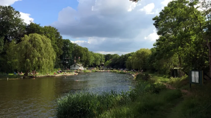
Henleaze Lake is a private swimming lake occupying a former limestone quarry in Henleaze. The site has a long recreational history and is associated with organised swimming, outdoor activity and local community use rather than general public open-water swimming.
Henleaze Lake is one of the area’s best-known landmarks. It occupies the former Southmead quarry, identified in Bristol City Council’s historical character assessment as one of the disused limestone quarries that shaped the area’s development.
The quarry’s transformation illustrates the changing land use of Henleaze. An area once associated with limestone extraction became a recreational landscape as the surrounding suburb developed.
Henleaze Lake is privately managed, so access differs from a public park. Visitors should check the organisation’s current membership, swimming and visitor arrangements before planning a visit.
The lake is also important to the local history of outdoor swimming. Its recreational identity developed alongside the expansion of Henleaze as a residential suburb.
The former quarry landscape provides an important reminder that modern Henleaze was not always a residential district. Much of the land occupied by today’s streets previously formed part of a rural and industrial landscape.
What types of homes are found in Henleaze?
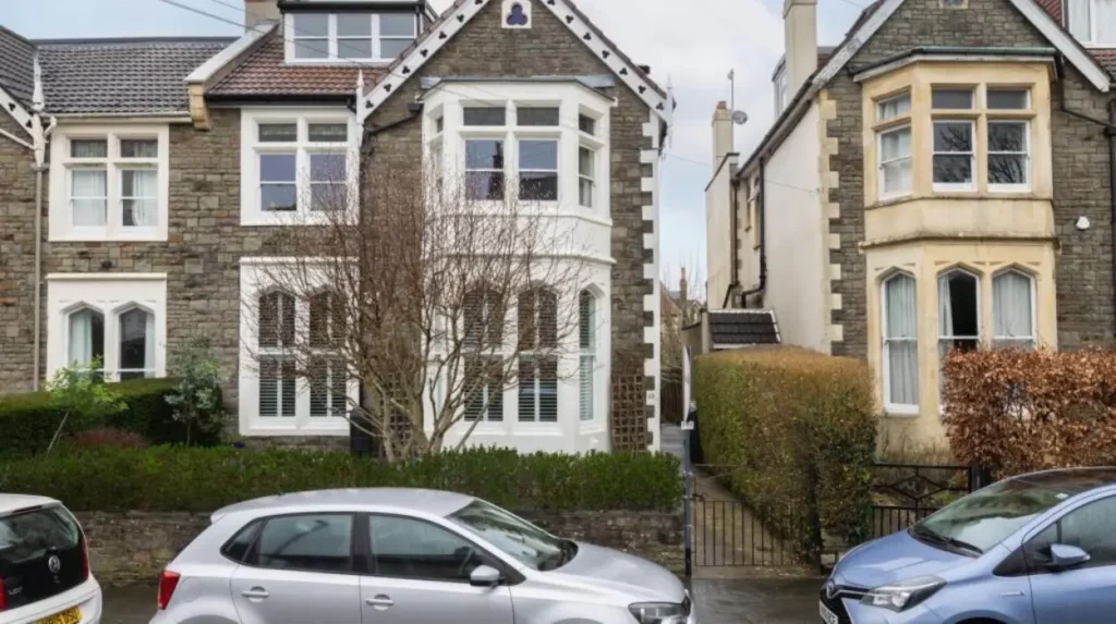
Henleaze contains a mixture of Victorian and Edwardian houses, inter-war semi-detached and detached properties, later twentieth-century homes and selected apartment developments. Housing character varies between streets according to development period, plot size, architectural style and the replacement of earlier buildings.
The dominant residential form developed during the inter-war period. This period produced many of the streets that give Henleaze its suburban appearance.
Edwardian properties are particularly important towards the southern parts of the neighbourhood. They form part of the area’s transition from older rural and villa landscapes towards dense suburban development.
Bristol City Council’s character assessment identifies several architectural features that contribute to Henleaze’s identity. These include extensive stone boundary walls, mature trees, historic hedges, former farm workers’ cottages, Victorian terraces, Edwardian villas and surviving lodge buildings.
Later construction introduced further variation. The Henleaze Society records housing development in the 1970s, including areas around Northumbria Drive and the northern part of Henleaze Road. Additional properties appeared in Remenham Drive, Remenham Park and Brean Down Avenue during the 1980s, followed by further construction around Golden Hill during the 1990s.
This layered development means that Henleaze does not have one uniform architectural style.
Property searches also need to distinguish Henleaze from neighbouring Westbury-on-Trym, Westbury Park, Golden Hill and Southmead. These areas have different boundaries even where their streets and services appear interconnected.
For anyone researching property, the most useful approach is to assess the specific street, building type, transport access, local services and planning history rather than treating the whole BS9 postcode as one housing market.
What shops and local amenities are available in Henleaze?
Henleaze Road provides a local commercial focus for the suburb, supported by nearby services and shopping areas in Westbury-on-Trym, Westbury Park, Bishopston and Horfield. The neighbourhood’s amenities primarily support everyday residential needs rather than large-scale destination retail.
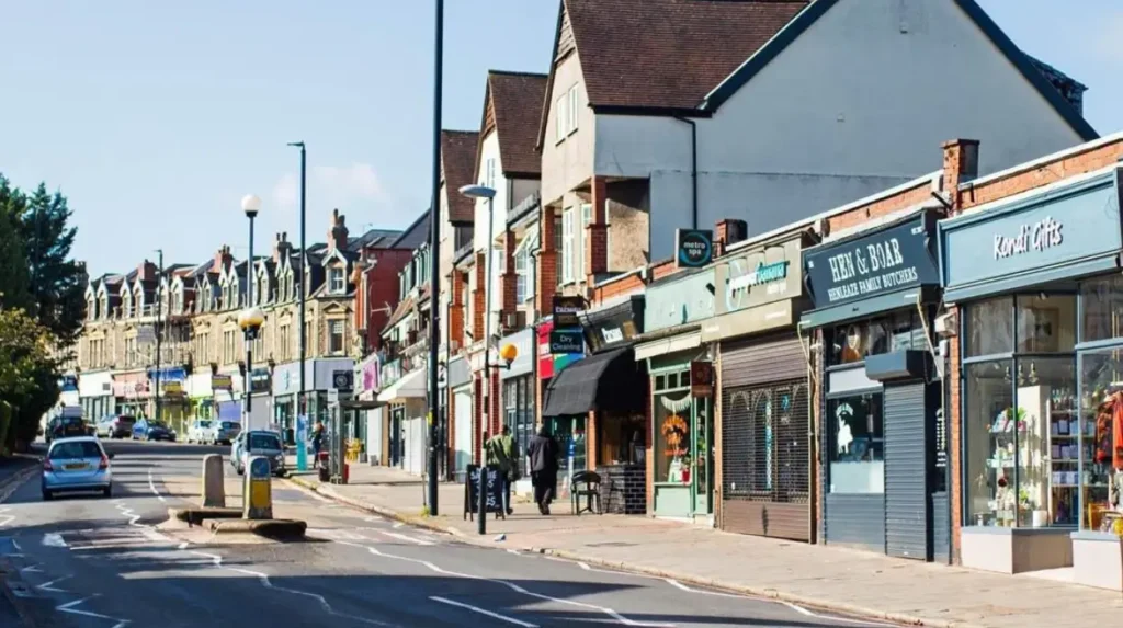
Henleaze Road is the principal local shopping corridor associated with the suburb. Its businesses serve residents through food, personal services, cafés, professional services and other everyday facilities.
The commercial environment reflects Henleaze’s residential role. Visitors looking for large retail centres can travel to other parts of Bristol, while residents have local options for routine purchases and services.
Neighbouring Westbury-on-Trym provides another important shopping and service centre. The village has a long-established commercial identity connected with its historic settlement pattern.
Bishopston and the Gloucester Road corridor provide additional independent businesses and food outlets to the east. Westbury Park also contributes nearby services.
The location therefore gives Henleaze residents several different shopping environments within north Bristol. Local shopping focuses on convenience and community services, while larger retail trips involve other parts of the city.
For visitors, Henleaze is better understood as a residential neighbourhood with local amenities than as a major Bristol shopping destination.
How green is Henleaze?
Henleaze has strong access to green space through Durdham Down, Horfield Common, local parks, mature residential streets and nearby Blaise Castle Estate. Former quarry landscapes and established trees also contribute to the suburb’s ecological and visual character.
Green space is an important part of Henleaze’s setting. Durdham Down lies close to the southern side of the neighbourhood, while Horfield Common provides another substantial recreational landscape nearby.
The area’s historic development preserved mature vegetation in several locations. Bristol City Council’s character assessment specifically highlights mature trees, hedges and historic landscape remnants as important components of Henleaze’s character.
Old Quarry Park provides another example of former industrial land becoming public green space. Its origins are connected with the Eastfield quarry identified in the city’s historical assessment.
Blaise Castle Estate is also an important nearby destination. Bristol City Council describes the estate as a 650-acre Grade II registered parkland* containing woodland, grassland, a museum, castle, children’s play areas, gardens and walking routes.
The estate is also a designated Site of Nature Conservation Interest, covering 100 hectares within the wider parkland. Its habitats include woodland, grassland, streams, ponds and caves. Bristol City Council records species and conservation activity including orchids, great crested newts, eels and trout.
Blaise Castle Estate has a much older history than modern Henleaze. Archaeological evidence indicates human activity in the wider estate during the Bronze Age, Iron Age and Roman periods.
The proximity of these spaces makes north-west Bristol particularly significant for outdoor recreation.
How can you travel from Henleaze to other parts of Bristol?
Henleaze is connected to Bristol through local bus services, major roads, cycling routes and nearby transport corridors. Bus connections link the area with Bristol city centre, Westbury-on-Trym, Cribbs Causeway and other north Bristol destinations, while roads provide access to wider routes.
Bus travel is a central part of local transport. Travelwest’s supported-services information identifies services serving Henleaze and neighbouring areas, including routes connecting residential districts with Bristol City Centre, Temple Meads, Clifton Triangle, Whiteladies Road and Cribbs Causeway.
The current West of England Travel Guide also shows Henleaze within the regional public transport network alongside Westbury-on-Trym, Westbury Park, Horfield, Stoke Bishop, Clifton and other Bristol districts.
Road access is shaped by the suburb’s established network of Henleaze Road, Westbury Road, Eastfield Road and Wellington Hill West.
Cycling forms another part of the wider north Bristol transport network. Nearby Blaise Castle Estate is connected to National Cycle Network Route 4, with cycle parking at the estate.
The exact journey time from Henleaze depends on the starting street, destination, traffic conditions and service timetable. For current travel planning, official Travelwest information provides the appropriate source for route and timetable changes.
Henleaze’s position also makes it practical for journeys towards north Bristol employment, education and retail destinations.
What schools and community facilities serve Henleaze?
Henleaze is served by local primary education, nearby secondary schools, community organisations, churches, sports facilities and public services across north-west Bristol. School catchments differ by address, so current admissions information is essential when assessing individual properties.
Education is an important part of the area’s residential infrastructure. Henleaze and its neighbouring districts are served by several primary and secondary education options across north-west Bristol.
School catchment boundaries do not necessarily match neighbourhood or ward boundaries. Families therefore need to check the exact address against Bristol City Council and individual school admissions information.
Henleaze also has a history of educational institutions occupying former residential estates. Bristol City Council’s character assessment records the former uses of Burfield House, Springfield House and Henleaze Park as schools.
Community activity extends beyond formal education. Churches, community organisations, local clubs and resident groups contribute to the area’s social infrastructure.
The Henleaze Society is one example of organised local involvement. Such organisations contribute to the understanding and preservation of local history and neighbourhood character.
The nearby Westbury-on-Trym community also provides additional facilities and services. Because the two neighbourhoods share transport routes and local connections, residents often use facilities across the wider area.
How does Henleaze compare with nearby Bristol neighbourhoods?
Henleaze differs from nearby Bristol neighbourhoods through its predominantly residential inter-war character, local shopping streets, mature greenery and suburban layout. Westbury-on-Trym has a stronger historic village identity, while Bishopston and Redland have denser urban streets and stronger connections to central Bristol.
Westbury-on-Trym is the closest major comparison. Its settlement history extends much further back than Henleaze, and the village centre retains a distinct historic identity. The River Trym is also central to the area’s name and landscape.
Bishopston has a more urban character and stronger association with Gloucester Road. Its commercial streets contain a high concentration of independent businesses and restaurants.
Redland has extensive Victorian and Edwardian housing and lies closer to central Bristol. Its urban structure is generally denser than Henleaze.
Westbury Park sits near Henleaze’s southern and western edges and shares some of the area’s residential character.
Horfield provides another neighbouring comparison, with a mixture of residential districts, commercial corridors, sports facilities and connections towards Southmead and the wider northern part of Bristol.
These comparisons demonstrate why neighbourhood-level research is important. Bristol contains substantial variation within short distances. Housing styles, transport access, commercial activity and green-space provision change from one district to another.
Explore More Area Guide
Brislington Area Guide: History, Parks, Transport & Local Life
Fishponds Area Guide: History, Parks, Food and Transport
Why is Henleaze historically significant within Bristol?
Henleaze demonstrates how Bristol expanded beyond its historic core through transport improvements, land development and suburban housing. Its surviving villas, cottages, hedgerows, quarry landscapes and inter-war streets preserve evidence of the transition from rural parish land to modern residential suburb.
The transformation of Henleaze reflects broader urban development in Bristol.
Before suburbanisation, the area consisted largely of agricultural land, orchards, meadows and parkland. Limestone quarrying provided a local industrial activity.
Housing development accelerated after the late nineteenth century. The extension of Bristol’s boundaries in 1904 and the introduction of tramcars on Westbury Road strengthened connections with the city.
The 1920s then brought extensive residential construction. The result was a suburb shaped by the inter-war expansion of British cities.
Some historical traces remain visible. Phoenix Lane’s historic hedge, stone walls, old cottages, former mansion sites and surviving lodge buildings provide physical evidence of earlier land uses.
Henleaze also demonstrates how industrial landscapes can acquire new functions. Former limestone quarries became recreational spaces, with Henleaze Lake and Old Quarry Park representing different forms of post-industrial land use.
Bristol City Council uses character assessments to understand how neighbourhood landscapes developed and to inform decisions about future change. The Henleaze assessment forms part of this wider approach to protecting and understanding local character.
The area’s future relevance therefore extends beyond housing. Planning, transport, green-space management, heritage protection and community facilities all influence how Henleaze develops.
What should visitors and new residents know about Henleaze?
Henleaze is primarily a residential Bristol neighbourhood rather than a major tourist district. Its main attractions are its historic suburban landscape, local shops, nearby green spaces, Henleaze Lake and convenient access to Westbury-on-Trym, Durdham Down, Bishopston and Blaise Castle Estate.
Visitors looking for central Bristol landmarks need to travel beyond Henleaze. The suburb instead provides a useful base for exploring north-west Bristol and its surrounding neighbourhoods.
The area’s strongest visitor assets are its green spaces and local character. Durdham Down provides open space close to the southern edge, while Blaise Castle Estate offers a larger destination with historic buildings, woodland, gardens and recreational facilities.
New residents often use a wider network of services than those located strictly inside Henleaze. Westbury-on-Trym, Bishopston, Horfield, Westbury Park and Redland are all closely connected to the neighbourhood.
Transport planning is important because bus routes and road conditions change. Current Travelwest information should be checked before making time-sensitive journeys.
Property research also benefits from looking beyond the neighbourhood name. Individual streets differ in architecture, parking arrangements, green-space access and proximity to shops or transport.
For people researching Henleaze as a place to live, the most useful factors include the specific street, local school catchment, transport links, nearby services, housing type and access to green space.
Henleaze’s defining feature is its combination of modern suburban infrastructure and surviving evidence of its rural and industrial past. That combination explains its position within Bristol’s north-west residential landscape.
Where is Henleaze in Bristol?
Henleaze is a residential suburb in north-west Bristol. It is close to Westbury-on-Trym, Westbury Park, Bishopston, Redland, Horfield and Durdham Down. The area is commonly associated with the BS9 postcode district.